![East India Archipelago [Eastern Passages to China and Japan] [Chart No. 4] . . . 1868 (Mindanao, B...](https://stacks.stanford.edu/image/iiif/qk341np8650%2F34532/full/!200,200/0/default.jpg)
East India Archipelago [Eastern Passages to China and Japan] [Chart No. 4] . . . 1868 (Mindanao, B...
- People
- Time
- Owner Organization
![East India Archipelago [Eastern Passages to China and Japan] [Chart No. 2] . . . 1868 (North Austr...](https://stacks.stanford.edu/image/iiif/hf333br4460%2F34582/full/!200,200/0/default.jpg)
East India Archipelago [Eastern Passages to China and Japan] [Chart No. 2] . . . 1868 (North Austr...
Stanford University Libraries
Stanford Libraries SearchWorks
![East India Archipelago [Eastern Passages to China and Japan] [Chart No. 7] . . . 1868 (Taiwan, Nor...](https://stacks.stanford.edu/image/iiif/xy078vp9272%2F34545/full/!200,200/0/default.jpg)
East India Archipelago [Eastern Passages to China and Japan] [Chart No. 7] . . . 1868 (Taiwan, Nor...
Stanford University Libraries
Stanford Libraries SearchWorks
![East India Archipelago [Eastern Passages to China and Japan] [Chart No. 1] . . . 1866 (Java, Borne...](https://stacks.stanford.edu/image/iiif/ww842xr3210%2F34640/full/!200,200/0/default.jpg)
East India Archipelago [Eastern Passages to China and Japan] [Chart No. 1] . . . 1866 (Java, Borne...
Stanford University Libraries
Stanford Libraries SearchWorks

A Chart of the Eastermost part of the East Indies and China from Cape Comarin to Japan with the Ad...
Stanford University Libraries
Stanford Libraries SearchWorks

A chart of the tradeing part of the East Indies and China, with the adjacent islands, from Surrat ...
Royal Museums Greenwich
Europeana API

Sketch of a voyage to the India and China seas, including Japan and the Pacific islands, for the p...
Research Libraries UK
Europeana API

Johnson's China and Japan. Entered ... 1868. (inset) Vicinity of Canton and Hong Kong
Stanford University Libraries
Stanford Libraries SearchWorks
![[Untitled Sea Chart of Australia, Indian Ocean, China, Japan, SE Asia, &c] (First Printed Map to S...](https://stacks.stanford.edu/image/iiif/cv359wv2441%2F22989/full/!200,200/0/default.jpg)
[Untitled Sea Chart of Australia, Indian Ocean, China, Japan, SE Asia, &c] (First Printed Map to S...
Stanford University Libraries
Stanford Libraries SearchWorks
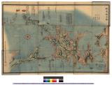
![[Railroads in China, Manchuria, Korea, Japan and the eastern U.S.S.R.] [cartographic material]](https://stacks.stanford.edu/image/iiif/pf710vm7134%2Fpf710vm7134_00_0001/full/!200,200/0/default.jpg)
[Railroads in China, Manchuria, Korea, Japan and the eastern U.S.S.R.] [cartographic material]
Stanford University Libraries
Stanford Libraries SearchWorks
The entrance of Nangasacqui the chief port of the island of Kiusiu in the Kingdom of Japan from the manuscript chart of the Dutch East India Company
National Library of Australia
Trove: National Library of Australia
The Suma oriental of Tomé Pires : an account of the East from the Red Sea to Japan, written in Malacca and India in 1512-1515; and, The Book of Francisco Rodrigues, rutter of a voyage in the Red Sea, nautical rules, almanack and maps written and drawn in the East before 1515 (Map in pocket of vol.2: The east, from the Red Sea to Japan, as known to Francisco Rodrigques)
National Library of Australia
Trove: National Library of Australia
A new chart of the Pacific Ocean : exhibiting the western coast of America, from Cape Horn to Beerings Strait, the eastern shores of Asia including Japan, China and Australia and all the numerous islands and known dangers situated in Polynesia and Australasia / correctly drawn and regulated according to the most approved and modern surveys and astronomical observations by J.W. Norie
State Library of New South Wales
Trove: National Library of Australia
Laurie and Whittle's new chart of the Indian and Pacific Oceans between the Cape of Good Hope, New Holland and Japan : comprehending New Zealand, New Caledonia, New Britain, New Ireland, New Guinea &c., Louisiade and New Georgia; also The Pelew, New Caroline, Ladrone and Philippine Islands &c. with the most remarkable tracks of the English, Spanish, French and Dutch navigators and chiefly the track of the Walpole, EastIndiaman, Captn. Thos. Butler, 1794 from the Cape of Good Hope to Van Diemen's Land and from thence to China, and the track of the Royal Admiral Captn. Henr. Bond in 1792 and 93 from the Cape to Port Jackson and China
State Library of New South Wales
Trove: National Library of Australia
![Carte de la Découverte faite en [1735] par les Hollandois, à la partie la plus orientale de l'Asie...](https://api.europeana.eu/api/v2/thumbnail-by-url.json?uri=http%3A%2F%2Fgallica.bnf.fr%2Fark%3A%2F12148%2Fbtv1b53032838p.thumbnail.jpg&type=IMAGE)
Carte de la Découverte faite en [1735] par les Hollandois, à la partie la plus orientale de l'Asie...
Bibliothèque nationale de France
Europeana API

Etchuuyongunmuramurakumiwakeezu
Imizu City Shinminato Museum
ADEAC: A System of Digitalization and Exhibition for Archive Collections

A New Chart of The Pacific Ocean, Exhibiting The Western Coast of America, From Cape Horn To Beeri...
Stanford University Libraries
Stanford Libraries SearchWorks

(Composite of) A New Chart of The Pacific Ocean, Exhibiting The Western Coast of America, From Cap...
Stanford University Libraries
Stanford Libraries SearchWorks
Laurie and Whittle's new chart of the Indian and Pacific Oceans between the Cape of Good Hope, New Holland and Japan : comprehending New Zealand, New Caledonia, New Britain, New Ireland, New Guinea &c., Louisiade and New Georgia; also The Pelew, New Caroline, Ladrone and Philippine Islands &c. with the most remarkable tracks of the English, Spanish, French and Dutch navigators and chiefly the track of the Walpole, EastIndiaman, Captn. Thos. Butler, 1794 from the Cape of Good Hope to Van Diemen's Land and from thence to China, and the track of the Royal Admiral Captn. Henr. Bond in 1792 and 93 from the Cape to Port Jackson and China
State Library of New South Wales
Trove: National Library of Australia

「上州草津温泉之図」
Tokyo Metropolitan Central Library
ARC Ukiyo-e Portal Database

「下総銚子之図」
Tokyo Metropolitan Central Library
ARC Ukiyo-e Portal Database
Jūmanbun no ichi Nyū Airurando-tō
National Library of Australia
Trove: National Library of Australia

「西国三十三所順拝地図」
Tokyo Metropolitan Central Library
ARC Ukiyo-e Portal Database

Kouyou kakuku kinkou zenzu
Yamanashi Prefectural Library
Yamanashi Digital Archive

東亞大陸圖 : 二百五十万分一
Yoshida-South Library, Kyoto University
IIIF Discovery in Japan
Edomeishoshijuuhakkeishibashinmei
Museum of Fine Arts, Boston
ARC Ukiyo-e Portal Database

興福寺三重塔
Tokyo National Museum
Integrated Collections Database of the National Museums, Japan
蝦夷地全図 : 蝦夷地全図
Iwase Bunko Libray
ADEAC: A System of Digitalization and Exhibition for Archive Collections

Laurie and Whittle's New Chart of the Indian and Pacific Oceans Between the Cape of Good Hope, New...
Stanford University Libraries
Stanford Libraries SearchWorks
Last Updated: 2020-04-17
Uploaded: 2021-09-21