![East India Archipelago [Eastern Passages to China and Japan] [Chart No. 2] . . . 1868 (North Austr...](https://stacks.stanford.edu/image/iiif/hf333br4460%2F34582/full/!200,200/0/default.jpg)
East India Archipelago [Eastern Passages to China and Japan] [Chart No. 2] . . . 1868 (North Austr...
- People
- Time
- Owner Organization
![East India Archipelago [Eastern Passages to China and Japan] [Chart No. 4] . . . 1868 (Mindanao, B...](https://stacks.stanford.edu/image/iiif/qk341np8650%2F34532/full/!200,200/0/default.jpg)
East India Archipelago [Eastern Passages to China and Japan] [Chart No. 4] . . . 1868 (Mindanao, B...
Stanford University Libraries
Stanford Libraries SearchWorks
![East India Archipelago [Eastern Passages to China and Japan] [Chart No. 7] . . . 1868 (Taiwan, Nor...](https://stacks.stanford.edu/image/iiif/xy078vp9272%2F34545/full/!200,200/0/default.jpg)
East India Archipelago [Eastern Passages to China and Japan] [Chart No. 7] . . . 1868 (Taiwan, Nor...
Stanford University Libraries
Stanford Libraries SearchWorks
![East India Archipelago [Eastern Passages to China and Japan] [Chart No. 1] . . . 1866 (Java, Borne...](https://stacks.stanford.edu/image/iiif/ww842xr3210%2F34640/full/!200,200/0/default.jpg)
East India Archipelago [Eastern Passages to China and Japan] [Chart No. 1] . . . 1866 (Java, Borne...
Stanford University Libraries
Stanford Libraries SearchWorks

A Chart of the Eastermost part of the East Indies and China from Cape Comarin to Japan with the Ad...
Stanford University Libraries
Stanford Libraries SearchWorks

The "itako" of North-Eastern Japan and their chants
German National Library
Europeana API
Sketch of a voyage to the India and China seas, including Japan and the Pacific islands, for the p...
Research Libraries UK
Europeana API

A chart of the tradeing part of the East Indies and China, with the adjacent islands, from Surrat ...
Royal Museums Greenwich
Europeana API
![[Untitled Sea Chart of Australia, Indian Ocean, China, Japan, SE Asia, &c] (First Printed Map to S...](https://stacks.stanford.edu/image/iiif/cv359wv2441%2F22989/full/!200,200/0/default.jpg)
[Untitled Sea Chart of Australia, Indian Ocean, China, Japan, SE Asia, &c] (First Printed Map to S...
Stanford University Libraries
Stanford Libraries SearchWorks
Nagasaki and Decima, Japan. - From the Secret Atlas of the East India Company, c.1670
National Library of Australia
Trove: National Library of Australia
The entrance of Nangasacqui the chief port of the island of Kiusiu in the Kingdom of Japan from the manuscript chart of the Dutch East India Company
National Library of Australia
Trove: National Library of Australia

An embassy from the East-India Company of the United Provinces, to the Grand Tartar Cham Emperor o...
Stanford University Libraries
Stanford Libraries SearchWorks

Indische Oceaan >> Oosterdeel van Oost-Indie. (Van Caap Comoryn tot Japan om de Noord, en to...
Nationaal Archief
Europeana API
The Suma oriental of Tomé Pires : an account of the East from the Red Sea to Japan, written in Malacca and India in 1512-1515; and, The Book of Francisco Rodrigues, rutter of a voyage in the Red Sea, nautical rules, almanack and maps written and drawn in the East before 1515 (Map in pocket of vol.2: The east, from the Red Sea to Japan, as known to Francisco Rodrigques)
National Library of Australia
Trove: National Library of Australia
A chart of the eastermost part of the East Indies with all the adjacent islands from Cape Comorin to Iapan / by Iohn Seller, Hydrographer to the King
National Library of Australia
Trove: National Library of Australia

Narrative of the Earl of Elgin's Mission to China and Japan in the Years 1857, '58, '59 - 2
Bavarian State Library
Europeana API
A new chart of the Pacific Ocean : exhibiting the western coast of America, from Cape Horn to Beerings Strait, the eastern shores of Asia including Japan, China and Australia and all the numerous islands and known dangers situated in Polynesia and Australasia / correctly drawn and regulated according to the most approved and modern surveys and astronomical observations by J.W. Norie
State Library of New South Wales
Trove: National Library of Australia
A chart of the eastermost part of the East Indies with all the adjacent islands from Cape Comorin to Iapan / by Iohn Seller, Hydrographer to the King ; F. Lamb Sculp
State Library of New South Wales
Trove: National Library of Australia
Laurie and Whittle's new chart of the Indian and Pacific Oceans between the Cape of Good Hope, New Holland and Japan : comprehending New Zealand, New Caledonia, New Britain, New Ireland, New Guinea &c., Louisiade and New Georgia; also The Pelew, New Caroline, Ladrone and Philippine Islands &c. with the most remarkable tracks of the English, Spanish, French and Dutch navigators and chiefly the track of the Walpole, EastIndiaman, Captn. Thos. Butler, 1794 from the Cape of Good Hope to Van Diemen's Land and from thence to China, and the track of the Royal Admiral Captn. Henr. Bond in 1792 and 93 from the Cape to Port Jackson and China
State Library of New South Wales
Trove: National Library of Australia
Asia and its islands according to Danville : divided into empires, kingdoms, states, regions &ca. with the European possessions and settlements in the East Indies and an exact delineation of all the discoveries made in the Eastern parts by the English under Captn. Cook
State Library of New South Wales
Trove: National Library of Australia
U.S.S. Columbia (CL56) - Action Report - Anti-Shipping sweep of China's Eastern Coastal Waters - East China and Yellow Seas, 25 July 1945 to 7 August 1945. 1945/08/11 : Report No. 2-m(1): Reports of various surface actions 30 June - 1 September 1945, USSBS Index Section 7
NDL Digital Collections
NDL Digital Collections
A map of the East-Indies and adjacent countries : with settlements, factories, and territories : explaining what belongs to England, Spain, France, Holland, Denmark, Portugal, etc. with many remarks not extant in any other map / by H. Moll, geog
National Library of Australia
Trove: National Library of Australia
Carte de L'Empire du Japon ..
Yale University Library
Yale University Library Digital Collections

Chart of Discoveries made in 1787, in the Seas of China and Tartary, by the Boussole and Astrolabe...
Stanford University Libraries
Stanford Libraries SearchWorks
East India Archipelago [Eastern Passages to China and Japan] [Chart No. 1] . . . 1866 (Java, Borne...
Stanford University Libraries
Stanford Libraries SearchWorks
East India Archipelago [Eastern Passages to China and Japan] [Chart No. 7] . . . 1868 (Taiwan, Nor...
Stanford University Libraries
Stanford Libraries SearchWorks
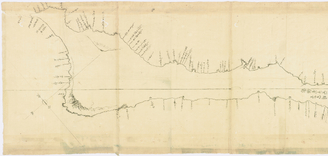
国後島測量大略図「クナシリ一里一寸八厘縮図」
Tokyo National Museum
Integrated Collections Database of the National Museums, Japan
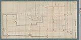
吉田城内之図
Toyohashi City Library
ADEAC: A System of Digitalization and Exhibition for Archive Collections

Karta Morskykh Otkrytii Rossiiskimi Moreplavatelimi na Tikhom ... [transliterated from the Cyrilli...
Stanford University Libraries
Stanford Libraries SearchWorks
Nokpong chŭngsŏ, 1819
Yale University Library
Yale University Library Digital Collections

Carte Reduite Des Mers Comprises Entre L'Asie et L'Amerique Apelees par les Navigateurs Mer Du Sud...
Stanford University Libraries
Stanford Libraries SearchWorks

Carte réduite de l'océan septentrional compris entre l'Asie et l'Amérique ... Par le Sr. Bellin ..
Yale University Library
Yale University Library Digital Collections

Western Portions of Flores
Stanford University Libraries
Stanford Libraries SearchWorks
Pascaerte vande Zuyd-Zee tussche California, en Ilhas de Ladrones / by Pieter Goos, op't Waater inde Vergulde Zeespiegel
National Library of Australia
Trove: National Library of Australia

(Composite of) A New Chart of The Pacific Ocean, Exhibiting The Western Coast of America, From Cap...
Stanford University Libraries
Stanford Libraries SearchWorks

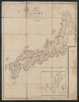
大日本國全圖
Yoshida-South Library, Kyoto University
IIIF Discovery in Japan
Samarai, New Guinea
National Library of Australia
Trove: National Library of Australia
Last Updated: 2020-04-17
Uploaded: 2021-09-21