
Maury's Wind and Current Chart, North Pacific Series A. No. 6 (China, Korea, Hong Kong, Japan, Phi...
- People
- Time
- Owner Organization
![[Spanish Chart of the Philippines, China, Japan, Korea, Kamtchatka, Western Pacific]](https://stacks.stanford.edu/image/iiif/nk348cb2252%2F42187sh/full/!200,200/0/default.jpg)
[Spanish Chart of the Philippines, China, Japan, Korea, Kamtchatka, Western Pacific]

China, Japan, and Mongolia. (inset) Hong Kong and Vicinity
![China--Japan, North Korea--South Korea--Russia, Sea of Japan [electronic resource]](https://www.gumtree.com/static/1/resources/assets/rwd/images/orphans/a37b37d99e7cef805f354d47.noimage_thumbnail.png)
China--Japan, North Korea--South Korea--Russia, Sea of Japan [electronic resource]

Pandanu tree and Japanese girls -- Hong Kong, China
East China Sea--north Pacific Ocean, China--Japan, Miyako-retto to Tokara-retto [electronic resour...
East Asia and North Pacific 1:4,350,000: South China Sea (Sheet 6)

Johnson's China and Japan. Entered ... 1868. (inset) Vicinity of Canton and Hong Kong
North Pacific Ocean, Japan, Nampō-Shotō [electronic resource]
Korean War 1950-1953 -- Asia, North Korea, South Korea, China, Manchuria, Japan Map / Maps.com(CR)

Japanese ladies under a beautiful Maritius Palm (Chrysolidocarpus), Public Gardens, Hong Kong, China
![East India Archipelago [Eastern Passages to China and Japan] [Chart No. 2] . . . 1868 (North Austr...](https://stacks.stanford.edu/image/iiif/hf333br4460%2F34582/full/!200,200/0/default.jpg)
East India Archipelago [Eastern Passages to China and Japan] [Chart No. 2] . . . 1868 (North Austr...
War map : Australia, China, Japan, and the South Pacific / Cyril Dillon

North West Pacific Ocean : Including Yellow, Japan & Okhotsk Seas, the Kuril Islands and Kamchatka
Foreign Exchange Rate Exposure in Hong Kong, Japan and Singapore Firm and Industry Level Analysis

map from "Canadian Pacific Railway's Royal Mail Steamship Line. Japan and China ... Handbook of in...

map from "Canadian Pacific Railway's Royal Mail Steamship Line. Japan and China ... Handbook of in...
Government’s role in Asia-Pacific market economies. Japan vs. China. Prace Naukowe Uniwersytetu Ek...
A New Chart of the Indian and Pacific Oceans Between the Cape of Good Hope, New Holland, and Japan...
The 'Western Pacific, showing the geographical relationship of Japan, French Indo-China, the Netherlands Eas...
![[Russian Map of Northeastern Asia, Japan, Korea, China, Alaska, etc.] ( Summary map of hydrographi...](https://stacks.stanford.edu/image/iiif/pj697kr2558%2F35405/full/!200,200/0/default.jpg)
[Russian Map of Northeastern Asia, Japan, Korea, China, Alaska, etc.] ( Summary map of hydrographi...

Reported Dangers to navigation in the Pacific Ocean, inclusive of the China and Japan Seas and the...
Sketch of a voyage to the India and China seas, including Japan and the Pacific islands, for the p...
Chart of the Kuro Siwo or Japan Stream of the Pacific : analogous to the Gulf Stream of the Atlantic, as investigated by the Officers of the U.S. Japan Expedition in 1854
Japan : Nipon, Kiusiu and Sikok, and a part of the coast of Korea / according to Krusenstern's Chart of 1827 ; J & C Walker sculpt

Carte Des Indes Orientales dessinee suivant les Observations les plus recentes dont le principal e...

Auckland Harbour

武相駿豆名所一覧図
![Asa no seisan narabi ryūdō ryakuzu [cartographic material]](https://stacks.stanford.edu/image/iiif/kr347vq0210%2Fkr347vq0210_00_0001/full/!200,200/0/default.jpg)
Asa no seisan narabi ryūdō ryakuzu [cartographic material]

Russia in Asia, Chinese Empire, etc. No. 3. Letts's popular atlas. Letts Son & Co. Limited, London...
![Cha no seisan narabi ryūdō ryakuzu [cartographic material] : 1936-nen genzai](https://stacks.stanford.edu/image/iiif/yr814zd0752%2Fyr814zd0752_00_0001/full/!200,200/0/default.jpg)
Cha no seisan narabi ryūdō ryakuzu [cartographic material] : 1936-nen genzai
Kasei Biruma Gojūmanbun ichi zu (7 he 501)
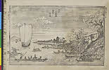
「江戸三囲堤花見景色」 「呼名 みめぐり」
A new map of the empires, states, provinces &c of Asia : including also the Turkish & Russian dominions in Europe & New Holland / compiled from the most authentic observations by Robert Wilkinson ; Walsh script. ; W. Palmer sculpt
Pas-caert van't Oostelyckste deel van Oost Indien : met alle de Eylanden daer onder gelegen, van Cabo Comorin tot aen Japan / by Hendrick Doncker Boekverkooper en Graadbooghmaacker Inde Nieuwbrughsteegh
City map, central Tokyo / prepared under the direction of the Engineer, GHQ, FEC ; by the 64th Engineer Base Topographic Battalion

(Composite Map of) Map of the Island of Japan, Kurile &c. with the Adjacent Coasts of the Chinese ...
Aoshima shigai kinbōzu

Etchuuyongunmuramurakumiwakeezu

「華頂山桜馬場風景」

「西国三十三所順拝地図」

Carte Des Indes et de la Chine Dressee sur plusieurs Rectifees par quelques Observations Par Guill...

Carte Des Indes et de la Chine Dressee sur plusieurs Relations particulieres Rectifees par quelque...

A New Chart of The Pacific Ocean, Exhibiting The Western Coast of America, From Cape Horn To Beeri...
A New Chart of The Pacific Ocean, Exhibiting The Western Coast of America, From Cape Horn To Beeri...

「豊前国羅漢寺絵図」
![Tokyo city proper [cartographic material]](https://stacks.stanford.edu/image/iiif/vj067cj0650%2Fvj067cj0650_00_0001/full/!200,200/0/default.jpg)
Tokyo city proper [cartographic material]
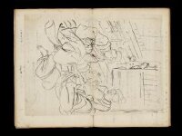
Kuniyoshi's preparatory drawings, no.39

A Chart of the Eastermost part of the East Indies and China from Cape Comarin to Japan with the Ad...
Last Updated: 2020-04-17
Uploaded: 2021-09-21