
(Covers to) Rand McNally map of Eastern Asia and Western Pacific Ocean Mercator projection. Copyri...

Rand McNally map of Eastern Asia and Western Pacific Ocean. Mercator projection. Copyright by Rand...
スタンフォード大学図書館
スタンフォード大学図書館SearchWorks

Rand McNally map of Eastern Asia and Western Pacific Ocean. (Mercator projection). Copyright by Ra...
スタンフォード大学図書館
スタンフォード大学図書館SearchWorks

Map of the Pacific Ocean
フィラデルフィア美術館
フィラデルフィア美術館コレクション

A new map of the Chinese Empire with Japan and Korea. Map of Asia. / by Rand, McNally & Co
イェール大学図書館
イェール大学図書館デジタルコレクション

Rand, McNally & Co.'s 1904 war map of Japan, Korea, and China ; Rand, McNally & Co.'s 1904 war map of Russia...
イェール大学図書館
イェール大学図書館デジタルコレクション

Rand, McNally & Co.'s 1904 war map of Japan, Korea, and China ; Rand, McNally & Co.'s 1904 war map of Russia...
イェール大学図書館
イェール大学図書館デジタルコレクション

Rand, McNally & Co.'s 1904 war map of Japan, Korea, and China ; Rand, McNally & Co.'s 1904 war map of Russia...
イェール大学図書館
イェール大学図書館デジタルコレクション
Globalization: Google and Asia-Pacific
スタンフォード大学図書館
スタンフォード大学図書館SearchWorks
Hagstrom's map of the Pacific and the Far East : on Mercator's projection
オーストラリア国立図書館
オーストラリア国立図書館Trove

(Covers to) Union and Central Pacific Railroad Line. The Great American Over-land Route. Rand, McN...
スタンフォード大学図書館
スタンフォード大学図書館SearchWorks
Seinan Taiheiyo seizu [Map of southwest Pacific Ocean] / compiled by Asahi Shinbunsha
オーストラリア国立図書館
オーストラリア国立図書館Trove
![Japan and adjacent regions of Asia and the Pacific Ocean [cartographic material] / compiled and drawn in the...](https://collections.library.yale.edu/iiif/2/15510875/full/!200,200/0/default.jpg)
Japan and adjacent regions of Asia and the Pacific Ocean [cartographic material] / compiled and drawn in the...
イェール大学図書館
イェール大学図書館デジタルコレクション
![Japan and adjacent regions of Asia and the Pacific Ocean [cartographic material] / compiled and drawn in the...](https://collections.library.yale.edu/iiif/2/15509964/full/!200,200/0/default.jpg)
Japan and adjacent regions of Asia and the Pacific Ocean [cartographic material] / compiled and drawn in the...
イェール大学図書館
イェール大学図書館デジタルコレクション

(Covers to) Erie Ry. New York, Lake Erie and Western R.R. August, 1887. Map and time tables inside...
スタンフォード大学図書館
スタンフォード大学図書館SearchWorks

North Pacific Ocean : Eastern Part of Hawaiin Islands
スタンフォード大学図書館
スタンフォード大学図書館SearchWorks
Ten leading trends in Asia & the Pacific. (travel trends) (Focus: Asia & the Pacific)
オーストラリア国立図書館Trove
Atlas of isotope hydrology - Asia and the Pacific
オーストラリア国立図書館
オーストラリア国立図書館Trove
Japan's Future in East Asia and the Pacific
OAPENオープンアクセス出版欧州ネットワーク
ヨーロピアナAPI
Japan's Future in East Asia and the Pacific
OAPENオープンアクセス出版欧州ネットワーク
ヨーロピアナAPI
Military balance in the Asia-Pacific: trends and implications
ライプニッツ社会科学研究所
ヨーロピアナAPI

Japan and its relation to the territory bordering on the Pacific Ocean
ボストン公共図書館
DPLA API
![[World War II battlefronts]. Map VI. The Southwest Pacific. Copyright, 1944, by Remington Rand, In...](https://stacks.stanford.edu/image/iiif/vs321mz7073%2F6758006/full/!200,200/0/default.jpg)
[World War II battlefronts]. Map VI. The Southwest Pacific. Copyright, 1944, by Remington Rand, In...
スタンフォード大学図書館
スタンフォード大学図書館SearchWorks
Erie Ry. New York, Lake Erie and Western R.R. August, 1887. Map and Time Tables Inside ... Rand, M...
スタンフォード大学図書館
スタンフォード大学図書館SearchWorks

A New Chart of The Pacific Ocean, Exhibiting The Western Coast of America from Cape Horn to Beerin...
スタンフォード大学図書館
スタンフォード大学図書館SearchWorks

豹蛮虎の戯遊
国立歴史民俗博物館
IIIF Discovery in Japan
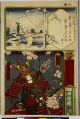
「書画五拾三駅」「伊勢」「石薬師」「逆桜」「伊与守源義経」
Nationaal Museum van Wereldculturen (Rijksmuseum Volkenkunde, Leiden)
ARC浮世絵ポータルデータベース
二十四孝(収載資料名:錦絵)
国立国会図書館
ARC浮世絵ポータルデータベース
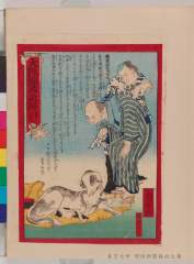
大阪錦画新話 8号 犬の乳を子猫にあてがう
東大近代日本法政史料C(明治新聞雑誌文庫)
ARC浮世絵ポータルデータベース

新古書画合
足立区立郷土博物館
ARC浮世絵ポータルデータベース
「諸国六十八景」 「伊豆 伊呂尾崎」「十四」
ベルギー王立美術歴史博物館
ARC浮世絵ポータルデータベース
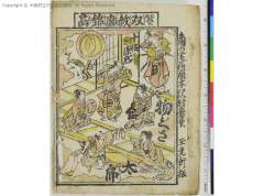
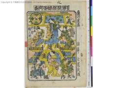
十帖源氏物ぐさ太郎、双紋廓錦画
大阪府立中之島図書館
ARC番付ポータルデータベース
大阪錦画日々新聞紙 36号 死霊の母が子に乳を与える
東大近代日本法政史料C(明治新聞雑誌文庫)
ARC浮世絵ポータルデータベース

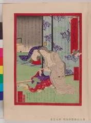
「吾妻源氏若紫之巻」
国立国会図書館
ARC浮世絵ポータルデータベース
![「司馬大泉[]」](https://www.arc.ritsumei.ac.jp/archive01/theater/th_image/PB/Leiden/Prints/Lei-P0221/Lei-1353-2436.jpg)
「司馬大泉[]」
Nationaal Museum van Wereldculturen (Rijksmuseum Volkenkunde, Leiden)
ARC浮世絵ポータルデータベース
芦屋道満大内鑑、染模様妹背門松
大阪府立中之島図書館
ARC番付ポータルデータベース
「滑稽穴さがし」「一」「女郎の足を抜人」「酒をみると追かける人」「船を漕丁稚」「節季の淵をおよぐ人」
Nationaal Museum van Wereldculturen (Rijksmuseum Volkenkunde, Leiden)
ARC浮世絵ポータルデータベース
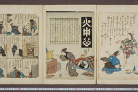
火用心
東京大学総合図書館
東京大学学術資産等アーカイブズポータル

「東京じまん名物會 司馬龍生 ビラ辰」「御料理海水浴 川崎屋 松沢左五郎」「新はし 辰中村屋千代 清水すゑ」「見立模様深川木場杢目染」
東京都立中央図書館
ARC浮世絵ポータルデータベース
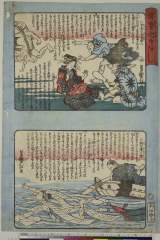
東京日々新話(咶) 号数不明 欲深い継母の所業に養女が自殺
東大近代日本法政史料C(明治新聞雑誌文庫)
ARC浮世絵ポータルデータベース
官許 錦画百事新聞 77号-2 田辺権右衛門が新聞箱を破棄
東大近代日本法政史料C(明治新聞雑誌文庫)
ARC浮世絵ポータルデータベース

「東海道筋」「遠馬道絵図」
東京都立中央図書館
ARC浮世絵ポータルデータベース

Shorelines. Volcanic Shorelines and Reefs. Koko Head, Hawaii. (inset map) Oryuzako Japan. (on oppo...
スタンフォード大学図書館
スタンフォード大学図書館SearchWorks
錦絵珍談新聞 錦絵珍談新聞
東大近代日本法政史料C(明治新聞雑誌文庫)
ARC浮世絵ポータルデータベース
「滑稽穴さがし」「三」「山をはる人」「大目玉を喰せる親方」「目玉を喰丁稚」「中の足の強ひ人」「腹のごくちいさい人」
Nationaal Museum van Wereldculturen (Rijksmuseum Volkenkunde, Leiden)
ARC浮世絵ポータルデータベース

「江戸名# 湯しま天満宮」 「江戸名所」「湯しま天満宮」
東京都立中央図書館
ARC浮世絵ポータルデータベース

Komurasaki no hanashi
アメリカ議会図書館
米議会図書館デジタルコレクション
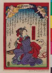
新聞図解 8号 見物に夢中になり、ひいきの狂言師に着物を投げつける
東大近代日本法政史料C(明治新聞雑誌文庫)
ARC浮世絵ポータルデータベース
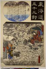
「東海道五十三対」「原」「竹とり物語」「かくやひめ」「竹取の翁」
Nationaal Museum van Wereldculturen (Rijksmuseum Volkenkunde, Leiden)
ARC浮世絵ポータルデータベース
最終更新日: 2020-04-17
登録日: 2021-09-21