

朝鮮地質総圖 = General geological map of Chosen (Korea)

北海道地勢及鑛産圖 = Topographical map of Hokkaido with localities of useful minerals

Kitashina chishitsuzu = Geological map of northern China

済州島地質図 = Geological Map of Saishuto

北海道地質鑛産圖

GEOLOGICAL MAP COMMONWEALTH OF AUSTRALIA

GEOLOGICAL MAP OF THE STATE OF CALIFORNIA

北海道地貭略圖

北海道地質報文ノ件

Geological Survey of Japan : reconnaissance map, geology : div. 4

Geological Survey of Japan : reconnaissance map, geology : div. 1

Geological Survey of Japan : reconnaissance map, geology : div. 2
Hokkaido, Japan : Special airfield relief map / prepared and reproduced in the United States Department of the Interior Geological Survey

北海道鳥瞰圖

Geological map of the Japanese Empire on the scale of 1:1,000,000
![Imperial Geological Survey of Japan topographical map : Division I-[V]](https://collections.library.yale.edu/iiif/2/15828616/full/!200,200/0/default.jpg)
Imperial Geological Survey of Japan topographical map : Division I-[V]

北海道空知油田地形及地質図
![[北海道拾壹箇國圖]](https://lapis.nichibun.ac.jp/image?did=6&pic=2&fid=10-5_01_01.jpg)
[北海道拾壹箇國圖]
Hokkaido, Japan / prepared and reproduced in the United States Department of the Interior, Geological Survey

大日本帝國油田第九區地質及地形圖 : 越後國寺泊油田 = Geological and topographical map of the oil fields of Japan, section IX : Teradomari oil field, Echigo
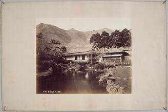
北海道・谷地頭
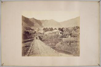
北海道・谷地頭

北海道土人風俗 Ainu Customs of the Hokkaido Tribe アイヌの老酋長

北海道土人風俗 Ainu Customs of the Hokkaido Tribe アイヌの老夫婦
北海道地勢及鑛産圖 = Topographical map of Hokkaido with localities of useful minerals

Map of China and the surrounding regions

Carte des découvertes au Nord du Japon faites en 1643 par les vaisseaux hollandais le Kastrikum et...

Chart of the S.W. Part of Japan from a dutch MS / by A. Dalrymple ; W. Harrison sc
Jūmanbun no ichi Nyū Airurando-tō
![[Taiwan and the Coast of Fujian and Guandong, China] Kaart van de Chineesche Kust en van Formosa v...](https://stacks.stanford.edu/image/iiif/zy510ks0323%2F34567/full/!200,200/0/default.jpg)
[Taiwan and the Coast of Fujian and Guandong, China] Kaart van de Chineesche Kust en van Formosa v...

Chart of the S.W. Part of Japan from a dutch MS / by A. Dalrymple ; W. Harrison sc

満州地質及鑛産分布圖 : 4

The Kanda Myojin Shrine
Kuniyoshi's preparatory drawings, no.39
Dai ichi-gun no heitan : Meiji sanjūnana-nen hachi-gatsu nijūgo nichi

〔富士山三尊九尊来迎図〕

〔富士山本宮浅間太神御影〕

名護屋古城之図

Carte des découvertes au Nord du Japon faites en 1643 par les vaisseaux hollandais le Kastrikum et...

National school board serie : No. 3 : America
![[Carte du Kamtchatka et des Kouriles]](https://api.europeana.eu/api/v2/thumbnail-by-url.json?uri=http%3A%2F%2Fgallica.bnf.fr%2Fark%3A%2F12148%2Fbtv1b53121764c.thumbnail.jpg&type=IMAGE)
[Carte du Kamtchatka et des Kouriles]
「永正年間 何曽合」 「松」
Woodblock print

Japan. London atlas series. Stanford's Geographical Establishment. London : Edward Stanford, 26 & ...
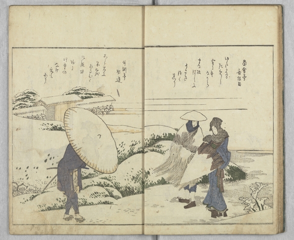
画本狂歌 山満多山 絵本

Carte Physique & Politique. : No. 2 : l'Europe et du Bassin de la Méditerranée

茶神陸鴻漸之像
Nokpong chŭngsŏ, 1819
Last Updated: 2020-04-16
Uploaded: 2021-07-27