
map from "Niphon and Pe-che-li; or, Two years in Japan and Northern China. [With plates and a map....
- Time
- Owner Organization

Japanese play bill from "Niphon and Pe-che-li; or, Two years in Japan and Northern China. [With pl...
China and Japan a record of observations made during a residence of several years in China, and a ...

Geographical and Statistical Map of China. China and the Tributary Kingdom of Corea. For the Eluci...

Iapon or Niphon the land of Iesso and Straits of the Vries &c

General map of China and adjacent regions, showing treaty ports and railways

Geological researches in China, Mongolia, and Japan during the years 1862 to 1865

Japan and Russia Will Divide China. Signs Increase That Northern Area and Lower Yangtze Basin Will...

1904 war map of Japan, Korea, and China

1904 war map of Russia and the continent of Asia

Rand, McNally & Co.'s 1904 war map of Russia and the continent of Asia
MAP, OF THE SEAT OF WAR BETWEEN CHINA AND JAPAN; (Auckland Star, 22 September 1894)
Stanford's map of eastern China, Japan and Korea : the seat of war in 1894
Relief map of Northern Honshu : special airfield relief map / prepared and reproduced in the United States Department of the Interior Geological Survey
Stanford's map of the empires of China and Japan : with the adjacent parts of the Russian Empire, ...

map from "Nine years in Nipon. Sketches of Japanese life and manners ... Second edition. [With ill...

map from "Nine years in Nipon. Sketches of Japanese life and manners ... Second edition. [With ill...

map from "Nine years in Nipon. Sketches of Japanese life and manners ... Second edition. [With ill...

Narrative of the Earl of Elgin's Mission to China and Japan in the Years 1857, '58, '59 - 2
Relief map of Northern Honshu / prepared and reproduced in the United States Department of the Interior Geological Survey

General map of China and adjacent regions showing treaty ports and railroads / prepared for the Department o...

map from "Canadian Pacific Railway's Royal Mail Steamship Line. Japan and China ... Handbook of in...

map from "Canadian Pacific Railway's Royal Mail Steamship Line. Japan and China ... Handbook of in...

Stanford's map of China and Japan with the adjacents parts of the Russian Rebubcs., India, Burma &...

Map of China And the Surrounding Regions. Compiled from the latest information by E. Bretscheider....
Japón [Material cartográfico]
新刻日本輿地路程全圖

Yonago, Tottori Prefecture, Honshu, Japan
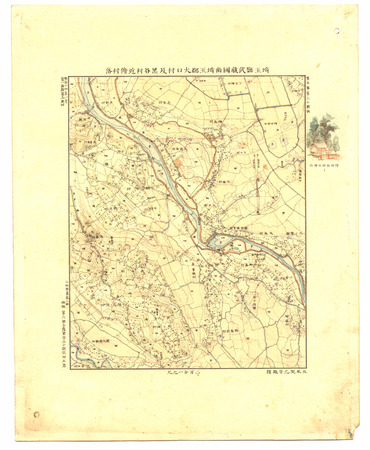
埼玉縣武蔵國南埼玉郡大口村及黒谷村近傍村落
Tectonic movements in Japan during the cainozic
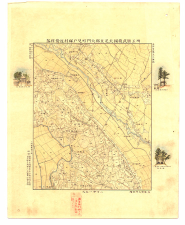
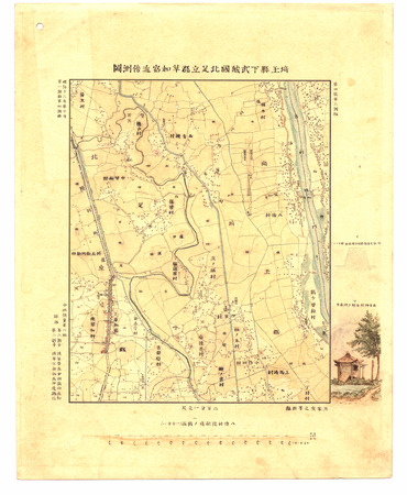
埼玉縣武蔵國北足立郡大門町及戸塚村近傍村落

Gojuusantsugimeishozuekameyama、fuuuraimei

Kaart van het keizerrijk Japan
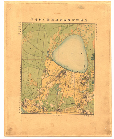
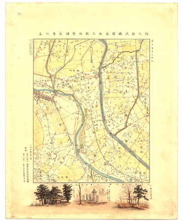
茨城縣常陸國鹿嶋郡溝口村近傍
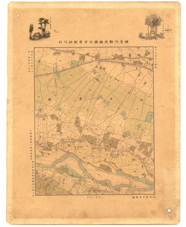
神奈川縣武蔵國北多摩郡砂川村
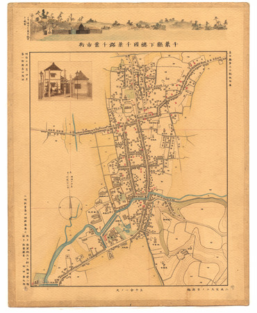
千葉縣下總國千葉郡千葉市街(五千分一ノ尺)

Kudamatsu, Yamaguchi Prefecture, Honshu, Japan
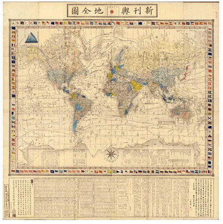
Shinkanyochizenzu
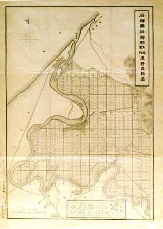
石狩国石狩郡生振当別原野区画図

Kameyama: Wind, Rain, and Thunder (Kameyama, fuu raimei), no. 47 from the series "Famous Sights of the Fifty-three Stations (Gojusan tsugi meisho zue)," also known as the Vertical Tokaido

Mar Del Zur Hispanis Mare Pacificum (Rare 2nd State with Tasman's Discoveries)
![Suirobu Hi [Kaizu]](https://stacks.stanford.edu/image/iiif/nm634np1065%2Fnm634np1065_0001/full/!200,200/0/default.jpg)
Suirobu Hi [Kaizu]
埼玉縣武蔵國南埼玉郡粕壁驛近傍村落
東京府下武蔵國葛飾郡東西宇喜田両村並傍近村落圖
Nakamura Macue III. jako Kacuragi tajú
埼玉縣下武蔵國北足立郡草加宿近傍測圖
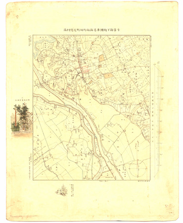
千葉縣下總國東葛飾郡野田町近傍村落
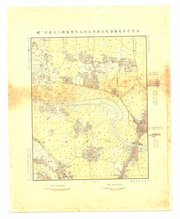
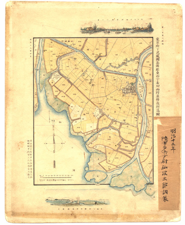
東京府武蔵國南足立郡本木村及北豊島郡三河島村ノ圖

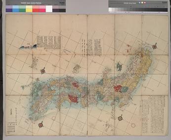
Map of Japan
Last Updated:
Uploaded: 2021-07-27