Relief map of Northern Honshu / prepared and reproduced in the United States Department of the Interior Geological Survey
- People
- Time
- Owner Organization
Relief map of Northern Honshu : special airfield relief map / prepared and reproduced in the United States Department of the Interior Geological Survey
Relief map of southern Japan / prepared and reproduced in the United States Department of the Interior Geological Survey
Relief map of Southern Japan : special airfield relief map / prepared and reproduced in the United States Department of the Interior Geological Survey
Hokkaido, Japan : Special airfield relief map / prepared and reproduced in the United States Department of the Interior Geological Survey
Hokkaido, Japan / prepared and reproduced in the United States Department of the Interior, Geological Survey

The M9.0 Great Tohoku Earthquake (northeast Honshu, Japan) of March 11, 2011 : earthquake summary map / U.S. Geological Survey
General map of China and adjacent regions, showing treaty ports and railways / prepared for the Department of State, by the Topographic Branch, U.S. Geological Survey

Topographical map of the Japanese Empire, 1899 / Imperial Geological Survey of Japan ; drawn by T. Togawa an...
Caroline Islands 1:25,000 : Yap / prepared under the direction of Engineer, Hq AFFE/BA, by the Military Geology Branch, Intelligence Division ; map compiled by C. G. Johnson, geologist, Military Geology Branch, U.S. Geological Survey, for the Intelligence Division, Office of the Engineer, Hq. U.S. Army Japan
Japan 1:500,000 / prepared under the direction of the Engineer, U.S. Sixth Army by the 69th EngineerTopo. Co., July 1945 ; reproduced by BMP no 1, GHQ. AFPAC, U.S. Army
Picture of a Steamship (Jokisen no zu) and Picture of the True Form of a Person of the Northern United States of America (Kita Amerika gasshū koku jinbutsu shinzō no zu)
Court Exh. No. 3710: Booklet prepared by the United States Tariff Commission in Sept 1945 entitled "Japanese Trade Studies - Annotated Tabular Survey of the Trade of Japan Proper (Including that with Korea and Formosa)." For idetification only
Relief map of Northern Honshu : special airfield relief map / prepared and reproduced in the United States Department of the Interior Geological Survey

Gōshū Karasaki Hitotsumatsu no zu
Ryuukyuuhakkei、ryuutoushoutou

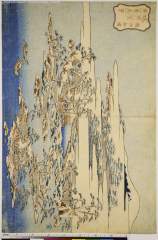
Magpies on a Mountainside

伊賀伊勢志摩図 : 伊賀伊勢志摩図
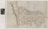
伊予国輿地全図 : 伊予国全図

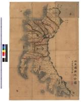
Strategical map of part of Korea and Manchuria / prepared by the Second Division, General Staff (Military In...
「見立浦島」

「李夫人(明和二年絵暦)」
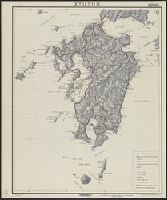
Kyushu
安房国之図
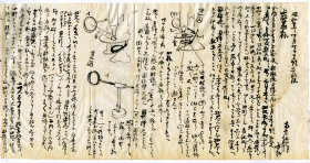
上松蓊宛・封書

Enoshima zenkei

東松浦郡町村図(甲)鳥巣村

朝鮮總圖 = General map of Chosen (Korea)

徳島県全図

尾濃御領分御代官所支配分図 : 尾張御領分御代官所支配分図

Couple with Baby in Basket (Chi no Oka no Fugokakematsu)
阿波国全図(木版)

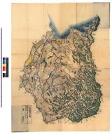
常陸国全図 : 常陸国図
武蔵国輿地全図 : 武蔵国輿地全図

日本北州西岸後志小樽港 = Japan Hokusyū, west coast, Shiribeshi, Otaru Kō
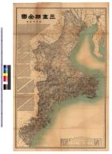
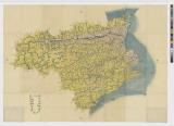
三重県全図 : 三重県全図
Last Updated: 2020-06-05
Uploaded: 2021-07-22