
Zee-atlassen, wereldkaarten enz. >> "A new and correct outline chart intended for the use of...
- People
- Loten, Joan Gideon西インド諸島植民地評議会Staten van Holland en West-Frieslandベルベス協会理事会商務植民地省商務植民地省総局旧スリナムアーカイブ・行政府長官東インド貿易及び付帯物委員会海軍植民地省海軍植民地省オランダ管区西インド諸島植民地暫定理事会Heneman, Johan Christophアムステルダム商工会議所東インド会社機器部門ゼーラント商工会議所西インド会社アムステルダム商工会議所西インド会社アムステルダム海事委員会海図長決定部会アメリカ所有及び設置評議会ギニア沿岸及びアメリカ植民地問題委員会スリナム協会理事会ゼーラント商工会議所東インド会社戦時総合補給廠アジア所有及び設置評議会アムステルダム商工会議所東インド会社
- Owner Organization

An Outline Chart of The World Intended For The Purpose of Marking Off A Ship's Track. . . . 1883

A New and Correct Chart of all the Known World Laid down according to Mercator's Projection

A New and Correct Chart of all the Known World Laid down according to Mercator's Projection

A New and Correct Chart of all the Known World Laid down according to Mercator's Projection
A New & Correct Chart of the Indian Sea From Cabo Bonea Esperanca to Japan [Material cartográfico]...

A new & correct chart of the Indian sea from Cabo Bonea Esperanca to Japan : according to Mr Edwar...

A Correct Sea Chart of the Whole World, According to Wright's, Commonly Called Mercator's, Project...

A Correct Sea Chart of the Whole World, According to Wright's, Commonly Called Mercator's, Project...
A new & correct chart of the Indian Sea from Cabo Bonea Esperanca to Japan according to Mr. Edward Wrights projection vulgarly called Mercators chart
A New Chart of the Indian and Pacific Oceans Between the Cape of Good Hope, New Holland, and Japan...

Laurie and Whittle's New Chart of the Indian and Pacific Oceans Between the Cape of Good Hope, New...

Laurie and Whittle's New Chart of the Indian and Pacific Oceans Between the Cape of Good Hope, New...

A New & Accurate Chart of the Discoveries made by the late Capt. Js. Cook, and other distinguished...

An Accurate Chart of the World, with the New Discoveries; Also a View of the General & Coasting Tr...
A new chart of the Indian and Pacific Oceans between the Cape of Good Hope, New Holland and Japan : comprehending New Zealand, New Caledonia, New Britain, New Ireland, New Guinea &c., also the New Caroline, Ladrone and Philippine Islands : with the tracks of the English, French, Spanish and Dutch discoverers
Members of the 28th New Zealand (Maori) Battalion training in the use of a mortar, Egypt
Elegy for a New Conscript: Under the Shadow of a Rifle Stand

A New Map of the Whole World According To The New Observations by Moll Geographer

Attitudes to the teaching of history and the use of creative skills in Japan and England :a compar...

A new and accurate map of the Empire of Japan. Laid down from the memoirs of the Portuguese and Du...

A Correct Map From Actual Surveys And Examinations Embracing A Portion of California Between Monte...

A new chart of the Pacific Ocean - with courses plotted on it of the whaling ships LEVI STARBUCK, MARCIA and WILLIAM ROTCH
Japan meets Mumindalen a qualitative case study of the fashion brand Monki and the use of fashions...
A new chart of the Indian and Pacific Oceans between the Cape of Good Hope, New Holland and Japan : comprehending New Zealand, New Caledonia, New Britain, New Ireland, New Guinea &c., Louisade and New Georgia ; also the Pellew, New Caroline, Ladrone and Philippine Islands; with all these which have been discovered in the year 1788; & the tracks of the English, French, Spanish and Dutch discoverers

Hyakumanbun no ichi Nanpō kōkūzu

Carte réduite de l'océan septentrional compris entre l'Asie et l'Amérique ... Par le Sr. Bellin ..

Empire of Japan. (with) Nagasaki Harbour. Engraved by J. & C. Walker. Published under the superint...

Map of China and the surrounding regions
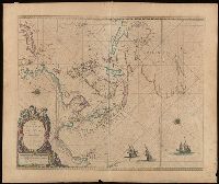
Paskaerte zynde t'Oosterdeel van Oost Indien : met alle de Eylanden daer ontrendt geleegen van C. Comorin to...

China divided into its great provinces and the Isles of Japan by Samuel Dunn

Amérique du Sud
Empire of Japan / published under the superintendence of the Society for the Diffusion of Useful Knowledge

北海道地勢及鑛産圖 = Topographical map of Hokkaido with localities of useful minerals

神埼二万分ノ一

狂月坊 絵本
A New & Accurate Chart of the Discoveries made by the late Capt. Js. Cook, and other distinguished...

Asia : Coast of China : Ryōtō Kaiwan. Approaches to Ryō Ga Entrance

Tabula Indiae Orientalis et Regnorum Adjacentium J. Van Braam et G. onder de Linden . .
![Shina busshi ryūdo sōgō zu [cartographic material]](https://stacks.stanford.edu/image/iiif/sy422nt0000%2Fsy422nt0000_00_0001/full/!200,200/0/default.jpg)
Shina busshi ryūdo sōgō zu [cartographic material]

Tabula Indiae Orientalis et Regnorum Adjacentium J. Van Braam et G. onder de Linden . .

唐土歴代州郡沿革図(08)

武相駿豆名所一覧図
![Indo Hyakumanbunnoichi Zu Tōbu Shūiki [cartographic material]](https://stacks.stanford.edu/image/iiif/wr290sd1084%2Fwr290sd1084_00_0001/full/!200,200/0/default.jpg)
Indo Hyakumanbunnoichi Zu Tōbu Shūiki [cartographic material]

Das Chinesische Reich mit den Schutz-Staaten, und Japan: entw. u. gez. v. C.G R.(eichard) 1826. Ge...
![[Japan] (Published in Manila!)](https://stacks.stanford.edu/image/iiif/gv355sq3352%2F37869hs/full/!200,200/0/default.jpg)
[Japan] (Published in Manila!)

「八坂祭礼六月七日山鉾之図」「六月十四日八坂祭礼之図」 「GION MATSURI」「GION MATSURI」
Iaponia Regnvm

De Nieuwe Groote Ligtende Zee-Fakkel, Het Sesde Deel, ... (etc.), uitgegeven door Johannes van Keu...
Last Updated:
Uploaded: 2021-07-27