
Map of Northern Japan. Map of Southern Japan
- Time
- Owner Organization

Map of Japan

Map of Japan
Map of Japan

Map of Japan
Map of Japan
Map of Japan

Map of Japan
Map of Japan
Map of Japan

Map of Japan

Map of Japan
Map - Southern Japan
Map - Southern Japan Road Map
Map - Northern Japan Road Map
Map - Northern Japan (Road Map)

A map of the Empire of Japan, made by Dr. Kaempfer [with maps of Kamchatka, Northern coast of Japan, as well...

New Map of Japan

Construction of the Auckland Harbour Bridge southern and northern anchorages

Map of the Empire of Japan
Map of Japan. (sheet 3)

The railway map of Japan
General railway map of Japan

Dish depicting map of Japan
Southern Japan : location of climatological stations

An Improved Map of the United States By Shelton & Kensett

Korea, Nordost-China und Süd-Japan / Carl Flemming

Carte Du Kamtchatka . .

A new and accurate map of the Empire of Japan : laid down from the memoirs of the Portuguese and Dutch, and ...

Charte Von America nach astronomischen Bestimmungen und den neuesten Charten entworfen von .L. Gus...

Carte des Indes, de la Chine & des Iles de Sumatra, Java &c.

Recentissima Novi Orbis Sive Americae Septentrionalis et Meridionalis Tabula ex Officina Caroli Al...

L'Amerique Septentrionale & Meridionale divisee en ses principales parties . .

Asiae Nova Delineatio . .

Asia Concinnata Secundum Observationes Academiae Regalis Scientiarum . .

China, Contains 15 Subject Provinces, including the 2 Islands of Hainan Formosa and the Tributary ...
![Iaponiae Insulae Descriptio Ludoico Teisera auctore [Korea Shown As An Island]](https://stacks.stanford.edu/image/iiif/cm271fr9684%2F33621/full/!200,200/0/default.jpg)
Iaponiae Insulae Descriptio Ludoico Teisera auctore [Korea Shown As An Island]
![Iaponiae Insulae Descriptio Ludoico Teisera auctore [Korea Shown As An Island]](https://stacks.stanford.edu/image/iiif/wx238nz6323%2F32405bp/full/!200,200/0/default.jpg)
Iaponiae Insulae Descriptio Ludoico Teisera auctore [Korea Shown As An Island]

A New and Accurate Map of the Empire of Japan Laid down from the Memoirs of the Portugese and Dutc...

Platte Kaart van de Geheele Werelt . .

Maris Pacifici quod vulgo Mar del Zud
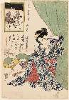
「今世斗計十二時」 「丑ノ刻」「夜ノ八ツ時」

滿洲歴史地理. : 第壹巻附図 : 三国時代満洲図 (220-265)・西晋時代満洲図 (265-316)

滿洲歴史地理. : 第壹巻附図 : 隋代及唐初満洲図(西暦五八九年-六六八年)

Japan. (with) Kurile Islands. Letts's popular atlas. Letts, Son & Co Limited, London. (1883)

Tartariae Sive Magni Chami Regni typus

Japan Nippon, Kiusiu, Sikok,Yesso and the Japanese Kuriles

「新板植木つくし」
「(狂斎百図)あみ陀の光も金次第」 「正直ノ頭上にかみやとる」
Last Updated:
Uploaded: 2021-07-27