![Japanese routed from Buna stronghold! [etc.] [electronic resource].](https://www.gumtree.com/static/1/resources/assets/rwd/images/orphans/a37b37d99e7cef805f354d47.noimage_thumbnail.png)
Japanese routed from Buna stronghold! [etc.] [electronic resource].
Australian troops attacking the Japanese Xtlong the Buna coast, New Guinea. The Australians on the left are ...
[Aerial photographs relating to the Japanese occupation of Buna-Gona region, Papua New Guinea, 1942-1943] [Allied air raids]
[Aerial photographs relating to the Japanese occupation of Buna-Gona region, Papua New Guinea, 1942-1943] [Allied air raids]. (61)
[Aerial photographs relating to the Japanese occupation of Buna-Gona region, Papua New Guinea, 1942-1943] [Allied air raids]. (46)
[Aerial photographs relating to the Japanese occupation of Buna-Gona region, Papua New Guinea, 1942-1943] [Allied air raids]. (56)
[Aerial photographs relating to the Japanese occupation of Buna-Gona region, Papua New Guinea, 1942-1943] [Allied air raids]. (52)
[Aerial photographs relating to the Japanese occupation of Buna-Gona region, Papua New Guinea, 1942-1943] [Allied air raids]. (53)
[Aerial photographs relating to the Japanese occupation of Buna-Gona region, Papua New Guinea, 1942-1943] [Allied air raids]. (44)
[Aerial photographs relating to the Japanese occupation of Buna-Gona region, Papua New Guinea, 1942-1943] [Allied air raids]. (58)
[Aerial photographs relating to the Japanese occupation of Buna-Gona region, Papua New Guinea, 1942-1943] [Allied air raids]. (57)
[Aerial photographs relating to the Japanese occupation of Buna-Gona region, Papua New Guinea, 1942-1943] [Allied air raids]. (59)
[Aerial photographs relating to the Japanese occupation of Buna-Gona region, Papua New Guinea, 1942-1943] [Allied air raids]. (51)
[Aerial photographs relating to the Japanese occupation of Buna-Gona region, Papua New Guinea, 1942-1943] [Allied air raids]. (40)
[Aerial photographs relating to the Japanese occupation of Buna-Gona region, Papua New Guinea, 1942-1943] [Allied air raids]. (45)
[Aerial photographs relating to the Japanese occupation of Buna-Gona region, Papua New Guinea, 1942-1943] [Allied air raids]. (41)
[Aerial photographs relating to the Japanese occupation of Buna-Gona region, Papua New Guinea, 1942-1943] [Allied air raids]. (55)
[Aerial photographs relating to the Japanese occupation of Buna-Gona region, Papua New Guinea, 1942-1943] [Allied air raids]. (42)
[Aerial photographs relating to the Japanese occupation of Buna-Gona region, Papua New Guinea, 1942-1943] [Allied air raids]. (63)
[Aerial photographs relating to the Japanese occupation of Buna-Gona region, Papua New Guinea, 1942-1943] [Allied air raids]. (54)
[Aerial photographs relating to the Japanese occupation of Buna-Gona region, Papua New Guinea, 1942-1943] [Allied air raids]. (37)
[Aerial photographs relating to the Japanese occupation of Buna-Gona region, Papua New Guinea, 1942-1943] [Allied air raids]. (47)
[Aerial photographs relating to the Japanese occupation of Buna-Gona region, Papua New Guinea, 1942-1943] [Allied air raids]. (38)
[Aerial photographs relating to the Japanese occupation of Buna-Gona region, Papua New Guinea, 1942-1943] [Allied air raids]. (50)
A map of the N.E. parts of Asia, and N.W. parts of America, shewing their situation with respect to Japan taken from a Japanese map of the world, brought over by Kempfer and late in the Museum of Sr. Hans Sloane
![Tsuruga-shi Kōkū shashin sokuryōzu [cartographic material]](https://stacks.stanford.edu/image/iiif/yn152cf5419%2Fyn152cf5419_00_0001/full/!200,200/0/default.jpg)
Tsuruga-shi Kōkū shashin sokuryōzu [cartographic material]

実測安房全図
Reconnaissance map of Brunei & adjacent territories, 1937 : Burunai

Sibérie, partie de l'empire chinois, îles du Japon / par Fx Delamarche, fils
Le isole del Giappone e la Corea : delineate sulle ultime osservazioni / Gio. Ma. Cassini, som inc

Wakanhyakumonogatarikayoufujin
Carte générale de l'empire Chinois et du Japon / par A. H. Brué, géographe de S.A.R. Monsieur ; gravée sous la direction de l'auteur
L'empire de la Chine : d'après l'atlas Chinois, avec les isles du Japon / par M. Bonne, Membre de la Societʹe Litteraire Militre. Ingenieur Gʹeographe &c

山梨県管内全図
![Carte De L'Empire De La Chine . . . An XII [Shows Formosa]](https://stacks.stanford.edu/image/iiif/qv486bn8087%2F18739/full/!200,200/0/default.jpg)
Carte De L'Empire De La Chine . . . An XII [Shows Formosa]
Corea and Japan
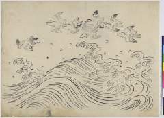
(浪に千鳥)
Japan, the islands of Loochoo & Formosa, and the maritime provinces of China with the tract of the Morrison's voyage in 1837 / J. Arrowsmith, Lith
Hototogisu、onnatenka

China divided into its Great Provinces, and The Isle of Japan . . . 1774
![Yokkaichi kōkū shashin sokuryōzu [cartographic material]](https://stacks.stanford.edu/image/iiif/dx686xz3690%2Fdx686xz3690_00_0001/full/!200,200/0/default.jpg)
Yokkaichi kōkū shashin sokuryōzu [cartographic material]
[Nisshin sensōji chizu] / Rikuchi Sokuryōbu

Ichiman bun no ichi Chōsen Chikeizu Heijō

Japan, Hokushu _ West Coast. Iwanai Byochi and Approaches

Atlas Russicus mappa una generali et undeviginti specialibus vastissimum imperium Russicum adjacen...

Gomanbun no ichi Karafuto kūchū shashin sokuryō yōzu

山梨県総合開発計画図

「妙法院翫雀歌曲信士」「子ノ二月十七日」 「行年五十八才中寺町浄国寺」
Last Updated: 2020-06-05
Uploaded: 2021-07-22