Reconnaissance map of Brunei & adjacent territories, 1937 : Burunai
- Time
- Owner Organization
Manchoutikuo and adjoining territories
National Library of Australia
Trove: National Library of Australia

(Composite Map of) Map of the Island of Japan, Kurile &c. with the Adjacent Coasts of the Chinese ...
Stanford University Libraries
Stanford Libraries SearchWorks

General map of China and adjacent regions, showing treaty ports and railways
Stanford University Libraries
Stanford Libraries SearchWorks
Stanford's map of the empires of China and Japan : with the adjacent parts of the Russian Empire, ...
VU University Amsterdam Library
Europeana API

(Upper Sheet to) Map of the Island of Japan, Kurile &c. with the Adjacent Coasts of the Chinese Do...
Stanford University Libraries
Stanford Libraries SearchWorks

Map of Japan and adjacenl regions. The Society for International Gulturel Relations. Tokyo 1937
Royal Library, Denmark
Europeana API
Stanford's map of China & Japan with the adjacent parts of the Russian Repubcs. India, Burma &c / Stanford's Geographical Establishment
National Library of Australia
Trove: National Library of Australia

(Lower Sheet to) Map of the Island of Japan, Kurile &c. with the Adjacent Coasts of the Chinese Do...
Stanford University Libraries
Stanford Libraries SearchWorks

Japan, Manchuria, and adjacent regions
Stanford University Libraries
Stanford Libraries SearchWorks
Map of the Island of Japan, Kurile &c. with the Adjacent Coasts of the Chinese Dominions and a Ske...
Stanford University Libraries
Stanford Libraries SearchWorks

Map of the Island of Japan, Kurile &c. with the Adjacent Coasts of the Chinese Dominions and a Ske...
Stanford University Libraries
Stanford Libraries SearchWorks
A map of the East-Indies and adjacent countries : with settlements, factories, and territories : explaining what belongs to England, Spain, France, Holland, Denmark, Portugal, etc. with many remarks not extant in any other map / by H. Moll, geog
National Library of Australia
Trove: National Library of Australia

A map of the East-Indies and adjacent countries : with settlements, factories, and territories : explaining what belongs to England, Spain, France, Holland, Denmark, Portugal, etc. with many remarks not extant in any other map / by H. Moll, geog
State Library of New South Wales
Trove: National Library of Australia

A map of the city of Nagasaki, and of the adjacent country; Sorts of money current in the Japanese Empire
General Research Division. The New York Public Library
DPLA API

Karta Aziatskoi Rossii . . . [Map of the Asian part of Russia and Possessions Adjacent, with the R...
Stanford University Libraries
Stanford Libraries SearchWorks

A Map of the East-Indies and the Adjacent Countries; with the Settlements, Factories and Territori...
Stanford University Libraries
Stanford Libraries SearchWorks

A Map of the East-Indies and the Adjacent Countries; with the Settlements, Factories and Territori...
Stanford University Libraries
Stanford Libraries SearchWorks

A Map of the East-Indies and the Adjacent Countries; with the Settlements, Factories and Territori...
Stanford University Libraries
Stanford Libraries SearchWorks

A Map of the East-Indies and the Adjacent Countries; with the Settlements, Factories and Territori...
Stanford University Libraries
Stanford Libraries SearchWorks

A Map of the East-Indies and the Adjacent Countries; with the Settlements, Factories and Territori...
Stanford University Libraries
Stanford Libraries SearchWorks

A Map of the East-Indies and the Adjacent Countries; with the Settlements, Factories and Territori...
Stanford University Libraries
Stanford Libraries SearchWorks

General map of China and adjacent regions showing treaty ports and railroads / prepared for the Department o...
Yale University Library
Yale University Library Digital Collections

Manchoutikuo and adjoining territories
Stanford University Libraries
Stanford Libraries SearchWorks

Series (Standard map series designation system) ; 5205
Yale University Library
Yale University Library Digital Collections

実測安房全図
Funabashi-shi Western Library
ADEAC: A System of Digitalization and Exhibition for Archive Collections
Buna
National Library of Australia
Trove: National Library of Australia
Zenakukasaneizutsu
Shochiku Otani Library
ARC Banzuke (Playbills) Portal Database
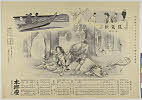
![Tsuruga-shi Kōkū shashin sokuryōzu [cartographic material]](https://stacks.stanford.edu/image/iiif/yn152cf5419%2Fyn152cf5419_00_0001/full/!200,200/0/default.jpg)
Tsuruga-shi Kōkū shashin sokuryōzu [cartographic material]
Stanford University Libraries
Stanford Libraries SearchWorks
Yuki、shinjufujin
Shochiku Otani Library
ARC Banzuke (Playbills) Portal Database

Wakanhyakumonogatarikayoufujin
Art Research Center, Ritsumeikan University
ARC Ukiyo-e Portal Database
Ichijiku、bikkuribako
Shochiku Otani Library
ARC Banzuke (Playbills) Portal Database
Kyoudai、yakimochi
Shochiku Otani Library
ARC Banzuke (Playbills) Portal Database

Kūchū shashin yōzu Sanman Gosen bun no ichi Bisumaruku Guntō Tsurubu - Busshingu Misaki kan
Stanford University Libraries
Stanford Libraries SearchWorks

Numazu
Shochiku Otani Library
ARC Banzuke (Playbills) Portal Database

Megurokoudan、tetsudounokyousou
Shochiku Otani Library
ARC Banzuke (Playbills) Portal Database
Hitonoun、seihazen
Shochiku Otani Library
ARC Banzuke (Playbills) Portal Database
Konjikiyasha
Shochiku Otani Library
ARC Banzuke (Playbills) Portal Database
Kusunokimasashige、bondoman、zashikibiraki
Shochiku Otani Library
ARC Banzuke (Playbills) Portal Database
Zenakukasaneizutsu
Shochiku Otani Library
ARC Banzuke (Playbills) Portal Database
〔牧狩御用掛趣意書〕
Funabashi-shi Western Library
ADEAC: A System of Digitalization and Exhibition for Archive Collections
Seishunnoyume、daiichininsha、inakagenji
Shochiku Otani Library
ARC Banzuke (Playbills) Portal Database

明智左馬之助光利
Mario Marega Collections, Salesian University, Rome
ARC Ukiyo-e Portal Database
Shinjufujin
Shochiku Otani Library
ARC Banzuke (Playbills) Portal Database
Kusunokimasashige、bondoman、zashikibiraki
Shochiku Otani Library
ARC Banzuke (Playbills) Portal Database
Shīzarukidan
Shochiku Otani Library
ARC Banzuke (Playbills) Portal Database

Kanjinchou
Shochiku Otani Library
ARC Banzuke (Playbills) Portal Database
Kumonowakareji、taruyaosen
Shochiku Otani Library
ARC Banzuke (Playbills) Portal Database
Biwauta
Shochiku Otani Library
ARC Banzuke (Playbills) Portal Database
Last Updated: 2020-06-05
Uploaded: 2021-07-22