
General map of China and adjacent regions showing treaty ports and railroads / prepared for the Department o...
- Time
- Owner Organization

General map of China and adjacent regions, showing treaty ports and railways
Stanford University Libraries
Stanford Libraries SearchWorks
General map of China and adjacent regions, showing treaty ports and railways / prepared for the Department of State, by the Topographic Branch, U.S. Geological Survey
National Library of Australia
Trove: National Library of Australia

Japan, Manchuria, and adjacent regions
Stanford University Libraries
Stanford Libraries SearchWorks
Japan and adjacent regions / prepared and distributed by Army Information Branch, Army Service Forces
Yale University Library
Yale University Library Digital Collections
Tokyo and vicinity : showing bombed-out areas / prepared ... by Nippon Map Co
National Library of Australia
Trove: National Library of Australia
Stanford's map of the empires of China and Japan : with the adjacent parts of the Russian Empire, ...
VU University Amsterdam Library
Europeana API
![Japan and adjacent regions of Asia and the Pacific Ocean [cartographic material] / compiled and drawn in the...](https://collections.library.yale.edu/iiif/2/15510875/full/!200,200/0/default.jpg)
Japan and adjacent regions of Asia and the Pacific Ocean [cartographic material] / compiled and drawn in the...
Yale University Library
Yale University Library Digital Collections
![Japan and adjacent regions of Asia and the Pacific Ocean [cartographic material] / compiled and drawn in the...](https://collections.library.yale.edu/iiif/2/15509964/full/!200,200/0/default.jpg)
Japan and adjacent regions of Asia and the Pacific Ocean [cartographic material] / compiled and drawn in the...
Yale University Library
Yale University Library Digital Collections

Map of China And the Surrounding Regions. Compiled from the latest information by E. Bretscheider....
Stanford University Libraries
Stanford Libraries SearchWorks

Map of Japan and adjacenl regions. The Society for International Gulturel Relations. Tokyo 1937
Royal Library, Denmark
Europeana API

Tokyo and vicinity, showing bombed-out areas. (Regional map on verso)
Stanford University Libraries
Stanford Libraries SearchWorks

A Map of the East-Indies and the Adjacent Countries; with the Settlements, Factories and Territori...
Stanford University Libraries
Stanford Libraries SearchWorks

A Map of the East-Indies and the Adjacent Countries; with the Settlements, Factories and Territori...
Stanford University Libraries
Stanford Libraries SearchWorks

A Map of the East-Indies and the Adjacent Countries; with the Settlements, Factories and Territori...
Stanford University Libraries
Stanford Libraries SearchWorks

A Map of the East-Indies and the Adjacent Countries; with the Settlements, Factories and Territori...
Stanford University Libraries
Stanford Libraries SearchWorks

A Map of the East-Indies and the Adjacent Countries; with the Settlements, Factories and Territori...
Stanford University Libraries
Stanford Libraries SearchWorks

A Map of the East-Indies and the Adjacent Countries; with the Settlements, Factories and Territori...
Stanford University Libraries
Stanford Libraries SearchWorks
Japan and adjacent regions of Asia and the Pacific Ocean / compiled and drawn in the Cartographic Section of the National Geographic Society
National Library of Australia
Trove: National Library of Australia

General Railway Map of Japan and Manchuria : Showing lines open and under construction on March 31...
Stanford University Libraries
Stanford Libraries SearchWorks

A chart of the tradeing part of the East Indies and China, with the adjacent islands, from Surrat ...
Royal Museums Greenwich
Europeana API

Charts, etc
Yale University Library
Yale University Library Digital Collections

Asia, Japan and Korea : with the surrounding seas and the adjacent coastal region of China / published at Wa...
Yale University Library
Yale University Library Digital Collections
Hokkaido, Japan : Special airfield relief map / prepared and reproduced in the United States Department of the Interior Geological Survey
National Library of Australia
Trove: National Library of Australia
Stanford's map of the empires of China and Japan with the adjacent parts of the Russian Empire, India, Burma &c / Stanford's Geogl. Estabt
National Library of Australia
Trove: National Library of Australia
![Gohyakumanbunnoichi sorenpō yochizu [cartographic material]](https://stacks.stanford.edu/image/iiif/vz338tz0647%2Fvz338tz0647_00_0001/full/!200,200/0/default.jpg)
Gohyakumanbunnoichi sorenpō yochizu [cartographic material]
Stanford University Libraries
Stanford Libraries SearchWorks

Nara, Yamada, Koyasan, & environs
Yale University Library
Yale University Library Digital Collections
Nara, Yamada, Koyasan, & environs
Yale University Library
Yale University Library Digital Collections
Kyoto South : Kyoto Prefecture, Honshu, Japan
Yale University Library
Yale University Library Digital Collections

Ise Bay - North :
Yale University Library
Yale University Library Digital Collections
![Indo oyobi Seia [cartographic material] : Roppyakmanbun no ichi](https://stacks.stanford.edu/image/iiif/dx650yf2686%2Fdx650yf2686_00_0001/full/!200,200/0/default.jpg)
Indo oyobi Seia [cartographic material] : Roppyakmanbun no ichi
Stanford University Libraries
Stanford Libraries SearchWorks

Nagasaki
Yale University Library
Yale University Library Digital Collections

The Japanese empire : with central and southern Manchukuo (Manchuria)
Yale University Library
Yale University Library Digital Collections

Gojūmanbun no ichi Gobaikaru hōmen sozu
Stanford University Libraries
Stanford Libraries SearchWorks
![Karte von China und Japan den Manen D'Anville's und Klapproth's [cartographic material] / gewidmet Potsdam v...](https://collections.library.yale.edu/iiif/2/15824679/full/!200,200/0/default.jpg)
Karte von China und Japan den Manen D'Anville's und Klapproth's [cartographic material] / gewidmet Potsdam v...
Yale University Library
Yale University Library Digital Collections

Carte Des Indes et de la Chine Dressee sur plusieurs Rectifees par quelques Observations Par Guill...
Stanford University Libraries
Stanford Libraries SearchWorks
Japan and adjacent regions / prepared and distributed by Army Information Branch, Army Service Forces
Yale University Library
Yale University Library Digital Collections

Japan : to illustrate the paper by Ellen Churchill Semple.
Yale University Library
Yale University Library Digital Collections
![[2 Maps of Korea:] Karte von der Koraischen Halbinsel... Nach einem japanischen Originale. 1840 [a...](https://stacks.stanford.edu/image/iiif/qt462tg9589%2F34409/full/!200,200/0/default.jpg)
[2 Maps of Korea:] Karte von der Koraischen Halbinsel... Nach einem japanischen Originale. 1840 [a...
Stanford University Libraries
Stanford Libraries SearchWorks
Manshūkoku chizu / Minami Manshū Tetsudō Kabushiki Kaisha chosaku ken hakkō
National Library of Australia
Trove: National Library of Australia
Japan, the islands of Loochoo & Formosa, and the maritime provinces of China with the tract of the Morrison's voyage in 1837 / J. Arrowsmith, Lith
National Library of Australia
Trove: National Library of Australia

東亞大陸圖 : 二百五十万分一
Yoshida-South Library, Kyoto University
IIIF Discovery in Japan

Map of Asia
Yale University Library
Yale University Library Digital Collections

Nyūjōjiatō fukin sozu
Stanford University Libraries
Stanford Libraries SearchWorks

Jūmanbun no ichizu Kokuka oyobi Buragōweshichensuku
Stanford University Libraries
Stanford Libraries SearchWorks

一枚摺(大原女)【大社連中】
手錢家
ADEAC: A System of Digitalization and Exhibition for Archive Collections
Islands of Japan
Yale University Library
Yale University Library Digital Collections
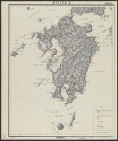
Kyushu
Yale University Library
Yale University Library Digital Collections

The Japanese empire : with central and southern Manchukuo (Manchuria)
Yale University Library
Yale University Library Digital Collections
Last Updated: 2021-01-30
Uploaded: 2021-07-29