![Il conflitto Russo-Giappanese : [map of the region]](https://collections.library.yale.edu/iiif/2/15828541/full/!200,200/0/default.jpg)
Il conflitto Russo-Giappanese : [map of the region]
- People
- Time
- Owner Organization
![[Highway map of the Tokyo region].](https://stacks.stanford.edu/image/iiif/gm158cc8245%2Fgm158cc8245_0001/full/!200,200/0/default.jpg)
[Highway map of the Tokyo region].

Russo-Japanese war map

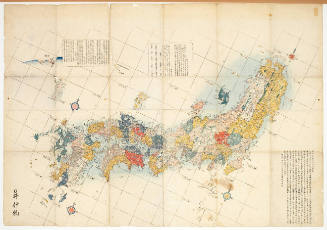
Map of the Empire of Japan

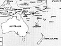
Map of the Pacific Ocean

The topographic map of Manchoukuo
![[Modern Map of the World]](https://stacks.stanford.edu/image/iiif/vc284tj9920%2F35672ll/full/!200,200/0/default.jpg)
[Modern Map of the World]
Map of the Japanese Archipelago

The railway map of Japan

(Composite Map of) Map of the Island of Japan, Kurile &c. with the Adjacent Coasts of the Chinese ...
Kanto Civil Affairs Region - Map of Shizuoka

Map of the Japanese telegraph system
The role of IDA (Inter-DFG-APE) region in the regulation of MAP kinase activity

Karta Aziatskoi Rossii . . . [Map of the Asian part of Russia and Possessions Adjacent, with the R...

Map of the Empire of Japan in 1914

[Transport Map of Russia: 'Map of the routes of Steamships, Communication lines, Railways and Road...

Map of Northern Japan. Map of Southern Japan
Stanford's map of the empires of China and Japan : with the adjacent parts of the Russian Empire, ...

Map of Tokio
Map of the Pacific theatre, 1941-1945
Cook's map of the tourist districts of New South Wales
1 1/2 sen Map of the Empire of Japan

The Map (Chizu)

Geologic map of the eastern part of Hakone Volcano

Map of Japan

Empire of Japan, Yedo ... Meaco. (insets) Nagasaki Harbour. Eastern Point of Yeso

Nieuwe Kaart van't Keizerryk. Japan na de Nieuste ontdekkingen

1904 war map of Russia and the continent of Asia

Empire of Japan. (with) Nagasaki Harbour. Engraved by J. & C. Walker. Published under the superint...

Northwestern America Showing The Territory Ceded By Russia To The United States Compiled For The D...
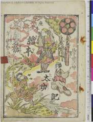
Ehontaikouki、hanabusakataminoshakkyou、gishindenyomikirikoushaku

China, Contains 15 Subject Provinces, including the 2 Islands of Hainan Formosa and the Tributary ...
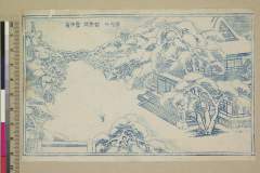
「華頂山智恩院雪中景」

Taiwan oyobi Rusontō. Hyakumanbun no ichi kōkūzu

1904 war map of Japan, Korea, and China
禽虫之図

L'empire du Japon divisé en sept principales parties, et subdivisé en soixante et six royaumes / p...

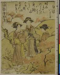
Koimoudekiyomizuzakura、edomurasakimusumedoujouji

Motor road network, Japan

滿洲歴史地理. : 第壹巻附図 : 前燕時代満洲図 (337-370)

滿洲歴史地理. : 第壹巻附図 : 前漢時代満洲図 西紀二〇二-西紀二五年

佐賀県管内図

Royaume du Iapon / designé par le pere Ph. Briet, de la Compagnie de Iesus, sur les memoires des peres de l...

Iaponia Regnum (gold highlights!) (1st map to show Korea as a peninsula)

Royaume du Japon designé / par le Père Ph. Briet,... sur les Mémoires des Pères de la mesme Compag...
![[Untitled] (Bird with Hydrangea)](https://d1lfxha3ugu3d4.cloudfront.net/images/opencollection/objects/size1/2007.32.121_PS4.jpg)
[Untitled] (Bird with Hydrangea)
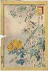
「生写四十八鷹」 「むし喰」「女竹」「堂銀花」「黄ばら」「十九」
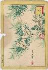
「生写四十八鷹」 「白つばめ」「柳」「ばら」「十八」
Kaianji momiji
Last Updated: 2021-01-30
Uploaded: 2021-07-29