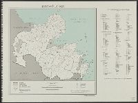
![Kyūshū no zu [Map of Kyūshū Island, Japan]](https://collections.library.yale.edu/iiif/2/15511837/full/!200,200/0/default.jpg)
Kyūshū no zu [Map of Kyūshū Island, Japan]
- Time
- Owner Organization
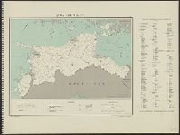
![Kyūshū no zu [Map of Kyūshū Island, Japan]](https://collections.library.yale.edu/iiif/2/15511841/full/!200,200/0/default.jpg)
Kyūshū no zu [Map of Kyūshū Island, Japan]
Yale University Library
Yale University Library Digital Collections

Map of Japanese Homeland Island
Philadelphia Museum of Art
Philadelphia Museum of Art collection

Map of Northern Japan. Map of Southern Japan
Bibliothèque nationale de France
Europeana API

(Composite Map of) Map of the Island of Japan, Kurile &c. with the Adjacent Coasts of the Chinese ...
Stanford University Libraries
Stanford Libraries SearchWorks

Map of Manchuria, Corea & Japan
Boston Public Library
DPLA API

Map of Japan
Boston Public Library
DPLA API

Map of Japan
Stanford University Libraries
Stanford Libraries SearchWorks
Map of Japan
Univerzita Karlova. Mapová sbírka
Europeana API

Map of Japan
Library of Congress
Digital Collections, Library of Congress
Map of Japan
Royal Library of the Netherlands
Europeana API
Map of Japan
National Library of Australia
Trove: National Library of Australia

Map of Japan
Stanford University Libraries
Stanford Libraries SearchWorks
Map of Japan
National Library of Australia
Trove: National Library of Australia
Map of Japan
National Library of Australia
Trove: National Library of Australia

Map of Japan
Boston Public Library
DPLA API

Map of Japan
Stanford University Libraries
Stanford Libraries SearchWorks
![[Shinkan Nagasaki No Zu. (Newly engraved Map of Nagasaki)]](https://collections.library.yale.edu/iiif/2/15823940/full/!200,200/0/default.jpg)
[Shinkan Nagasaki No Zu. (Newly engraved Map of Nagasaki)]
Yale University Library
Yale University Library Digital Collections

New Map of Japan
Stanford University Libraries
Stanford Libraries SearchWorks
![Map of Manchuria, Corea & Japan [cartographic material]](https://collections.library.yale.edu/iiif/2/15828540/full/!200,200/0/default.jpg)
Map of Manchuria, Corea & Japan [cartographic material]
Yale University Library
Yale University Library Digital Collections

Map of the Empire of Japan
Salem State University Archives and Special Collections
DPLA API
Map of Japan. (sheet 3)
National Library of Australia
Trove: National Library of Australia

The railway map of Japan
Boston Public Library
DPLA API

Map of Nagasaki (Hizen Nagasaki zu)
Art Institute of Chicago
Art Institute of Chicago API
Map of Hiroshima. Nakao. (cover title) Map of Hiroshima 1947. Japan Travel Bureau, Hiroshima
Stanford University Libraries
Stanford Libraries SearchWorks
Kyūshū no zu [Map of Kyūshū Island, Japan]
Yale University Library
Yale University Library Digital Collections

Japan, Fukuoka-ken
Yale University Library
Yale University Library Digital Collections

Japan, spring areas
Yale University Library
Yale University Library Digital Collections

Nieuwe Kaart van't Keizerryk. Japan na de Nieuste ontdekkingen
Yale University Library
Yale University Library Digital Collections
Japan. Ōita-ken : administrative divisions, November 1943
Yale University Library
Yale University Library Digital Collections
Ehime-ken
Yale University Library
Yale University Library Digital Collections

Japan, Oita-ken
Yale University Library
Yale University Library Digital Collections

Kagoshima-ken
Yale University Library
Yale University Library Digital Collections

Nagasaki
Yale University Library
Yale University Library Digital Collections
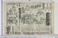
![[芝居大繁昌之図]](http://www.arc.ritsumei.ac.jp/archive01/theater/th_image/PB/kokkai/rarebook.ndl.go.jp/pre/th_image/gazou/W0000009/w0000155/w0000000/w0000007.jpg)
[芝居大繁昌之図]
National Diet Library, Japan
ARC Ukiyo-e Portal Database
![Japan, Oita-ken [cartographic material]](https://stacks.stanford.edu/image/iiif/qg228fy6190%2Fqg228fy6190_00_0001/full/!200,200/0/default.jpg)
Japan, Oita-ken [cartographic material]
Stanford University Libraries
Stanford Libraries SearchWorks
Katakiuchigappougatsuji
University of Tokyo Graduate School of Arts and Sciences / College of Liberal Arts
UTokyo Academic Archives Portal

China, Contains 15 Subject Provinces, including the 2 Islands of Hainan Formosa and the Tributary ...
Stanford University Libraries
Stanford Libraries SearchWorks
![Japan, Yamaguchi-ken [cartographic material]](https://stacks.stanford.edu/image/iiif/zc849tw9296%2Fzc849tw9296_00_0001/full/!200,200/0/default.jpg)
Japan, Yamaguchi-ken [cartographic material]
Stanford University Libraries
Stanford Libraries SearchWorks

「蛍狩当風俗」
National Diet Library, Japan
ARC Ukiyo-e Portal Database
Mitsuirekosoganokaomise
University of Tokyo Graduate School of Arts and Sciences / College of Liberal Arts
UTokyo Academic Archives Portal

Southwest Japan (Kyūshū, Shikoku, and southwest Honshū), railroads and railroad facilities
Yale University Library
Yale University Library Digital Collections
Sanbukutsuikakizomesoga
University of Tokyo Graduate School of Arts and Sciences / College of Liberal Arts
UTokyo Academic Archives Portal
Kanadehonchuushingura
University of Tokyo Graduate School of Arts and Sciences / College of Liberal Arts
UTokyo Academic Archives Portal

「加古川本蔵」
National Diet Library, Japan
ARC Ukiyo-e Portal Database
Map of Manchuria, Corea & Japan [cartographic material]
Yale University Library
Yale University Library Digital Collections
Yasagunbaiodanokarigane
University of Tokyo Graduate School of Arts and Sciences / College of Liberal Arts
UTokyo Academic Archives Portal

「東海道五十三対」 「掛川」
National Diet Library, Japan
ARC Ukiyo-e Portal Database
Map of Foreign Ships (Perry Expedition) in Edo Bay
Harvard Art Museums
Harvard Art Museums API
Last Updated: 2021-01-30
Uploaded: 2021-07-29