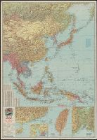
![Japan and adjacent Asiatic mainland [cartographic material]](https://collections.library.yale.edu/iiif/2/15511788/full/!200,200/0/default.jpg)
Japan and adjacent Asiatic mainland [cartographic material]
- People
- Time
- Owner Organization
War map III featuring the Pacific Theater
Yale University Library
Yale University Library Digital Collections
Esso war map III featuring the Pacific Theater : a third war map / edited, drafted and printed by the makers...
Yale University Library
Yale University Library Digital Collections
Esso war map III featuring the Pacific Theater : a third war map / edited, drafted and printed by the makers...
Yale University Library
Yale University Library Digital Collections
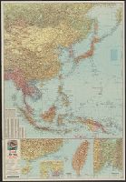
![The Pacific Theater [cartographic material]](https://collections.library.yale.edu/iiif/2/15472146/full/!200,200/0/default.jpg)
The Pacific Theater [cartographic material]
Yale University Library
Yale University Library Digital Collections

The war against Japan (Japanese & Pacific Map)
Australian National Maritime Museum
Trove: National Library of Australia
War map : Australia, China, Japan, and the South Pacific / Cyril Dillon
National Library of Australia
Trove: National Library of Australia
![[World War II battlefronts]. Map VI. The Southwest Pacific. Copyright, 1944, by Remington Rand, In...](https://stacks.stanford.edu/image/iiif/vs321mz7073%2F6758006/full/!200,200/0/default.jpg)
[World War II battlefronts]. Map VI. The Southwest Pacific. Copyright, 1944, by Remington Rand, In...
Stanford University Libraries
Stanford Libraries SearchWorks
Theater of war in the Pacific Ocean / compiled and drawn in the Cartographic Section of the National Geographic Society for the National Geographic Magazine
National Library of Australia
Trove: National Library of Australia
Theater of war. Episode 2, Under attack, Pearl Harbor [electronic resource] : the Pacific campaign
Stanford University Libraries
Stanford Libraries SearchWorks
Theater of war. Episode 4, Victory at sea, America fights back [electronic resource] : the Pacific...
Stanford University Libraries
Stanford Libraries SearchWorks
Pacific war map / Dept. of Home Security ; issued by authority of the Minister for Home Security with the permission of Associated Newspapers Ltd
National Library of Australia
Trove: National Library of Australia

The New War Map of Maryland Part of Virginia & Pennsylvania. Published by B.B. Russell . .
Stanford University Libraries
Stanford Libraries SearchWorks

On December 7, 1941, Japan struck the first treacherous, devastating blow of the pacific war. Sneaking in fr...
Auckland Libraries
DigitalNZ New Zealand API
Submarines for sale. Four of the seven American submarines, all boasting outstanding Pacific war records, no...
National Library of New Zealand
DigitalNZ New Zealand API
Esso war map III featuring the Pacific Theater : a third war map / edited, drafted and printed by the makers...
Yale University Library
Yale University Library Digital Collections

Japan, Saga-ken
Yale University Library
Yale University Library Digital Collections
Esso war map III featuring the Pacific Theater : a third war map / edited, drafted and printed by the makers...
Yale University Library
Yale University Library Digital Collections
Nemuro
Yale University Library
Yale University Library Digital Collections

Nemuro
Yale University Library
Yale University Library Digital Collections
War map III featuring the Pacific Theater
Yale University Library
Yale University Library Digital Collections

Nieuwe Kaart van't Keizerryk. Japan na de Nieuste ontdekkingen
Yale University Library
Yale University Library Digital Collections

Kaisei shinkoku Ōsaka shigai shinzu
Stanford University Libraries
Stanford Libraries SearchWorks

Japan and it's relation to the territory bordering on the Pacific ocean
Yale University Library
Yale University Library Digital Collections
China Divided into its Great Provinces and the Isles of Japan [Material cartográfico]
Biblioteca Nacional de España
Europeana API

Tokyo city plan
Stanford University Libraries
Stanford Libraries SearchWorks

Nagasaki
Yale University Library
Yale University Library Digital Collections

China, Contains 15 Subject Provinces, including the 2 Islands of Hainan Formosa and the Tributary ...
Stanford University Libraries
Stanford Libraries SearchWorks

Japan, Oita-ken
Yale University Library
Yale University Library Digital Collections

Japan, Kumamoto-ken
Yale University Library
Yale University Library Digital Collections
![Far East, Japanese occupied area, major railroads [cartographic material] / Board of Economic Warfare, Enemy...](https://collections.library.yale.edu/iiif/2/15510697/full/!200,200/0/default.jpg)
Far East, Japanese occupied area, major railroads [cartographic material] / Board of Economic Warfare, Enemy...
Yale University Library
Yale University Library Digital Collections
![Map of Manchuria, Corea & Japan [cartographic material]](https://collections.library.yale.edu/iiif/2/15828540/full/!200,200/0/default.jpg)
Map of Manchuria, Corea & Japan [cartographic material]
Yale University Library
Yale University Library Digital Collections
Japan and South China Seas / prepared at the direction of the commanding general, Army Air Forces, for the A...
Yale University Library
Yale University Library Digital Collections
Japan, Miyazaki-ken
Yale University Library
Yale University Library Digital Collections

Japan electric power / drawn and reproduced by Co B, 942nd Engr. Avn. Topo. Bn, 325th Ric., US Army
Yale University Library
Yale University Library Digital Collections

A Map of the East-Indies and the Adjacent Countries; with the Settlements, Factories and Territori...
Stanford University Libraries
Stanford Libraries SearchWorks
The Pacific Theater [cartographic material]
Yale University Library
Yale University Library Digital Collections

Burma, lifeline to China, May be key to Japanese defeat. Howard Burke. Los Angeles Examiner. Monda...
Stanford University Libraries
Stanford Libraries SearchWorks

Japan, Fukuoka-ken
Yale University Library
Yale University Library Digital Collections
Last Updated: 2021-01-30
Uploaded: 2021-07-29