
Western shore of the Bay of Yedo / surveyed by order of Commodore M.C. Perry U.S.N. by Lieut. Wm. L. Maury a...
- Time
- Owner Organization
Western shore of the Bay of Yedo / surveyed by order of Commodore M.C. Perry U.S.N. by Lieut. Wm. L. Maury and other officers of the Japan Expedition 1854 ; drawn by Edward Sels ; engraved by Selmar Siebert
National Library of Australia
Trove: National Library of Australia
Reconnoissance of the Gulf and survey of the western shore of the Bay of Yedo / by order of Commodore M.C. Perry U.S.N. by Lieut. W.L. Maury and other officers of the U.S. Japan Expedition in 1853-54 ; drawn by Edw. Sels ; engr. by Selmar Siebert
National Library of Australia
Trove: National Library of Australia
Simoda Harbor, I. of Nippon / surveyed by order of Commodore M.C. Perry U.S.N. by Lieut. W.L. Maury, Lieut. Bent, Lieut. S. Nicholson, Act. Lieut. A. Barbot, Act. Mr. G.V. Denniston, Pd. Mdn. T.T. Houston in 1854 ; drawn by Edward Sels ; engraved by S. Siebert, lettering by C.A. Knight
National Library of Australia
Trove: National Library of Australia
The harbor of Hakodadi, Yesso Id. Japan / surveyed by order of Commodore M.C. Perry U.S.N. by Lieuts. W.L. Maury and G.H. Preble, S. Nicholson & A. Barbot in 1854 ; drawn by Edward Sels ; engraved by S. Siebert
National Library of Australia
Trove: National Library of Australia
Island of Lew Chew : surveyed by order of Commodore M.C. Perry U.S.N. / by W.B. Whiting, Silas Bent, G.B. Balch, I. Mathews & A. Barbot, Lieutenants U.S.N. ; drawing by Edward Sels ; engraved by Selmar Siebert
National Library of Australia
Trove: National Library of Australia
Lew Chew Id. Deep Bay : surveyed by order of Commodore M.C. Perry U.S.N. / by Lieut. W.B. Whiting and A. Barbot, U.S. Ship Vandalia, J. Pope Commander ; engraved by S. Siebert, lettering by C.A. Knight
National Library of Australia
Trove: National Library of Australia
Shah Bay, Lew Chew I. surveyed by order of Commodore M.C. Perry U.S.N. / by Lieut. W.B. Whiting and Alph. Barbot of the U.S. Ship Vandalia, J. Pope Commr. ; engraved by Selmar Siebert ; drawn by S. Bent
National Library of Australia
Trove: National Library of Australia
The Coffin Islands / surveyed by order of Commodore M.C. Perry U.S.N. by Lieuts. G.B. Balch, G.H. Cooper & L.A. Beardslee Mid. of the U.S. Ship Plymouth Commander John Kelly U.S.N. ; engraved by S. Siebert, lettering by C.A. Knight
National Library of Australia
Trove: National Library of Australia
Keelung Harbor, Formosa Island : surveyed by order of Commodore M.C. Perry U.S.N. / by Lieut. G.H. Preble & Pd. Md. Walter F. Jones in the U.S. Ship Macedonian Capt. J. Abbot. ; drawn by Edwd. Sels ; engr. by Selmar Siebert
National Library of Australia
Trove: National Library of Australia
The harbor of Napha, Lew Chew Id. surveyed by order of Commodore M.C. Perry U.S.N. / by Lieut. S. Bent assisted by F.S. Conover, J.W. Bennet and D. Ochiltree, Actg. Masters ; J.H. March, E.H. Grey, Pd. Midshipmen ; O.F. Stanton, W.F. Boardman, Midshipmen ; drawn by S. Bent ; engraved by Selmar Siebert
National Library of Australia
Trove: National Library of Australia
Chart of the coast of China and of the Japan Islands including the Marianes and a part of the Philippines / compiled by order of Commodore M.C. Perry U.S.N. from the latest authorities with additions and corrections by the U.S. Japan Expedition by Lieuts. W.L. Maury and S. Bent U.S.N. ; drawn by Edw. Sels ; engr. by S. Siebert
National Library of Australia
Trove: National Library of Australia
Map of the Japan Islands : copied from von Siebold's with slight additions & corrections, by the U.S. Japan Expedition and other authorities / Compiled by order of Commodore M.C. Perry, U.S.N. by Lieuts. W.L. Maury and Silas Bent ; James Ackerman, lith. 379 Broady NY
National Library of Australia
Trove: National Library of Australia
(Lew Chew) Tubootch & Suco Harbors / surveyed July 1854 by Lieuts. William B. Whiting and Alphonse Barbot, U.S.N. belonging to U.S. Ship Vandalia, John Pope Commander by Order of Commodore Matthew C. Perry Commanding U.S. Naval Forces in East Indies, China and Japan Seas ; drawn by Lieut. S. Bent ; engraved by S. Siebert, lettering by C.A. Knight
National Library of Australia
Trove: National Library of Australia
Chart of the world shewing the track of the U.S. steam frigates Mississippi, Susquehanna and Powhatan as flagships of the Japan Squadron under the command of Commodore M.C. Perry U.S.N. 1853-54 / drawn by Edw. Sels ; engr. by Selmar Siebert
National Library of Australia
Trove: National Library of Australia

A Chart of The Entrance of Cape Fear River Surveyed By Order of The Honorable J.K. Paulding, Sec. ...
Stanford University Libraries
Stanford Libraries SearchWorks
Harbours in Kii Channel / Surveyed by Lieut. C. Bullock, J.H. Kerr, & G. Robinson, Masters, R.N. 1861. Engraved under the Direction of Captn. G.A. Bedford, R.N. by Davies & Powell
National Library of Australia
Trove: National Library of Australia
[Birds-eye view of first landing at Kurihama Beach near Uraga, Tokyo Bay, July 14 1853, by US Navy Commodore Matthew Perry, Special American Diplomatic Expedition]
National Library of Australia
Trove: National Library of Australia
![Narrative of the expedition of an American squadron to the China seas and Japan : performed in the years 1852, 1853, and 1854, under the command of Commodore M.C. Perry, United States Navy, by order of the Government of the United States [v. 1]](https://dgcl.doshisha.ac.jp/images/iiif/50000/MD00000114/69035.tiff/full/200,/0/default.jpg)
Narrative of the expedition of an American squadron to the China seas and Japan : performed in the years 1852, 1853, and 1854, under the command of Commodore M.C. Perry, United States Navy, by order of the Government of the United States [v. 1]
Doshisha University
IIIF Discovery in Japan

Narrative of the expedition of an American squadron to the China seas and Japan : performed in the years 1852, 1853, and 1854, under the command of Commodore M.C. Perry, United States Navy, by order of the Government of the United States v. 2
Doshisha University
IIIF Discovery in Japan
Narrative of the expedition of an American squadron to the China seas and Japan : performed in the years 1852, 1853, and 1854, under the command of Commodore M.C. Perry, United States Navy, by order of the Government of the United States [v. 1]
Doshisha University Digital Collections
Doshisha University Digital Collections
Narrative of the expedition of an American squadron to the China seas and Japan : performed in the years 1852, 1853, and 1854, under the command of Commodore M.C. Perry, United States Navy, by order of the Government of the United States <v. 2>
Doshisha University Digital Collections
Doshisha University Digital Collections
Handbook of instructions for the guidance of the officers of the Elder Scientific Exploration Expedition to the unknown portions of Australia / issued by the Council of the Royal Geographical Society of Australasia, South Australian Branch
National Library of Australia
Trove: National Library of Australia
探幽/日ニ波図
Tokyo National Museum
Integrated Collections Database of the National Museums, Japan

荘内地区都市計画図
Tamano City Library
ADEAC: A System of Digitalization and Exhibition for Archive Collections

為重村ノ内字三重分村中全図
Saga Prefectual Library
IIIF Discovery in Japan
Carte de L'Empire du Japon ..
Yale University Library
Yale University Library Digital Collections
Nanpō kyōeiken yōzu
National Library of Australia
Trove: National Library of Australia

横手村内一番字四本柳全圖
Saga Prefectual Library
IIIF Discovery in Japan
萬國全圖
Shimane University Library Digital Archive Collection
IIIF Discovery in Japan
探幽/訪戴安道図
Tokyo National Museum
Integrated Collections Database of the National Museums, Japan

探幽/歌意図
Tokyo National Museum
Integrated Collections Database of the National Museums, Japan

官許飛騨国中全図
National Archives of Japan
ADEAC: A System of Digitalization and Exhibition for Archive Collections
Jawa - Gōshū seihokubu
National Library of Australia
Trove: National Library of Australia
津村薬用植物園一覧
Tamashin Chiiki Bunka Zaidan
ADEAC: A System of Digitalization and Exhibition for Archive Collections
![East India Archipelago [Eastern Passages to China and Japan] [Chart No. 2] . . . 1868 (North Austr...](https://stacks.stanford.edu/image/iiif/hf333br4460%2F34582/full/!200,200/0/default.jpg)
East India Archipelago [Eastern Passages to China and Japan] [Chart No. 2] . . . 1868 (North Austr...
Stanford University Libraries
Stanford Libraries SearchWorks
探幽/須磨明石図
Tokyo National Museum
Integrated Collections Database of the National Museums, Japan
探幽/維摩図
Tokyo National Museum
Integrated Collections Database of the National Museums, Japan
福富村内貳番字貳號字参本松全圖
Saga Prefectual Library
IIIF Discovery in Japan
Piece
Metropolitan Museum of Art
The Metropolitan Museum of Art Open Access CSV
Turtle
Honolulu Museum of Art
Honolulu Museum of Art Collection
Shoji, vägg: skjutvägg, shoji
Museum of World Culture
Europeana API

探幽/達磨図
Tokyo National Museum
Integrated Collections Database of the National Museums, Japan
![East India Archipelago [Eastern Passages to China and Japan] [Chart No. 7] . . . 1868 (Taiwan, Nor...](https://stacks.stanford.edu/image/iiif/xy078vp9272%2F34545/full/!200,200/0/default.jpg)
East India Archipelago [Eastern Passages to China and Japan] [Chart No. 7] . . . 1868 (Taiwan, Nor...
Stanford University Libraries
Stanford Libraries SearchWorks

白石南郷六ヶ里村
Saga Prefectual Library
IIIF Discovery in Japan
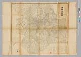
豊橋市地図 二万分の一 昭和十二年
Toyohashi City Library
ADEAC: A System of Digitalization and Exhibition for Archive Collections

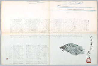
surimono
British Museum
British Museum Collection
Last Updated: 2021-01-30
Uploaded: 2021-07-29