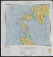
Nemuro
- Time
- Owner Organization

Eastern Asia
Yale University Library
Yale University Library Digital Collections
![Sea fisheries of eastern Asia [cartographic material]](https://stacks.stanford.edu/image/iiif/mr870gt3467%2Fmr870gt3467_00_0001/full/!200,200/0/default.jpg)
Sea fisheries of eastern Asia [cartographic material]
Stanford University Libraries
Stanford Libraries SearchWorks

A fork in Asia. Episode 1, Japan
Stanford University Libraries
Stanford Libraries SearchWorks
![East India Archipelago [Eastern Passages to China and Japan] [Chart No. 1] . . . 1866 (Java, Borne...](https://stacks.stanford.edu/image/iiif/ww842xr3210%2F34640/full/!200,200/0/default.jpg)
East India Archipelago [Eastern Passages to China and Japan] [Chart No. 1] . . . 1866 (Java, Borne...
Stanford University Libraries
Stanford Libraries SearchWorks

Rand McNally map of Eastern Asia and Western Pacific Ocean. (Mercator projection). Copyright by Ra...
Stanford University Libraries
Stanford Libraries SearchWorks
Rand McNally map of Eastern Asia and Western Pacific Ocean. Mercator projection. Copyright by Rand...
Stanford University Libraries
Stanford Libraries SearchWorks
![[Untitled Sea Chart of Australia, Indian Ocean, China, Japan, SE Asia, &c] (First Printed Map to S...](https://stacks.stanford.edu/image/iiif/cv359wv2441%2F22989/full/!200,200/0/default.jpg)
[Untitled Sea Chart of Australia, Indian Ocean, China, Japan, SE Asia, &c] (First Printed Map to S...
Stanford University Libraries
Stanford Libraries SearchWorks

Southeast Asia (Scale: ca. 1:5,500,000). Japan (Scale: ca. 2,450,000). Northeast China and Japan (...
Stanford University Libraries
Stanford Libraries SearchWorks
The JVC video anthology of world music and dance. Volume 1, East Asia I : Korea 1
Stanford University Libraries
Stanford Libraries SearchWorks

Eastern Asia, showing Japan, Korea, Manchuria and adjoining parts of Siberia and China. 185 miles ...
Bibliothèque nationale de France
Europeana API
[East Asia 1:8,000,000] / drawn and reproduced by 512 (A. Fd. Svy.) Coy
National Library of Australia
Trove: National Library of Australia
Far Eastern Air Command Weekly Intelligence summary [No. 34], southeast Asia, 20 April 1945. Report No. 1-k(27), USSBS Index Section 6
NDL Digital Collections
NDL Digital Collections
Far Eastern Air Command Weekly Intelligence summary [No. 35], southeast Asia, 27 April 1945. Report No. 1-k(28), USSBS Index Section 6
NDL Digital Collections
NDL Digital Collections

Oji, from vol. 1 of the illustrated book "Fine Views of the Eastern Capital at a Glance (Toto shokei ichiran)"
Art Institute of Chicago
Art Institute of Chicago API
A new chart of the Pacific Ocean : exhibiting the western coast of America, from Cape Horn to Beerings Strait, the eastern shores of Asia including Japan, China and Australia and all the numerous islands and known dangers situated in Polynesia and Australasia / correctly drawn and regulated according to the most approved and modern surveys and astronomical observations by J.W. Norie
State Library of New South Wales
Trove: National Library of Australia
Asia and its islands according to Danville : divided into empires, kingdoms, states, regions &ca. with the European possessions and settlements in the East Indies and an exact delineation of all the discoveries made in the Eastern parts by the English under Captn. Cook
State Library of New South Wales
Trove: National Library of Australia

Tokyo city plan
Stanford University Libraries
Stanford Libraries SearchWorks
Eastern Asia
Yale University Library
Yale University Library Digital Collections

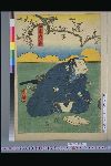
「江戸自慢三十六興」 「鉄砲洲いなり 富士詣」
National Diet Library, Japan
ARC Ukiyo-e Portal Database
![Tōbu nyūginia fon hantō oyobi madan chiku heiyō chishi shiryōzu [cartographic material]](https://stacks.stanford.edu/image/iiif/ns225gy7512%2Fns225gy7512_00_0001/full/!200,200/0/default.jpg)
Tōbu nyūginia fon hantō oyobi madan chiku heiyō chishi shiryōzu [cartographic material]
Stanford University Libraries
Stanford Libraries SearchWorks
「唐木政右衛門」
National Diet Library, Japan
ARC Ukiyo-e Portal Database

Genjikumoukiyoeawase
National Diet Library, Japan
ARC Ukiyo-e Portal Database
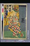
「市蔵」
National Diet Library, Japan
ARC Ukiyo-e Portal Database

Saeki, Oita Prefecture. Kyushu, Japan
Stanford University Libraries
Stanford Libraries SearchWorks

「関取道中之図」 「剱山」
National Diet Library, Japan
ARC Ukiyo-e Portal Database

「外記左衛門 市川団蔵」
National Diet Library, Japan
ARC Ukiyo-e Portal Database
Last Updated: 2021-01-30
Uploaded: 2021-07-29