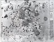
![[4 maps of Luzon, Philippines, in Japanese.]](https://collections.library.yale.edu/iiif/2/15251546/full/!200,200/0/default.jpg)
[4 maps of Luzon, Philippines, in Japanese.]
- Time
- Owner Organization
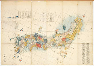
![[3 maps of Leyte Island, Philippines, in Japanese.]](https://collections.library.yale.edu/iiif/2/15251299/full/!200,200/0/default.jpg)
[3 maps of Leyte Island, Philippines, in Japanese.]
Yale University Library
Yale University Library Digital Collections
![[Map of Marinduque, Philippines, in Japanese.]](https://collections.library.yale.edu/iiif/2/15251559/full/!200,200/0/default.jpg)
[Map of Marinduque, Philippines, in Japanese.]
Yale University Library
Yale University Library Digital Collections
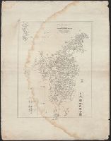
![[Map of part of Samar, Philippines, in Japanese.]](https://collections.library.yale.edu/iiif/2/15251561/full/!200,200/0/default.jpg)
[Map of part of Samar, Philippines, in Japanese.]
Yale University Library
Yale University Library Digital Collections
The northern part of Luzon Island, in the Philippines, where a large Japanese force is reported to be attemp...
National Library of New Zealand
DigitalNZ New Zealand API
![Asia, China--Tʻai-wan--Philippines--Japan, Luzon Strait [electronic resource]](https://www.gumtree.com/static/1/resources/assets/rwd/images/orphans/a37b37d99e7cef805f354d47.noimage_thumbnail.png)
Asia, China--Tʻai-wan--Philippines--Japan, Luzon Strait [electronic resource]
Stanford University Libraries
Stanford Libraries SearchWorks

CAPITAL OF THE PHILIPPINES RUTHLESSLY BOMBED BY JAPANESE
Auckland Libraries
DigitalNZ New Zealand API
Book: Maps of China
Brooklyn Museum
Brooklyn Museum API

WAR PICTURES FROM THE PHILIPPINES: RUTHLESS JAPANESE BOMBENG OF MANILA
Auckland Libraries
DigitalNZ New Zealand API

WRITHING IN VAIN: JAPANESE AIRCRAFT-CARRIERS SUNK OFF THE PHILIPPINES IN OCTOBER, 1944
Auckland Libraries
DigitalNZ New Zealand API
![[Salisbury Collection of World Maps]](https://collections.library.yale.edu/iiif/2/15248723/full/!200,200/0/default.jpg)
[Salisbury Collection of World Maps]
Yale University Library
Yale University Library Digital Collections

SPECTACULAR EXPLOSION ON JAPANESE WARSHIP CAUGHT BY ALLIED BOMBER OFF LEYTE ISLAND IN THE PHILIPPINES
Auckland Libraries
DigitalNZ New Zealand API

CAPITAL OF PHILIPPINES RETAKEN BY AMERICAN FORCES AFTER THREE YEARS OF JAPANESE OCCUPATION: VIEWS OF LIBERAT...
Auckland Libraries
DigitalNZ New Zealand API

Map of Colorado Territory, Compiled from Government Maps & Actual Surveys. Made In 1861
Stanford University Libraries
Stanford Libraries SearchWorks

Map of Colorado Territory, Compiled from Government Maps & Actual Surveys. Made In 1861
Stanford University Libraries
Stanford Libraries SearchWorks

Map of Colorado Territory, Compiled from Government Maps & Actual Surveys. Made In 1861
Stanford University Libraries
Stanford Libraries SearchWorks

Map of Colorado Territory, Compiled from Government Maps & Actual Surveys. Made In 1861
Stanford University Libraries
Stanford Libraries SearchWorks
The ruins of Ormoc, one of the larger towns on Leyte Island, in the Philippines, after it had been won from ...
National Library of New Zealand
DigitalNZ New Zealand API
Distribution maps of vascular plants in Hokkaido, Japan [electronic resource]
Stanford University Libraries
Stanford Libraries SearchWorks
Map of the Japanese Archipelago
Honolulu Museum of Art
Honolulu Museum of Art Collection

1. Figure of Girogin (H. 7-1/4 in.), A stag (H. 12-1/4 in.), Figure of Hotei (H. 8-3/4 in.); 2. Figure of a ...
The Miriam and Ira D. Wallach Division of Art, Prints and Photographs. The New York Public Library
DPLA API

Map of Japanese Homeland Island
Philadelphia Museum of Art
Philadelphia Museum of Art collection

LARGE JAPANESE FLEET PUT TO FLIGHT BETWEEN MARIANS AND PHILIPPINES: SUCCESS OF AMERICAN NAVAL AIRCRAFT
Auckland Libraries
DigitalNZ New Zealand API
A history of the world in twelve maps / Jerry Brotton
National Library of Australia
Trove: National Library of Australia
Maps of Tohoku Prefectures Reparations Buildings Now in Use
NDL Digital Collections
NDL Digital Collections
[Map of Marinduque, Philippines, in Japanese.]
Yale University Library
Yale University Library Digital Collections

Nagasaki
Yale University Library
Yale University Library Digital Collections
郡山市平面図 昭和28年
Koriyama City Library
ADEAC: A System of Digitalization and Exhibition for Archive Collections

Hyakumanbun no ichi Nanpō kōkūzu
Stanford University Libraries
Stanford Libraries SearchWorks

Empire of Japan. (with) Nagasaki Harbour. Engraved by J. & C. Walker. Published under the superint...
Stanford University Libraries
Stanford Libraries SearchWorks
Dai ni-gun no heitan : Meiji sanjūnana-nen hachi-gatsu jūichi nichi
National Library of Australia
Trove: National Library of Australia

Map of Chosen (Korea)
Yale University Library
Yale University Library Digital Collections
Japan
Yale University Library
Yale University Library Digital Collections
Plan Porta Loĭda (Ostrova Bonin) sni︠a︡tyĭ i sostavlennyĭ Leitenantom Zavalishinym i Michmanom Glazenappom = Plan du Port de Lloyd (Iles Bonine) / leve et dresse par Mr. Zavalichine Lieutenant de Vaisseau et Mr. Glasenapp Enseigne de Vaisseau
National Library of Australia
Trove: National Library of Australia
Kinshū hantō fukin [chizu]: 金城廳 [Kinchūchō] (Sheet 6)
National Library of Australia
Trove: National Library of Australia
Charte von JAPAN mit seinen VII Provinzen
Univerzita Karlova. Mapová sbírka
Europeana API
Kūchū shashin yōzu Sanman Gosen bun no ichi Bisumaruku Guntō (sheet 1)
National Library of Australia
Trove: National Library of Australia
![[Japan] (Published in Manila!)](https://stacks.stanford.edu/image/iiif/gv355sq3352%2F37869hs/full/!200,200/0/default.jpg)
[Japan] (Published in Manila!)
Stanford University Libraries
Stanford Libraries SearchWorks

Japan, Hokushu _ West Coast. Iwanai Byochi and Approaches
Stanford University Libraries
Stanford Libraries SearchWorks

Iaponia Regnum
Stanford University Libraries
Stanford Libraries SearchWorks

L'Empire Du Japon devisé en sept principales parties, et subdivisè en soixante et six Royaumes, Par le Sr....
Yale University Library
Yale University Library Digital Collections
Jūmanbunnoichi sumatora (Sheet LIII)
National Library of Australia
Trove: National Library of Australia

Atlas Russicus mappa una generali et undeviginti specialibus vastissimum imperium Russicum adjacen...
Bibliothèque nationale de France
Europeana API

Kuniyoshi's preparatory drawings, no.39
Victoria and Albert Museum
Victoria and Albert Museums API

Gomanbun no ichi Karafuto kūchū shashin sokuryō yōzu
Stanford University Libraries
Stanford Libraries SearchWorks

Descripcion De Las Yndias Ocidentales
Stanford University Libraries
Stanford Libraries SearchWorks
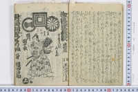
Taimensumouserifu
University of Tokyo Graduate School of Arts and Sciences / College of Liberal Arts
UTokyo Academic Archives Portal

Carte de la Presqu'Ile De Coree Dressee Mr. J. de la Roche Poncie . . . 1848 (with added pasted do...
Stanford University Libraries
Stanford Libraries SearchWorks

A New & Accurate Chart of the Discoveries made by the late Capt. Js. Cook, and other distinguished...
Stanford University Libraries
Stanford Libraries SearchWorks
Last Updated: 2021-01-30
Uploaded: 2021-07-29