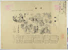
Dau Nihon Teikoku kōsanzu : Mineral distribution of Japanese empire
- Time
- Owner Organization

Nihon teikoku kousanzu : Mineral distribution of Japanese empire

The Display of Imperial Japanese Decorations (Dai Nihon teikoku kunshōkyō)

The birds of the Japanese Empire
The birds of the Japanese Empire
Japanese Empire--802 M

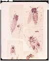
Terebridae of the Japanese empire / by Y. Hirase
Terebridae of the Japanese empire / by Y. Hirase
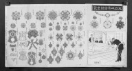
Mirror of Decorative Medals for the Empire of Japan (Dainippon Teikoku gunshō kagami)

The Army of the Japanese Empire Returns Triumphantly after Their Total Victory at Asan (Nihon teikoku rikugun Gazan zenshō gaisen no zu)

Empire of Japan

Empire of Japan . .

"Banzai" "Banzai" for the Great Japanese Empire: The Great Victory in the Fierce Battle of Pingyang (Dai Nihon teikoku banbanzai Heijō gekisen taishōzu)

Map of the Great Japanese Empire (Dainihon Kokugun Yochi Zenzu)

Distribution of land; distribution of people

Dai Nihon zenzu (The picture of the Great Whole Map of Japan; Provinces in the Japanese Empire, in...

Japan distribution of waterworks

The Japanese Empire: territorial changes

Banzai! Banzai! For the Great Japanese Empire: The Assault on Songhwan (Dai Nihon teikoku banbanzai: Seikan shūgeki waga gun taishō no zu)

Map of the Empire of Japan
Telecommunication and the Japanese Empire : a preliminary analysis of telegraphic traffic

Geological map of the Japanese Empire on the scale of 1:1,000,000
Tōa yochizu / Dai Nihon Teikoku Rikuchi Sokuryōbu
Japanese Empire / produced under the direction of Alexander Gross, F.R.G.S
Landkarte des: Empire of Japan/Kaiserreich Japan

Japan : ports of greatest shipping activity (entrances and clearances of vessels in gross tons) 1934

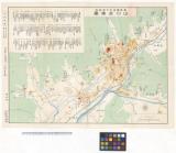
Japan cities and towns : (shi and machi)

Tonamigunwakabayashigumiyagimuraryouoyobidoumuraryoutsukigenrokusannenkyouhoujuuichinenbunkajuuninenshinkairyounaikenchiezu

大松村絵図

Carte Des Missions Cathliques au Japan . . . 1898 (China and Formosa related insets)
大小暦類聚

Kitashina kyūsui oyobi eisei heiyō chishi gaiyōzu

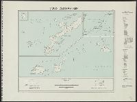
Revised estimate of Nansei-Shotō (including Ryūkyū-rettō and Satsunan-shotō)
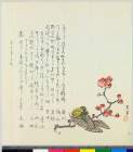
写生帖
Okinawa-ken
Comparative Curves of C□□s Sectional areas and W.Lines
Yōzu Papua gomanbun no ichi zu Kumushi-Gawa (Kumusi River)

Yōzu (kūchū shashin sokuryō) Rusontō jūmanbun no ichi zu
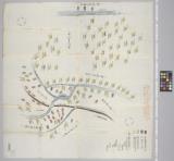
Dai ni-gun no heitan : Meiji sanjūnana-nen hachi-gatsu jūichi nichi

喰場之一部
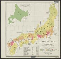
Japan: population densities by prefectures and province
山口史蹟図
〔武州葛飾郡絵図〕
![[Japan] Japan ten tyde van Zin-mu-ten-won 660 v.c. genaamd Jama-to v. Aki-Tsu-Sima](https://stacks.stanford.edu/image/iiif/zs637tn2663%2F37873/full/!200,200/0/default.jpg)
[Japan] Japan ten tyde van Zin-mu-ten-won 660 v.c. genaamd Jama-to v. Aki-Tsu-Sima
Kyokutō gunbi gensei chizu / Chūō Kōron henshūbu sōan
Patorī、shinosero

日本本州北西岸能登七尾湾= Japan Honshū, N. W. coast, Nanao Bay : north bay from survey of Lieutt. K. Kimotski, I. J. N. 12th. Year of Meiji (1879), South Bay, West Bay and the Soundings at outer part of the Bays from survey of commr. K. Isono
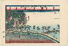
「東海道名所之内横浜風景」
-
Last Updated: 2020-06-05
Uploaded: 2021-07-22