

![[歴民カード_歴史] 山口城配備図](https://khirin-i.rekihaku.ac.jp/iiif/nmjh_rekimin_h/13547007_02.tif/full/200,/0/default.jpg)


![[歴民カード_歴史] 孔子聖蹟図](https://khirin-i.rekihaku.ac.jp/iiif/nmjh_rekimin_h/14648060_02.tif/full/200,/0/default.jpg)


![[歴民カード_歴史] 前田豊山書蹟](https://khirin-i.rekihaku.ac.jp/iiif/nmjh_rekimin_h/14649012_02.tif/full/200,/0/default.jpg)

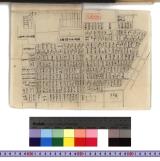


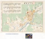
![豊橋市街図 [昭和13年] 複製](https://adeac.jp/items/toyohashi-city/catalog/mp000160-200030/t.jpg)
豊橋市街図 [昭和13年] 複製
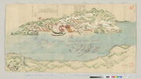
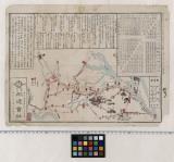
伊豫國嶋々古城之図

奥久慈温泉郷 三美亭 科学万博 つくば,85 昭和60年(1985)3月17日~9月16日

Southwest Japan (Kyūshū, Shikoku, and southwest Honshū), telecommunications
![[天明三年浅間山噴火]](https://da.dl.itc.u-tokyo.ac.jp/portal/sites/default/files/styles/large/public/images/assets/ishimoto/c8494f2b-237e-453f-bf27-c61b5fa7f949_1.jpg?itok=gXfHug8N)
[天明三年浅間山噴火]
Japan--USSR : northern territories / Central Intelligence Agency

茨城県(科学万博 つくば,85)/三美亭

Japan electric power / drawn and reproduced by Co B, 942nd Engr. Avn. Topo. Bn, 325th Ric., US Army
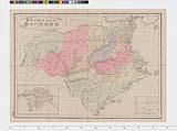
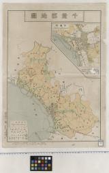
徳島県管内地図

Kahokugunbungenezu
千葉県安房国全図
Grateloupia divaricata Okamura
〔利根川汽船いろは丸案内〕

Southwest Japan (Kyūshū, Shikoku, and southwest Honshū), railroads and railroad facilities [cartog...

-
千葉郡地図

「亀井町」 (神田祭礼山車)(浦島)
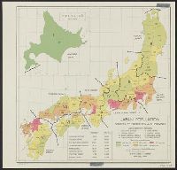
Japan: population densities by prefectures and province
Index to Admiralty charts of Nakai or Inland Sea, Korea Strait, Okhotsk Sea, Kamchatka and Peter the Great Bay / Hydrographic Office
!["Roti"-tō heiyō chishi shiryōzu [cartographic material]](https://stacks.stanford.edu/image/iiif/gk414rt9197%2Fgk414rt9197_00_0001/full/!200,200/0/default.jpg)
"Roti"-tō heiyō chishi shiryōzu [cartographic material]

Chiba
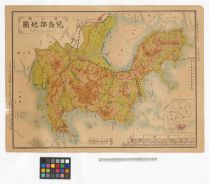
岡山県児島郡地図
遍路道中図(四国八十八カ所)
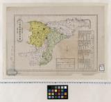
安房国全図
Last Updated: 2025-07-15T01:26:19
Uploaded: 2025-07-16