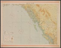
East Asia and North Pacific 1:4,350,000: South China Sea (Sheet 6)
- Time
- Owner Organization

East China Sea--north Pacific Ocean, China--Japan, Miyako-retto to Tokara-retto [electronic resour...
Asia, China--South Korea--Japan, Yellow Sea, including the East China Sea and Korea Strait [electr...

South China Sea. South East Asia - Selected Areas. Pergamon World Atlas. Pergamon Press, Ltd. & P....
Maritime territorial disputes in East Asia: a comparative analysis of the South China Sea and the ...
.jpg)
SOUTH-EAST ASIA AND EAST INDIES ARCHIPELAGO
Japan's Future in East Asia and the Pacific
Japan's Future in East Asia and the Pacific
Globalization: Google and Asia-Pacific
Proceedings of the ASP-DAC ... Asia and South Pacific Design Automation Conference
War map : Australia, China, Japan, and the South Pacific / Cyril Dillon
[East Asia 1:8,000,000] (China and Japan. Revised & reprinted Jan. 1942.)
East Asia and North Pacific 1:4,350,000 / prepared under the direction of the Chief of Engineers by the Army Map Service (AM) ; U.S. Army, Washington, D.C

Maury's Wind and Current Chart, North Pacific Series A. No. 6 (China, Korea, Hong Kong, Japan, Phi...

South Pacific Ocean : New Hebrides Is. North Coast of Aneityum Island showing Port Patrick, Ijipth...

Pacific Ocean, Approaches to south east part of New Guinea
China--Japan, North Korea--South Korea--Russia, Sea of Japan [electronic resource]
Atlas of isotope hydrology - Asia and the Pacific
Korean War 1950-1953 -- Asia, North Korea, South Korea, China, Manchuria, Japan Map / Maps.com(CR)

South Pacific Ocean : Islands and Anchorages in Cook Islands
Military balance in the Asia-Pacific: trends and implications
China's hotel revolution. (join ventures and foreign management) (Focus: Asia & the Pacific)

North West Pacific Ocean : Including Yellow, Japan & Okhotsk Seas, the Kuril Islands and Kamchatka

Southeast Asia (Scale: ca. 1:5,500,000). Japan (Scale: ca. 2,450,000). Northeast China and Japan (...

A voyage of discovery to the North Pacific Ocean in which the coast of Asia, from the lat. of 35@ ...

Japan cities and towns : (shi and machi)
Japan / by J.G. Bartholomew, F.R.G.S

大松村絵図
![Kasei Kita Shina jūmanbun no ichi zu. Hsüchow (Xuzhou) [cartographic material]](https://stacks.stanford.edu/image/iiif/js550gn2130%2Fjs550gn2130_00_0001/full/!200,200/0/default.jpg)
Kasei Kita Shina jūmanbun no ichi zu. Hsüchow (Xuzhou) [cartographic material]

Imizugunkaiganmuramuranarabinikaikyounadomitoriezu

小石川元御殿地跡より巣鴨染井辺迄絵図 : 江戸区分図
Junō--Shiyatoru / Rikuchi Sokuryōbu, Sanbō Honbu
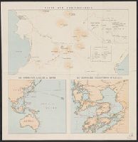
Kyokutō gunbi gensei chizu / Chūō Kōron henshūbu sōan

総州国附台並船橋太神宮順道図

The Islands of Japan, by James Wyld,..
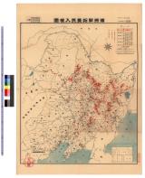
満洲開拓農民入植図 : 満洲開拓農民入植図

Tō "So" jūmanbun no ichizu

寺井津ノ内字西寺井全図
Dau Nihon Teikoku kōsanzu : Mineral distribution of Japanese empire
Unzen and neighbourhood

東松浦郡町村図(乙)岩野村
![[Kuril Islands] Hyakumanbunnoichi Zu](https://stacks.stanford.edu/image/iiif/jx418rz0875%2Fjx418rz0875_00_0001/full/!200,200/0/default.jpg)
[Kuril Islands] Hyakumanbunnoichi Zu

Japan and Korea / compiled and drawn in the Cartographic Section of the National Geographic Society ; James ...
![三河国[東海道図]](https://rmda.kulib.kyoto-u.ac.jp/iiif/RB00020016/RB00020016_00001_0.ptif/full/200,/0/default.jpg)
三河国[東海道図]

Tonamigunyanazemuraonkenchiryouezu

Tonamigunwakabayashigumiyagimuraryouoyobidoumuraryoutsukigenrokusannenkyouhoujuuichinenbunkajuuninenshinkairyounaikenchiezu
![越後国[北陸道図]](https://rmda.kulib.kyoto-u.ac.jp/iiif/RB00020039/RB00020039_00001_0.ptif/full/200,/0/default.jpg)
越後国[北陸道図]

Fukui, Fukui Prefecture, Honshu, Japan

東松浦郡町村図(乙)横竹村
Last Updated: 2020-06-05
Uploaded: 2021-07-22