The Pacific Ocean
North Pacific Ocean

Pacific Ocean, Iwate

South Pacific Ocean, Maraenui

South Pacific Ocean, Tearai

South Pacific Ocean, Waihau
North Pacific Ocean, Iwate

South Pacific Ocean, Maraenui
North Pacific Ocean, Stinson Beach

Map of the Pacific Ocean
Seinan Taiheiyo seizu [Map of southwest Pacific Ocean] / compiled by Asahi Shinbunsha
North Pacific Ocean / compiled & drawn by J.W. Appleton ; engraved by Homewood & Son

Pacific Ocean. Gilbert Islands (Kingsmill Group)

Rand McNally map of Eastern Asia and Western Pacific Ocean. (Mercator projection). Copyright by Ra...
Rand McNally map of Eastern Asia and Western Pacific Ocean. Mercator projection. Copyright by Rand...

North Pacific Ocean : Eastern Part of Hawaiin Islands
E. G. Taylor 1942 Pacific Campaign 08

South Pacific Ocean ; Fiji Islands ; Viti Levu. Suva Harbour
North Pacific Ocean, Japan, Nampō-Shotō [electronic resource]

South Pacific Ocean : Islands and Anchorages in Cook Islands

Pacific Ocean, Approaches to south east part of New Guinea

Pacific Ocean, Bōshū (Bōshū Futomi), series Souvenirs of Travel

Japan and its relation to the territory bordering on the Pacific Ocean
Western Pacific / Compiled by James F. Imray F.R.G.S

駿河国富士山頂上八葉内院八方遠見図
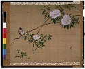
花鳥図(椿雀図)
Laurie and Whittle's new chart of the Indian and Pacific Oceans between the Cape of Good Hope, New Holland and Japan : comprehending New Zealand, New Caledonia, New Britain, New Ireland, New Guinea &c., Louisiade and New Georgia; also The Pelew, New Caroline, Ladrone and Philippine Islands &c. with the most remarkable tracks of the English, Spanish, French and Dutch navigators and chiefly the track of the Walpole, EastIndiaman, Captn. Thos. Butler, 1794 from the Cape of Good Hope to Van Diemen's Land and from thence to China, and the track of the Royal Admiral Captn. Henr. Bond in 1792 and 93 from the Cape to Port Jackson and China

(Composite Map of) Map of the Island of Japan, Kurile &c. with the Adjacent Coasts of the Chinese ...

Karte von Australien oder Polynesien, nach den Zeichnungen, Reisebe Schreibungen und Tagebucher de...
Australien / wolfenbuttel bei C. H. Hartmann

An Accurate Chart of the World, with the New Discoveries; Also a View of the General & Coasting Tr...

Soudakasenhachijuugokokumenyottsuimizugunimaimurasoutakamawarinaikenchiryouezushitagaki
Japanese Empire--802 M
A new map of India & China from the latest observations / by I. Senex
A new & accurate map of Asia : drawn from the most approved modern maps & charts / by Thos. Bowen ; engraved for Middletons complete system of geography
![Tokyo city proper [cartographic material]](https://stacks.stanford.edu/image/iiif/vj067cj0650%2Fvj067cj0650_00_0001/full/!200,200/0/default.jpg)
Tokyo city proper [cartographic material]

Carte réduite de l'Océan Oriental depuis le Cap de Bonne Esperance, jusqu'au Japon : dédiée à l'Ac...

Karta Morskykh Otkrytii Rossiiskimi Moreplavatelimi na Tikhom ... [transliterated from the Cyrilli...

「鎌倉一覧之図」

A New and Correct Chart of all the Known World Laid down according to Mercator's Projection
![Carte de la Découverte faite en [1735] par les Hollandois, à la partie la plus orientale de l'Asie...](https://api.europeana.eu/api/v2/thumbnail-by-url.json?uri=http%3A%2F%2Fgallica.bnf.fr%2Fark%3A%2F12148%2Fbtv1b53032838p.thumbnail.jpg&type=IMAGE)
Carte de la Découverte faite en [1735] par les Hollandois, à la partie la plus orientale de l'Asie...
Asia and its several islands and regions : according to their most approved divisions with Captain Cooks new discoveries / by Thomas Kitchin, Hydrographer to His Majesty

東亞大陸圖 : 二百五十万分一

A Chart of the Eastermost part of the East Indies and China from Cape Comarin to Japan with the Ad...

筑後川改修図

Carte réduite de l'océan septentrional compris entre l'Asie et l'Amérique ... Par le Sr. Bellin ..
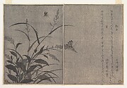
Tree cricket (Matsumushi); Firefly (Hotaru), from the Picture Book of Crawling Creatures (Ehon mushi erami)
To the Right Honourable William, Lord Cowper, Lord High Chancellor of Great Britain, this map of Asia : according to ye newest and most exact observations is most humbly dedicated / by your Lordship's most humble servant, Herman Moll, geographer
Last Updated: 2020-06-05
Uploaded: 2021-07-22