Japan, the islands of Loochoo & Formosa, and the maritime provinces of China with the tract of the Morrison's voyage in 1837 / J. Arrowsmith, Lith
- People
- Time
- Owner Organization

China, Contains 15 Subject Provinces, including the 2 Islands of Hainan Formosa and the Tributary ...

China, Contains 15 Subject Provinces, including the 2 Islands of Hainan Formosa and the Tributary ...

China, Contains 15 Subject Provinces, including the 2 Islands of Hainan Formosa and the Tributary ...

China, Contains 15 Subject Provinces, including the 2 Islands of Hainan Formosa and the Tributary ...
A chart of the northern part of the China Sea shewing the passage from Formosa to Japan : with the eastern coast of China and the Lekeyo Islands

Sketch of a voyage to the India and China seas, including Japan and the Pacific islands, for the p...

Figures and descriptions of the fishes of Japan : including Riukiu Islands, Bonin Islands, Formosa...
Figures and descriptions of the fishes of Japan : including Riukiu Islands, Bonin Islands, Formosa...

Chart of the coast of China and of the Japan islands including the Marianes and part of the Philippines
A chart of the northern part of the China Sea shewing the passage from Formosa to Japan with the eastern coast of China and the Lekeyo islands / by Van Kuelen ; improved from the maps drawn in China by Father Gaubil in 1752
Maritime territorial disputes in East Asia: a comparative analysis of the South China Sea and the ...

A mapp of the Formosa described by Candidius being Tyawan and part of the coast of Formosa
The flight of the Lapwing, a naval officer's jottings in China, Formosa and Japan
![[Taiwan and the Coast of Fujian and Guandong, China] Kaart van de Chineesche Kust en van Formosa v...](https://stacks.stanford.edu/image/iiif/zy510ks0323%2F34567/full/!200,200/0/default.jpg)
[Taiwan and the Coast of Fujian and Guandong, China] Kaart van de Chineesche Kust en van Formosa v...

China, divided into its great provinces, and the Isles of Japan

China divided into its great provinces and the Isles of Japan by Samuel Dunn

China divided into its Great Provinces, and The Isle of Japan . . . 1774

Our elite forces capturing the Hoko islands of Taiwan

A chart of the tradeing part of the East Indies and China, with the adjacent islands, from Surrat ...
The Philippine Islands, Molucas, Siam, Cambodia, Japan and China, at the close of the sixteenth ce...
China Divided into its Great Provinces and the Isles of Japan [Material cartográfico]
Paymaster Lieutenant G H Lloyd Davies and Lieutenant J P Mitchell of the HMS Leander

Geographical and Statistical Map of China. China and the Tributary Kingdom of Corea. For the Eluci...
A new mapp of y Empire of China : with its several provinces or kingdomes together w.th [i.e. with] the adjacent Isles of Iapon or Niphon, Formosa, Hainan, etc. / rendred into English & enlarged w.th the Isles of Iapon by Rich. [i.e. Richard] Blome by his Majesties command ; W. Hollar fecit 1669
Ranyō Nyūginia zenzu
The island of Formosa
Dai ichi-gun no heitan : Meiji sanjūnana-nen hachi-gatsu nijūgo nichi

Japon. Carte / dressée pour les missions catholiques par M. R. Hausermann ; avec le concours de M....

Plans on the West Coast of Celebes

Japan, Hokushu _ West Coast. Iwanai Byochi and Approaches
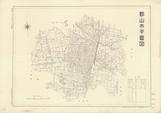
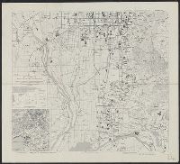
郡山市平面図 昭和28年

Empire Chinois et Japon
![[Japan] (Published in Manila!)](https://stacks.stanford.edu/image/iiif/gv355sq3352%2F37869hs/full/!200,200/0/default.jpg)
[Japan] (Published in Manila!)
![Gomanbunnoichi Rusontō zu [cartographic material]](https://stacks.stanford.edu/image/iiif/pp221kq2864%2Fpp221kq2864_00_0001/full/!200,200/0/default.jpg)
Gomanbunnoichi Rusontō zu [cartographic material]
Kyoto South : Kyoto Prefecture, Honshu, Japan

A New & Accurate Chart of the Discoveries made by the late Capt. Js. Cook, and other distinguished...

Yōzu (kūchū shashin sokuryō) Mōko jūmanbun no ichizu
![The Northwestern Pacific [cartographic material].](https://stacks.stanford.edu/image/iiif/hk776rv6776%2Fhk776rv6776_00_0001/full/!200,200/0/default.jpg)
The Northwestern Pacific [cartographic material].

General map of China and adjacent regions showing treaty ports and railroads / prepared for the Department o...

Nyūjōjiatō fukin sozu
Dai ni-gun no heitan : Meiji sanjūnana-nen hachi-gatsu jūichi nichi

China - east coast : Hangchow Wan - southeast portion : including the approaches to the Yung Kiang

Ryōtō Kaiwan : Daitzu Shan to Fuchou Chao
![America Bay [cartographic material]](https://stacks.stanford.edu/image/iiif/nj035cf2832%2Fnj035cf2832_00_0001/full/!200,200/0/default.jpg)
America Bay [cartographic material]
Kasei Biruma Gojūmanbun ichi zu (7 he 501)
Buna

The Islands of Japan, by James Wyld,..
Jūmanbun no ichi Nyū Airurando-tō
Last Updated: 2020-06-05
Uploaded: 2021-07-22