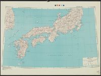
Relief map of Southern Japan : special airfield relief map / prepared and reproduced in the United States Department of the Interior Geological Survey
- People
- Time
- Owner Organization
Relief map of Northern Honshu : special airfield relief map / prepared and reproduced in the United States Department of the Interior Geological Survey
Relief map of southern Japan / prepared and reproduced in the United States Department of the Interior Geological Survey
Hokkaido, Japan : Special airfield relief map / prepared and reproduced in the United States Department of the Interior Geological Survey
Relief map of Northern Honshu / prepared and reproduced in the United States Department of the Interior Geological Survey
Hokkaido, Japan / prepared and reproduced in the United States Department of the Interior, Geological Survey
General map of China and adjacent regions, showing treaty ports and railways / prepared for the Department of State, by the Topographic Branch, U.S. Geological Survey
![Imperial Geological Survey of Japan topographical map : Division I-[V]](https://collections.library.yale.edu/iiif/2/15828616/full/!200,200/0/default.jpg)
Imperial Geological Survey of Japan topographical map : Division I-[V]

The M9.0 Great Tohoku Earthquake (northeast Honshu, Japan) of March 11, 2011 : earthquake summary map / U.S. Geological Survey

Topographical map of the Japanese Empire, 1899 / Imperial Geological Survey of Japan ; drawn by T. Togawa an...
Court Exh. No. 3155: Map of Hailar Sappa area prepared in 1932 by the Japanese Land Survey Department
Court Exh. No. 3155: Map of Hailar Sappa area prepared in 1932 by the Japanese Land Survey Department
Series ; 5207
Caroline Islands 1:25,000 : Yap / prepared under the direction of Engineer, Hq AFFE/BA, by the Military Geology Branch, Intelligence Division ; map compiled by C. G. Johnson, geologist, Military Geology Branch, U.S. Geological Survey, for the Intelligence Division, Office of the Engineer, Hq. U.S. Army Japan
Special map : Haha Jima / prepared for CinCPac-CinCPOA by 64th Engr. Top. Bn. USAFCPBC, Dec. 1944 ; reproduced by 30th Engr. Base Top. Bn. USAFCPBC No. 1337-1, February 1945
Special map : Muko Jima / prepared for CinCPac-CinCPOA by 64th Engr. Top. Bn. USAFCPBC, No. 1157 Jan. 1945 ; reproduced by 30th Engr. Base Top. Bn. USAFCPBC No. 1340-1, February 1945
Relief map of southern Japan / prepared and reproduced in the United States Department of the Interior Geological Survey

「兵庫屋あふ州」

「吃り」
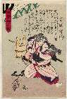
「わたなべの綱 沢村源之助」

「風流略六芸(やつしりくげい)」 「和歌」
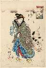
「江戸名所百人美女 赤さか氷川」

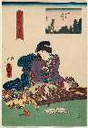
「五節句」 「角海老屋内箙」「いくた」「うめの」
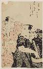
「江尻」 「府中へ二里二十七丁」

「文相撲」
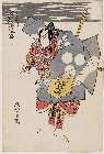
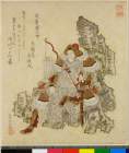
「侠勇祥虎伝」 「宮城野」
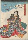
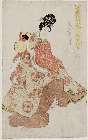
「大和高名列女鏡」 「源氏 わか紫」

Drawing for Chelsea White House
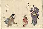
「伝兵へ 小川吉太郎」「女さる廻し小よし 中村三光」
.jpg)
「でつち久松」
「よしだ」
「葛飾廿四将」 「武☆槌太神」

Genjigoshuuyojou、suetsumuhana
「七変化之内 なりひら」
「虫撰(「むしえらみ」) 「あしまとひ」」

大村庵

三国通覧輿地路程全圖 /
「是業之讃」
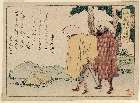
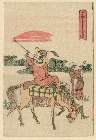
「東海道」 「保土ヶ谷」「戸塚へ一里九丁」
Yamashironomeisho、idenotamagawa
Last Updated: 2020-06-05
Uploaded: 2021-07-22