The Suma oriental of Tomé Pires : an account of the East from the Red Sea to Japan, written in Malacca and India in 1512-1515; and, The Book of Francisco Rodrigues, rutter of a voyage in the Red Sea, nautical rules, almanack and maps written and drawn in the East before 1515 (Map in pocket of vol.2: The east, from the Red Sea to Japan, as known to Francisco Rodrigques)
- People
- Time
- Owner Organization
East of the Sea
Seasonal Variation of Circulations in the East China Sea and the Yellow Sea

Biodiversity and distribution of the deep-sea fauna in the Sea of Japan and in the Kuril-Kamchatka...
The country trade East-India pilot, for the navigation of the East-Indies and oriental seas, within the limits of the East-India Company, extending from the Cape of Good Hope to China, New Holland and New Zeeland, with the Red Sea, Gulf of Persia, Bay of Bengal, and China Seas / chiefly composed from actual surveys and draughts communicated by experienced officers of the East-India Company, and from the Neptune oriental by M. d'Apres de Mannevillette
Maritime territorial disputes in East Asia: a comparative analysis of the South China Sea and the ...

Fishes of the Sea of Japan and the adjacent areas of the Sea of Okhotsk and the Yellow Sea / G.U. ...
Fishes of the Sea of Japan and the adjacent areas of the Sea of Okhotsk and the Yellow Sea / G.U. ...
Prisoner of war and internee camps in the Far East / produced by Australian Red Cross Society
Studies on the age, growth and reproduction of Lophiomus setigerus and Lophius litulon in the East China Sea and the Yellow Sea

In the inland sea of Japan

THE WAR IN THE EAST: SOME OF THE JAPANESE WOUNDED IN HOSPITAL AT CHEMULPHO, JAPANESE RED CROSS NURSES IN THE...
A chart of the northern part of the China Sea shewing the passage from Formosa to Japan with the eastern coast of China and the Lekeyo islands / by Van Kuelen ; improved from the maps drawn in China by Father Gaubil in 1752

Voyage of discovery into the South Sea and to Behring's Straits, in search of a north-east passage : undertaken in the years 1815, 16, 17, and 18, in the Ship Rurick

Reported Dangers to navigation in the Pacific Ocean, inclusive of the China and Japan Seas and the...

A chart of the Tartarian Sea from Nova Zemla to Japan

"Out of the east." Reveries and studies in new Japan, by Lafcadio Hearn ..
WAR IN THE EAST This map shows Malaya and the Philippine Islands and the principal scenes of the Japanese of...
The Oriental navigator, or, Directions for sailing to, from, and upon the coasts of, the East-Indies, China, Australia...To the work are prefixed a series of ... tables of the determined positions of all the principle points and places from the British seas to Cape Horn, the Cape of Good Hope, and thence to the islands of Japan, by John Purdy. (Plan of Chatham Island, &c. Whittle & Laurie, London, 1815.)

Hōjō Tokimasa Praying to a Goddess in the Sea

A Chart of the Eastermost part of the East Indies and China from Cape Comarin to Japan with the Ad...

A Chart of the Eastermost part of the East Indies and China from Cape Comarin to Japan with the Ad...
Japan's Future in East Asia and the Pacific
Japan's Future in East Asia and the Pacific
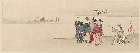
Fisherman rowing out to fish in the snowstorm, in northern district in Japan, along the coast of the Japan Sea

Yuushimeimeidenyuasagosuke

「三代目大谷広右衛門の髭の意休(いきゅう)」

Imizugunkitanoyousuiesujihorikaenegaiezu

「たばこや源七 市川団十郎」
Schetskaart van de Schouten en Padeaido Eilanden

「お七 岩井粂三郎」

Prepatory drawing for "Five Festivals: Doll's Day, Third Month"

「源氏匂宮の体」 「柳町 平田屋」

「風流四眠?」

Tsurugabiwakokanungakeikakuzu
Japanners aan het werk na de bevrijding
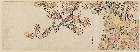
「紅葉と幹に吊された幕」

「天橋立」
「大神楽」
Tangū mātō haisen oyobi futō no zu / Un'yu-bu Haisha-ka
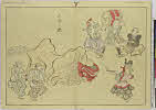
「夷参り?(題名は『秘蔵浮世絵大観」 「ベルギー王立美術館』による。川向こうを指さす茶摘み娘?と福笹を持つ参詣の人々)」

Imizugunnunomemuraryoushitaezu

「四代目岩井半四郎」

「三代中島勘左衛門(なかじまかんざえもん)」
Japanner slaat vrouw

Makinokitanodeaiyousuiesujiezu

「荻のや八重桐 瀬川菊之丞」

Yamashironomeisho、idenotamagawa

「初代芳沢いろは」
Last Updated: 2020-06-05
Uploaded: 2021-07-22