![[Manchuria] (7 sheet US Military Information Division Map of Manchuria)](https://stacks.stanford.edu/image/iiif/yr430hp5690%2F41524/full/!200,200/0/default.jpg)
[Manchuria] (7 sheet US Military Information Division Map of Manchuria)
- People
- Time
- Owner Organization

Strategical map of part of Korea and Manchuria / prepared by the Second Division, General Staff (Military In...
Yale University Library
Yale University Library Digital Collections

Map of Manchuria, Corea & Japan
Boston Public Library
DPLA API
![Map of Manchuria, Corea & Japan [cartographic material]](https://collections.library.yale.edu/iiif/2/15828540/full/!200,200/0/default.jpg)
Map of Manchuria, Corea & Japan [cartographic material]
Yale University Library
Yale University Library Digital Collections

The latest map of Manchuria, Korea, Formosa, and Saghalien
Stanford University Libraries
Stanford Libraries SearchWorks
Map of Japan. (sheet 3)
National Library of Australia
Trove: National Library of Australia

The topographic map of Manchoukuo
Stanford University Libraries
Stanford Libraries SearchWorks
![Imperial Geological Survey of Japan topographical map : Division I-[V]](https://collections.library.yale.edu/iiif/2/15828616/full/!200,200/0/default.jpg)
Imperial Geological Survey of Japan topographical map : Division I-[V]
Yale University Library
Yale University Library Digital Collections

Bilingual map of Greater Tokyo. Prepared by the Cartographic Division of King Associates. Publishe...
Stanford University Libraries
Stanford Libraries SearchWorks
JAPAN'S MILITARY LEADERS IN MANCHURIA.—GeneraI Kan-, aya, Chief of the General Staff (riglit) -with General ...
National Library of New Zealand
DigitalNZ New Zealand API

(Lower Sheet to) Map of the Island of Japan, Kurile &c. with the Adjacent Coasts of the Chinese Do...
Stanford University Libraries
Stanford Libraries SearchWorks

General Railway Map of Japan and Manchuria : Showing lines open and under construction on March 31...
Stanford University Libraries
Stanford Libraries SearchWorks

The 24th Division Artillery. A Map & History of the 24th Divarty in Camp Hakata & Camp Fukuoka, Ky...
Stanford University Libraries
Stanford Libraries SearchWorks
A military display held by the units of the New Zealand Division in New Caledonia during World War II, enemy...
Alexander Turnbull Library
DigitalNZ New Zealand API

Maple Leaves in Shimosa Province (Shimosa, momiji), section of sheet no. 7 from the series "Cutout Pictures of the Provinces (Kunizukushi harimaze zue)"
Art Institute of Chicago
Art Institute of Chicago API
This map of the Pacific shows the "pincers" strength of the United States from the Aleutian Islands in the n...
National Library of New Zealand
DigitalNZ New Zealand API
Map of Nanking, the Chinese southern capital, which is being attached by a Japanese army and is expected to ...
National Library of New Zealand
DigitalNZ New Zealand API
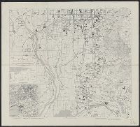
Kyoto South : Kyoto Prefecture, Honshu, Japan
Yale University Library
Yale University Library Digital Collections
![[歴民カード_歴史] 山水図](https://khirin-i.rekihaku.ac.jp/iiif/nmjh_rekimin_h/12249088_02.tif/full/200,/0/default.jpg)
[歴民カード_歴史] 山水図
National Museum of Japanese History
IIIF Discovery in Japan
![Sanjūmanbun no ichi Shina engan rikukai hengōzu [cartographic material]](https://stacks.stanford.edu/image/iiif/cn019rx5665%2Fcn019rx5665_00_0001/full/!200,200/0/default.jpg)
Sanjūmanbun no ichi Shina engan rikukai hengōzu [cartographic material]
Stanford University Libraries
Stanford Libraries SearchWorks
![[Cinq vignettes : femmes, chats] : [estampe] / H. Somm](https://api.europeana.eu/thumbnail/v2/url.json?uri=https%3A%2F%2Fgallica.bnf.fr%2Fiiif%2Fark%3A%2F12148%2Fbtv1b10524453z%2Ff1%2Ffull%2F512%2C%2F0%2Fnative.jpg&type=IMAGE)
[Cinq vignettes : femmes, chats] : [estampe] / H. Somm
Bibliothèque nationale de France
Europeana API
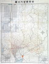
岐阜県管内全図
Takayamashi Kyoiku Iinkai
ADEAC: A System of Digitalization and Exhibition for Archive Collections
![[歴民カード_歴史] 紅花屏風 横山華山筆(六曲屏風)](https://khirin-i.rekihaku.ac.jp/iiif/nmjh_rekimin_h/10648009_02.tif/full/200,/0/default.jpg)
[歴民カード_歴史] 紅花屏風 横山華山筆(六曲屏風)
National Museum of Japanese History
IIIF Discovery in Japan
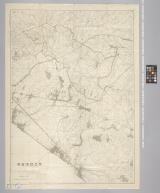
習志野演習場
Funabashi-shi Western Library
ADEAC: A System of Digitalization and Exhibition for Archive Collections

山城国駅路図全
Kyoto University Library
IIIF Discovery in Japan
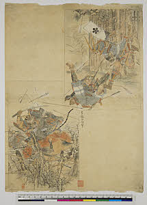
武者絵 不明 全体図
朝日智雄
ARC Ukiyo-e Portal Database

東松浦郡町村図(甲)久保村
Saga Prefectual Library
IIIF Discovery in Japan
Last Updated: 2020-04-17
Uploaded: 2021-09-21