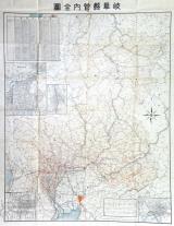

岐阜県管内図
Takayamashi Kyoiku Iinkai
ADEAC: A System of Digitalization and Exhibition for Archive Collections

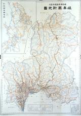
岐阜県管内実測新地図 : 岐阜県管内図
Iwase Bunko Libray
ADEAC: A System of Digitalization and Exhibition for Archive Collections

岐阜県岐阜市
NHK Archives
Michi-shiru: Japan Seasonal Journey
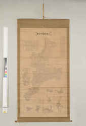
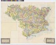
岐阜県管内地図 二十万分一
Sekigahara Town History and Folklore Museum
Sekigahara Collection Database
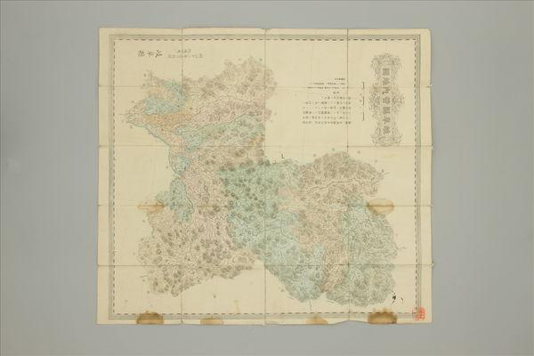
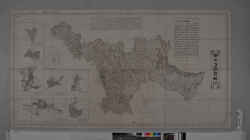
岐阜県飛騨国全図
Takayamashi Kyoiku Iinkai
ADEAC: A System of Digitalization and Exhibition for Archive Collections
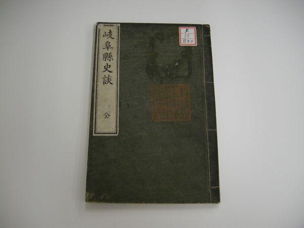
岐阜県史談 全
Sekigahara Town History and Folklore Museum
Sekigahara Collection Database

岐阜県全図 大日本分県地図全56枚ノ内
Kochi Prefectural Library
OTEPIA Kochi Library collection search
岐阜県新地図
Takayamashi Kyoiku Iinkai
ADEAC: A System of Digitalization and Exhibition for Archive Collections

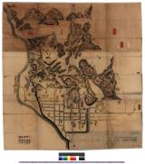
岐阜古図 : 岐阜古図
Iwase Bunko Libray
ADEAC: A System of Digitalization and Exhibition for Archive Collections
濃州岐阜図 : 岐阜図
Iwase Bunko Libray
ADEAC: A System of Digitalization and Exhibition for Archive Collections

岐阜県土岐市
NHK Archives
Michi-shiru: Japan Seasonal Journey
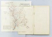
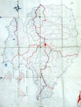
岐阜県郡上郡図
郡上市歴史資料館
ADEAC: A System of Digitalization and Exhibition for Archive Collections
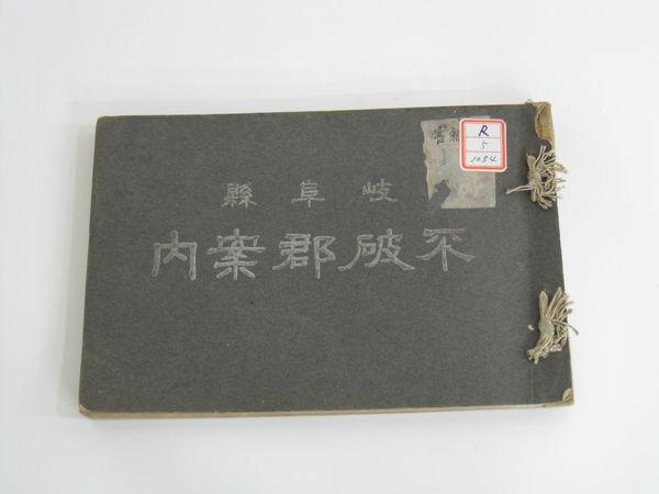
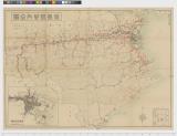
岐阜県 不破郡案内
Sekigahara Town History and Folklore Museum
Sekigahara Collection Database

岐阜県山県市
NHK Archives
Michi-shiru: Japan Seasonal Journey
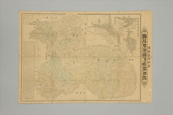
改正新旧対照 岐阜県管内実測新地図
Sekigahara Town History and Folklore Museum
Sekigahara Collection Database

岐阜県主要観光地案内図
国際日本文化研究センター
IIIF Discovery in Japan

岐阜県関市
NHK Archives
Michi-shiru: Japan Seasonal Journey
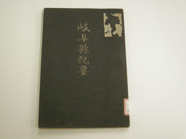
岐阜県紀要
Sekigahara Town History and Folklore Museum
Sekigahara Collection Database
三重県管内全図
三重県環境生活部文化振興課
Specified Historical Public Records and Archives, Mie
三重県管内全図
Mie Prefectural Museum
三重県総合博物館所蔵品(人文)
徳島県管内全図
ADEAC: A System of Digitalization and Exhibition for Archive Collections
徳島県管内全図
Tokushima Prefectural Archives
ADEAC: A System of Digitalization and Exhibition for Archive Collections

徳島県管内図 全
Tokushima Prefectural Archives
ADEAC: A System of Digitalization and Exhibition for Archive Collections

福井県管内全図
Digital Archive Fukui
Digital Archive Fukui

Tabula Indiae Orientalis et Regnorum Adjacentium J. Van Braam et G. onder de Linden . .
Stanford University Libraries
Stanford Libraries SearchWorks
![Sanjūmanbun no ichi Shina engan rikukai hengōzu [cartographic material]](https://stacks.stanford.edu/image/iiif/cn019rx5665%2Fcn019rx5665_00_0001/full/!200,200/0/default.jpg)
Sanjūmanbun no ichi Shina engan rikukai hengōzu [cartographic material]
Stanford University Libraries
Stanford Libraries SearchWorks
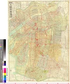
最新大阪市街地図
国際日本文化研究センター
SODA Collection: Pictorial and Miscellaneous Materials

小城郡村図多久原村
Saga Prefectual Library
IIIF Discovery in Japan

Tabula Indiae Orientalis et Regnorum Adjacentium J. Van Braam et G. onder de Linden . .
Stanford University Libraries
Stanford Libraries SearchWorks
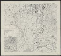
Kyoto South : Kyoto Prefecture, Honshu, Japan
Yale University Library
Yale University Library Digital Collections

Fukui, Fukui Prefecture, Honshu, Japan
Stanford University Libraries
Stanford Libraries SearchWorks
![[歴民カード_歴史] 萩城下町絵図](https://khirin-i.rekihaku.ac.jp/iiif/nmjh_rekimin_h/13549110_02.tif/full/200,/0/default.jpg)
[歴民カード_歴史] 萩城下町絵図
National Museum of Japanese History
IIIF Discovery in Japan

Gomanbunnoichi chikeizu Kaimondake
Stanford University Libraries
Stanford Libraries SearchWorks
Last Updated: 2025-07-15
Uploaded: 2025-07-16