Craigie's map of South Australia showing towns, roads & railways / compiled, drawn & published by Kenneth Craigie & Co
- People
- Time
- Owner Organization

Dai Ni-hon kai riku zenzu, resentsu Chosen hei Karafuto [Carte complète de l'Empire Japonais, mers...
浜名湖津波絵図(その2)津波の去った泥田の図
Ezo no Kuni Zenzu / Hayashi Shihei zu
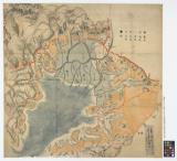
Kōgun senka kakudai ikkenzu : (fu) fukin chiten no koji gaisetsu

大佐賀最新市街全図
Imperii Sinarum nova descriptio [prepared by Martino Martini]
Japan and adjacent regions of Asia and the Pacific Ocean / compiled and drawn in the Cartographic Section of the National Geographic Society
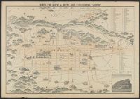
Bird's eye view of Kioto and surrounding country / Y. Shimidzu
「しな川」

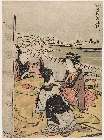
Shimotsuke no Kuni Shiobara Onsen shinkei

Carte générale de la Tartarie Chinoise dressée sur les cartes particulières faites sur les lieux p...

Carte des terres aux environs du Japon ou du nord-est de l'Asie et du nord-ouest de l'Amérique ext...
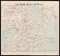
Nara, Yamada, Koyasan, & environs
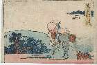
「(東海道五十三次)荒井」

A New Map of Asia from the latest Observations Most Humbly Inscrib'd to the Right Honbl. George Ea...
Korea / prepared ... by the Army Map Service, U.S. Army
![Carte De L'Empire De La Chine . . . An XII [Shows Formosa]](https://stacks.stanford.edu/image/iiif/qv486bn8087%2F18739/full/!200,200/0/default.jpg)
Carte De L'Empire De La Chine . . . An XII [Shows Formosa]
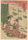
「風流(ふうりゅう)近江(おうみ)八景(はっけい)」 「比良(ひら)のぼせつ」

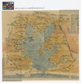
Soudakasenhachijuugokokumenyottsuimizugunimaimurasoutakamawarinaikenchiryouezushitagaki

「六十余州名所図会」 「大和」「立田山(たつたやま)龍田川(たつたがわ)」

Suruga no Kuni Abe-gun Shizuhatayama Sengen Sōja goshachū goe zumen
遠淡海浜名湖之図
Dai Nippon Teikoku zenzu
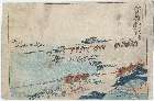
「(東海道五十三次)蒲原」
Last Updated: 2020-06-05
Uploaded: 2021-07-22