
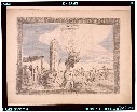
Chart of the Discoveries made in 1787, in the Seas of China and Tartary by the Boussole and Astrol...
- Time
- Owner Organization

Chart of Discoveries made in 1787, in the Seas of China and Tartary, by the Boussole and Astrolabe...

Chart of Discoveries, Made in 1787, in the Seas of China and Tartary, by the Boussole and Astrolab...

Chart of Discoveries made in 1787 In the Seas of China and Tartary between Manilla and Avateha by ...

A New & Accurate Chart of the Discoveries made by the late Capt. Js. Cook, and other distinguished...
Chart of Japanese islands and surrounding seas

Chart of the Discoveries to the North of Japan, in 1643, by the Dutch Ships the Kastrikum & the Br...

Narrative of the expedition of an American squadron to the China Seas and Japan performed in the y...

Narrative of the expedition of an American squadron to the China Seas and Japan performed in the y...

Narrative of the expedition of an American squadron to the China Seas and Japan performed in the y...

Narrative of the expedition of an American squadron to the China Seas and Japan : performed in the years 185...

Report on the ichthyology of the seas of China and Japan /
Report on the ichthyology of the seas of China and Japan /

Fankwei; or, the San Jacinto in the seas of India, China and Japan
China and Japan a record of observations made during a residence of several years in China, and a ...

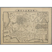
Chart of the coast of China and of the Japan islands including the Marianes and part of the Philippines

Reported Dangers to navigation in the Pacific Ocean, inclusive of the China and Japan Seas and the...

Narrative of the expedition of an American squadron to the China Seas and Japan : performed in the...
Report on the ichthyology of the seas of China and Japan.
A chart of the northern part of the China Sea shewing the passage from Formosa to Japan with the eastern coast of China and the Lekeyo islands / by Van Kuelen ; improved from the maps drawn in China by Father Gaubil in 1752

Narrative of the expedition of an American squadron to the China Seas and Japan : performed in the...
Narrative of the expedition of an American squadron to the China Seas and Japan : performed in the...

Narrative of the expedition of an American squadron to the China Seas and Japan : performed in the...

An Accurate Chart of the World, with the New Discoveries; Also a View of the General & Coasting Tr...
Narrative of the expedition of an American squadron to the China seas and Japan.

Carte des decouvertes, faites en 1787 dans les mers de Chine et de Tartarie par les Fregates Franc...
Chart of Discoveries, Made in 1787, in the Seas of China and Tartary, by the Boussole and Astrolab...
Chart of the Discoveries to the North of Japan, in 1643, by the Dutch Ships the Kastrikum & the Br...

Royaume du Iapon / désigné par le père Ph. Briet,... ; Somer sculp
The island of Formosa

A new and accurate map of the Empire of Japan. Laid down from the memoirs of the Portuguese and Du...

Chinesisches Reich und Japan. Entw. u. gez. v. F. Handtke. Druck und Verlag von C Flemming in Glog...
![[Carte abrégée de la ville d'Osaka, divisée en quartiers.]](https://api.europeana.eu/api/v2/thumbnail-by-url.json?uri=http%3A%2F%2Fgallica.bnf.fr%2Fark%3A%2F12148%2Fbtv1b530667803.thumbnail.jpg&type=IMAGE)
[Carte abrégée de la ville d'Osaka, divisée en quartiers.]

Carte des decouvertes au nord du Japon. Faites en 1643 par les Vaisseaux Hollandais le Kastrikum e...

Chinese Empire. Fenner Sc., Paternoster Row. (London, Joseph Thomas 1835)

China and Japan. (with) Islands of Japan. By Keith Johnston, F.R.S.E. Keith Johnston's General Atl...

Empire of Japan. (with) Nagasaki Harbour. Engraved by J. & C. Walker. Published under the superint...

Das Chinesische Reich mit den Schutz-Staaten, und Japan: entw. u. gez. v. C.G R.(eichard) 1826. Ge...
Collection of Thirty-six Kyōka Poems

Tatariae Sive Magni Chami Regni typus. Cum Privilegio
見立玄宗皇帝

Japan. Copyright 1892 by Appleton & Co. (insets) Kurile Islands; Tokyo. (to accompany) The Library...
富士登山口全図

武相駿豆名所一覧図

(Covers to) Picture map of China. Designed by Frank Randolph Southard. Printed in United States of...
須崎弁天

「江戸名所」「真乳山 山谷堀 三囲堤」 「江戸名所」「真乳山山」「谷堀」「三囲提」

Chinese Empire

Auckland Harbour
Last Updated: 2020-04-17
Uploaded: 2021-09-21