
(Southeast Asia, China &c.)
- People
- Time
- Owner Organization

(Southeast Asia, China &c.)
Stanford University Libraries
Stanford Libraries SearchWorks

Southeastern Asia, China, and Japan
Stanford University Libraries
Stanford Libraries SearchWorks

Southeast Asia (Scale: ca. 1:5,500,000). Japan (Scale: ca. 2,450,000). Northeast China and Japan (...
Stanford University Libraries
Stanford Libraries SearchWorks

Singapore, from the series India and Southeast Asia
Freer and Sackler
DPLA API

Fatehpur-Sikri, from the series India and Southeast Asia
Freer and Sackler
DPLA API

Kanchenjunga (Afternoon), from the series India and Southeast Asia
Freer and Sackler
DPLA API

Ajmer Gate, Jaipur, from the series India and Southeast Asia
Freer and Sackler
DPLA API

Morning of Darjeeling, from the series India and Southeast Asia
Freer and Sackler
DPLA API

Caravan from Afganistan, from the series India and Southeast Asia
Freer and Sackler
DPLA API
![[Untitled Sea Chart of Australia, Indian Ocean, China, Japan, SE Asia, &c] (First Printed Map to S...](https://stacks.stanford.edu/image/iiif/cv359wv2441%2F22989/full/!200,200/0/default.jpg)
[Untitled Sea Chart of Australia, Indian Ocean, China, Japan, SE Asia, &c] (First Printed Map to S...
Stanford University Libraries
Stanford Libraries SearchWorks

Outskirt of a village, from the series India and Southeast Asia
Freer and Sackler
DPLA API

Island Palaces in Udaipur, from the series India and Southeast Asia
Freer and Sackler
DPLA API
China, Japan, &c.
Stanford University Libraries
Stanford Libraries SearchWorks
Southeast Asian studies
Stanford University Libraries
Stanford Libraries SearchWorks

Golden Temple in Amritsar, from the series India and Southeast Asia
Freer and Sackler
DPLA API

The Taj Mahal Gardens at Night, from the series "India and Southeast Asia"
Art Institute of Chicago
Art Institute of Chicago API

The Great Temple in Madurai, from the series India and Southeast Asia
Freer and Sackler
DPLA API
Southern Asia
National Library of Australia
Trove: National Library of Australia

Moon Light of the Taj Mahal No. 4, from the series India and Southeast Asia
Freer and Sackler
DPLA API
![[Russian Map of Northeastern Asia, Japan, Korea, China, Alaska, etc.] ( Summary map of hydrographi...](https://stacks.stanford.edu/image/iiif/pj697kr2558%2F35405/full/!200,200/0/default.jpg)
[Russian Map of Northeastern Asia, Japan, Korea, China, Alaska, etc.] ( Summary map of hydrographi...
Stanford University Libraries
Stanford Libraries SearchWorks
Asean and Asean plus three: manifestations of collective identities in Southeast and East Asia
German National Library
Europeana API

China - east coast : Hangchow Wan - southeast portion : including the approaches to the Yung Kiang
Stanford University Libraries
Stanford Libraries SearchWorks

Morning Mist in Taj Mahal No.5, from the series India and Southeast Asia
Freer and Sackler
DPLA API
The JVC video anthology of world music and dance. Volume 10, Southeast Asia V : Indonesia 2
Stanford University Libraries
Stanford Libraries SearchWorks
(Southeast Asia, China &c.)
Stanford University Libraries
Stanford Libraries SearchWorks

Carte des Costes de L'Asie Sur L'Ocean Contenant les Bancs Isle et Costes &c. (Indian Ocean, South...
Stanford University Libraries
Stanford Libraries SearchWorks

Carte Reduite De L'Ocean Septentrional compris entre l'Asie et l'Amerique Suivant les Decouvertes ...
Stanford University Libraries
Stanford Libraries SearchWorks
新訂万国全図
Kyushu National Museum
Integrated Collections Database of the National Museums, Japan

Togian Isles to Peleng Strait
Stanford University Libraries
Stanford Libraries SearchWorks

A New and Correct Chart of all the Known World Laid down according to Mercator's Projection
Stanford University Libraries
Stanford Libraries SearchWorks

Nova Et Vera Exhibito Geographica Insularum Marianarum Cum Insulis De Pais Marianis ad Austrum Obi...
Stanford University Libraries
Stanford Libraries SearchWorks

Carte Reduite Des Mers Comprises Entre L'Asie et L'Amerique Apelees par les Navigateurs Mer Du Sud...
Stanford University Libraries
Stanford Libraries SearchWorks
![Ichimanbun no ichi chikeizu Shinkyō kinbō [cartographic material]](https://stacks.stanford.edu/image/iiif/jc790cg6868%2Fjc790cg6868_00_0001/full/!200,200/0/default.jpg)
Ichimanbun no ichi chikeizu Shinkyō kinbō [cartographic material]
Stanford University Libraries
Stanford Libraries SearchWorks

New Guinea - N. E. Coast. C. Ward Hunt to C. Nelson
Stanford University Libraries
Stanford Libraries SearchWorks

Jūmanbunnoichi Maroerapputō fukin
Stanford University Libraries
Stanford Libraries SearchWorks

Tabula Indiae Orientalis et Regnorum Adjacentium J. Van Braam et G. onder de Linden . .
Stanford University Libraries
Stanford Libraries SearchWorks

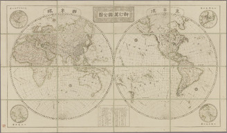
重訂萬國全圖
Kyoto University Library
IIIF Discovery in Japan

Nieuwe Paskaart van het Noordelijkste Gedeelte van de Golf van Bengalen Vertoonende de Custen van ...
Stanford University Libraries
Stanford Libraries SearchWorks

Karte von Australien oder Polynesien, nach den Zeichnungen, Reisebe Schreibungen und Tagebucher de...
Stanford University Libraries
Stanford Libraries SearchWorks

Central Portion of Sumbawa with Pulo Tenga Islands
Stanford University Libraries
Stanford Libraries SearchWorks

Karta Morskykh Otkrytii Rossiiskimi Moreplavatelimi na Tikhom ... [transliterated from the Cyrilli...
Stanford University Libraries
Stanford Libraries SearchWorks

Asie entre l'Angara, le Kamtchatka, Macao et le Pacifique, y compris Formose et le Japon / par le ...
Bibliothèque nationale de France
Europeana API
Last Updated: 2020-04-17
Uploaded: 2021-09-21