
Colton's Rail-road and Military Map of the United States, Mexico, the West Indies, &c…1861
- People
- Time
- Owner Organization

Williams' Copper - Plate Map Of The United States, Canada, Mexico, Central America, West Indies, &...

Two Years in the French West Indies

An Improved Map of the United States By Shelton & Kensett
A United States cruiser blasting military installations on a Japanese island in the Pacific. (Evening Post, ...
One of the pictures released by the United States military authorities on the anniversary of the treacherous...

A Map of the East-Indies and the Adjacent Countries; with the Settlements, Factories and Territori...

A Map of the East-Indies and the Adjacent Countries; with the Settlements, Factories and Territori...

A Map of the East-Indies and the Adjacent Countries; with the Settlements, Factories and Territori...

A Map of the East-Indies and the Adjacent Countries; with the Settlements, Factories and Territori...

A Map of the East-Indies and the Adjacent Countries; with the Settlements, Factories and Territori...

A Map of the East-Indies and the Adjacent Countries; with the Settlements, Factories and Territori...
This map of the Pacific shows the "pincers" strength of the United States from the Aleutian Islands in the n...
Relief map of Southern Japan : special airfield relief map / prepared and reproduced in the United States Department of the Interior Geological Survey
Relief map of Northern Honshu : special airfield relief map / prepared and reproduced in the United States Department of the Interior Geological Survey
Relief map of Northern Honshu / prepared and reproduced in the United States Department of the Interior Geological Survey
Relief map of southern Japan / prepared and reproduced in the United States Department of the Interior Geological Survey
This map shows, by the cross-lining, the Netherlands East Indies and also the island possessions of the U.S....
Hokkaido, Japan : Special airfield relief map / prepared and reproduced in the United States Department of the Interior Geological Survey
Types of warships which took part in the Solomon Islands battle. Top, a United States battleship of the Sout...
Map of Manila Bay, showing Bataan Peninsula, on the west of the bay, where General Mac Arthur's American and...
The decks of a United States cruiser as the crew pour shells into one of the Pacific Islands held, by the Ja...
Okinawa henkan kinenzu : Map of Japan / limited first edition in commemoration of the return by the United States to Japan of Administrative Rights over the Ryūkyū Islands and the Daitō Islands, May 15, 1972
This map shows how the United Nations' action in the Solomon Islands opens the way to a possible move agains...

Strategical map of part of Korea and Manchuria / prepared by the Second Division, General Staff (Military In...

Famous flights and air routes of the world. Complement of H.J. Heinz Company 57. Litho. in U.S.A. ...

Map of the State of New York Published by Charles Magnus

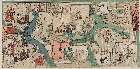
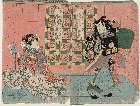
佐賀県内見学はやまわりすごろく」(表)

Exacta & Accurata Delineatio cum Orarum Maritimarum tum etjam locorum terrestrium quae in Regionib...
A Map of the East-Indies and the Adjacent Countries; with the Settlements, Factories and Territori...

Karuta of "Midaregami"

Tartariae Sive Magni Chami Regni typus (Heightened with Gold!)

Map of the State of New York Published by Charles Magnus
Straw Dolls on Display
A Map of the East-Indies and the Adjacent Countries; with the Settlements, Factories and Territori...
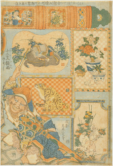
「新狂言 皆人の色にひかれてのぼりけり 京の高尾も江戸の高尾も 全盛伊達曲輪入 大入錦絵三枚続」

To the Right Honorable William Lord Cowper Lord High Chancellor of Great Britain This Map of Asia ...

「白玉」 「坂東三津五郎」

Exacta & Accurata Delineatio cum Orarum Maritimarum tum etjam locorum terrestrium quae in Regionib...

Map of the State of New York Published by Charles Magnus

Maris Pacifici quod vulgo Mar del Zud
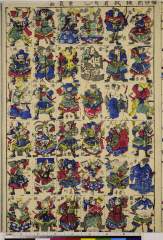
Shinpan mushazukushi
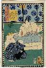
「仮名手本忠臣蔵」 「第四段目」

Haiyuushinasadameshirabyoushihanago nakamurashikan

Asiae Nova Descriptio

Exacta & Accurata Delineatio cum Orarum Maritimarum tum etjam locorum terrestrium quae in Regionib...
「工藤左衛門祐つね」 「片岡仁左衛門/和田の息女舞鶴姫」「瀬川菊之丞」

Map of the State of New York Published by Charles Magnus

Exacta et accurata delineatio cùm orarum maritimarum tùm etjam locorum terrestrium quæ in regionib...
Last Updated: 2020-04-17
Uploaded: 2021-09-21