
Lloyd's Official Map of the State of Tennessee Compiled From Actual Sureys and Official Documents ...
- People
- Time
- Owner Organization

Map of Colorado Territory, Compiled from Government Maps & Actual Surveys. Made In 1861
Stanford University Libraries
Stanford Libraries SearchWorks

Map of Colorado Territory, Compiled from Government Maps & Actual Surveys. Made In 1861
Stanford University Libraries
Stanford Libraries SearchWorks

Map of Colorado Territory, Compiled from Government Maps & Actual Surveys. Made In 1861
Stanford University Libraries
Stanford Libraries SearchWorks

Samples of official documents and Emperors' seals
General Research Division. The New York Public Library
DPLA API

Map of the State of New York Published by Charles Magnus
Stanford University Libraries
Stanford Libraries SearchWorks

Map of the State of New York Published by Charles Magnus
Stanford University Libraries
Stanford Libraries SearchWorks

New railway map of Tokyo and vicinity. Published by Japan Guide Map Co., Ltd. Compiled and printed...
Stanford University Libraries
Stanford Libraries SearchWorks
![Japan and adjacent regions of Asia and the Pacific Ocean [cartographic material] / compiled and drawn in the...](https://collections.library.yale.edu/iiif/2/15510875/full/!200,200/0/default.jpg)
Japan and adjacent regions of Asia and the Pacific Ocean [cartographic material] / compiled and drawn in the...
Yale University Library
Yale University Library Digital Collections
![Japan and adjacent regions of Asia and the Pacific Ocean [cartographic material] / compiled and drawn in the...](https://collections.library.yale.edu/iiif/2/15509964/full/!200,200/0/default.jpg)
Japan and adjacent regions of Asia and the Pacific Ocean [cartographic material] / compiled and drawn in the...
Yale University Library
Yale University Library Digital Collections

China under the empress dowager: being the history of the life and times of tzŭ hsi/ compiled from state papers and the private diary of the comptroller of her household
Kansai University Open Research Center for Asian Studies
IIIF Discovery in Japan

Thirty-seven miscellaneous documents and informal manuscripts from an album
Freer and Sackler
DPLA API

Japan and Korea / compiled and drawn in the Cartographic Section of the National Geographic Society ; James ...
Yale University Library
Yale University Library Digital Collections

The topographic map of Manchoukuo
Stanford University Libraries
Stanford Libraries SearchWorks

The latest map of Manchuria, Korea, Formosa, and Saghalien
Stanford University Libraries
Stanford Libraries SearchWorks

A New and Accurate Map of the Empire of Japan Laid down from the Memoirs of the Portugese and Dutc...
Stanford University Libraries
Stanford Libraries SearchWorks

Japan : South coast of Honshu : Gulf of Tokyo or Yedo. Compiled from Japanese Government, and Brit...
Stanford University Libraries
Stanford Libraries SearchWorks

[Transport Map of Russia: 'Map of the routes of Steamships, Communication lines, Railways and Road...
Stanford University Libraries
Stanford Libraries SearchWorks

map from "Japan in Transition. A comparative study of the progress, policy, and methods of the Jap...
British Library
Europeana API
Japan opened compiled chiefly from the narrative of the American expedition to Japan, in the years...
オクスフォード大学ボドリアン図書館サービス
Europeana API

A Map of the East-Indies and the Adjacent Countries; with the Settlements, Factories and Territori...
Stanford University Libraries
Stanford Libraries SearchWorks

A Map of the East-Indies and the Adjacent Countries; with the Settlements, Factories and Territori...
Stanford University Libraries
Stanford Libraries SearchWorks

A Map of the East-Indies and the Adjacent Countries; with the Settlements, Factories and Territori...
Stanford University Libraries
Stanford Libraries SearchWorks

A Map of the East-Indies and the Adjacent Countries; with the Settlements, Factories and Territori...
Stanford University Libraries
Stanford Libraries SearchWorks

An inquiry into the original state and formation of the earth : deduced from facts and the laws of nature
Department of Science, Kyoto University
IIIF Discovery in Japan

Williams' Copper - Plate Map Of The United States, Canada, Mexico, Central America, West Indies, &...
Stanford University Libraries
Stanford Libraries SearchWorks

高山城下町絵図
Takayamashi Kyoiku Iinkai
ADEAC: A System of Digitalization and Exhibition for Archive Collections

実測群馬・栃木県交通地図
Gunma Prefectural Library
Digital library of Gunma Prefectural Library
Map of the State of New York Published by Charles Magnus
Stanford University Libraries
Stanford Libraries SearchWorks

Igakoenorikakegappa
Museum of Fine Arts, Boston
ARC Banzuke (Playbills) Portal Database
A Map of the East-Indies and the Adjacent Countries; with the Settlements, Factories and Territori...
Stanford University Libraries
Stanford Libraries SearchWorks

Carte réduite de l'Ocean Oriental depuis le Cap de Bonne Espérance jusqu'au Japon / dressée sur le...
Bibliothèque nationale de France
Europeana API

L'Empire de la Chine d'après l'Atlas Chinois avec les Isles du Japon . .
Stanford University Libraries
Stanford Libraries SearchWorks

Tabula Tartariae et majoris partis regni Chinae / edita a F. de Wit ; Lhuilier fecit
Yale University Library
Yale University Library Digital Collections

A Chart of the Eastermost part of the East Indies and China from Cape Comarin to Japan with the Ad...
Stanford University Libraries
Stanford Libraries SearchWorks

春在流水図
Aichi Prefectural Museum of Art
The collection of Aichi Prefectural Museum of Art
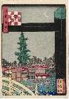
Naniwahyakkei
Museum of Fine Arts, Boston
ARC Ukiyo-e Portal Database

Naniwahyakkei
Museum of Fine Arts, Boston
ARC Ukiyo-e Portal Database

Asia According to the best Authorities
Stanford University Libraries
Stanford Libraries SearchWorks
Last Updated: 2020-04-17
Uploaded: 2021-09-21