
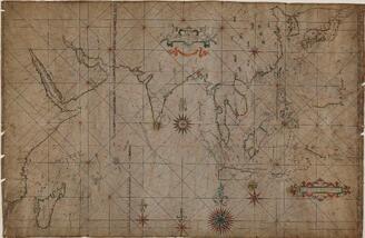
Chart of the Coast of China from Cambodia to Nanquam with Part of Japan
- People
- Time
- Owner Organization

A Chart of the Coast of China From Cambodia to Nanquam with Part of Japan
Stanford University Libraries
Stanford Libraries SearchWorks

A Chart of the Eastermost part of the East Indies and China from Cape Comarin to Japan with the Ad...
Stanford University Libraries
Stanford Libraries SearchWorks

Japan : Nipon, Kiusiu and Sikok, and a part of the coast of Korea / according to Krusenstern's Chart of 1827 ; J & C Walker sculpt
Library of Congress
Trove: National Library of Australia
A Chart of the Northern Part of the China Sea [Material cartográfico] : shewing the Passage from F...
Biblioteca Nacional de España
Europeana API

A New Chart of The Pacific Ocean, Exhibiting The Western Coast of America from Cape Horn to Beerin...
Stanford University Libraries
Stanford Libraries SearchWorks

A chart of the tradeing part of the East Indies and China, with the adjacent islands, from Surrat ...
Royal Museums Greenwich
Europeana API

A New Chart of The Pacific Ocean, Exhibiting The Western Coast of America, From Cape Horn To Beeri...
Stanford University Libraries
Stanford Libraries SearchWorks

A New Chart of The Pacific Ocean, Exhibiting The Western Coast of America, From Cape Horn To Beeri...
Stanford University Libraries
Stanford Libraries SearchWorks

Japan-Yezo Id., e. coast, Akishi Bay republished from the Brt. Admty. chart no. 992, corrected to 1873
Boston Public Library
DPLA API

Chart of the S.W. Part of Japan from a dutch MS / by A. Dalrymple ; W. Harrison sc
Bibliothèque nationale de France
Europeana API
A chart of the eastermost part of the East Indies with all the adjacent islands from Cape Comorin to Iapan / by Iohn Seller, Hydrographer to the King
National Library of Australia
Trove: National Library of Australia

A chart of the easternmost part of the East Indies with all the adjacent islands from Cape Comorin...
Royal Museums Greenwich
Europeana API

Part of Japan or Nipon. (with) View of the coast of Japan when we first saw it (Engraved by) W. H(...
Stanford University Libraries
Stanford Libraries SearchWorks

WITH THE BRITISH PACIFIC FLEET OFF THE COAST OF JAPAN
Auckland Libraries
DigitalNZ New Zealand API
![[Spanish Chart of the Philippines, China, Japan, Korea, Kamtchatka, Western Pacific]](https://stacks.stanford.edu/image/iiif/nk348cb2252%2F42187sh/full/!200,200/0/default.jpg)
[Spanish Chart of the Philippines, China, Japan, Korea, Kamtchatka, Western Pacific]
Stanford University Libraries
Stanford Libraries SearchWorks
A chart of the eastermost part of the East Indies with all the adjacent islands from Cape Comorin to Iapan / by Iohn Seller, Hydrographer to the King ; F. Lamb Sculp
State Library of New South Wales
Trove: National Library of Australia
Part of Japan or Nippon [east coast of Honshu Island, Japan] / T. Bowen, sct
National Library of Australia
Trove: National Library of Australia
The Philippine Islands, Molucas, Siam, Cambodia, Japan and China, at the close of the sixteenth ce...
Biblioteca Nacional de España
Europeana API

(Composite of) A New Chart of The Pacific Ocean, Exhibiting The Western Coast of America, From Cap...
Stanford University Libraries
Stanford Libraries SearchWorks
Fisherman rowing out to fish in the snowstorm, in northern district in Japan, along the coast of the Japan Sea
Minneapolis Institute of Arts
Minneapolis Institute of Art API

map from "Yedo and Peking. A narrative of a journey to the capitals of Japan and China. With notic...
British Library
Europeana API

China - east coast : Hangchow Wan - southeast portion : including the approaches to the Yung Kiang
Stanford University Libraries
Stanford Libraries SearchWorks
Universal - Historie auf der Land-Karten [ ... most of the eastern hemisphere, omitting Japan, part of China...
Yale University Library
Yale University Library Digital Collections

The greedy lady with the box of demons, from the series 100 Ghost Stories of China and Japan
Freer and Sackler
DPLA API
A Chart of the Coast of China From Cambodia to Nanquam with Part of Japan
Stanford University Libraries
Stanford Libraries SearchWorks

't Ooster deel van Oost Indien, streckende van Ceylon tot Japan en Hollandia Nova
Royal Museums Greenwich
Europeana API

Paskaerte Zynde t'Oosterdeel Van Oost Indien, met alle de Eylanden daer ontrendt geleegen van C.Co...
Stanford University Libraries
Stanford Libraries SearchWorks
![Noordoost Cust Van Asia Van Japan tot Nova Zemla [Gold Highlighted!]](https://stacks.stanford.edu/image/iiif/zc604np2680%2F17235/full/!200,200/0/default.jpg)
Noordoost Cust Van Asia Van Japan tot Nova Zemla [Gold Highlighted!]
Stanford University Libraries
Stanford Libraries SearchWorks

(帆船)
C. V. Starr East Asian Library, University of California, Berkeley
ARC Ukiyo-e Portal Database
Nova et accvrata Iaponiæ, Terræ Esonis ac insularum adjacentium ex novißima detectione descriptio
VU University Amsterdam Library
Europeana API
Nautical Chart of Asia
Tokyo National Museum
Integrated Collections Database of the National Museums, Japan
A chart of the easternmost part of the East Indies with all the adjacent islands from Cape Comorin...
Royal Museums Greenwich
Europeana API

画本狂歌 山満多山 絵本
Keio University Media Center
Digital Collections of Keio University Libraries

Noordoost Cust van Asia : van Iapan tot Nova Zemla
Stanford University Libraries
Stanford Libraries SearchWorks
A chart of the tradeing part of the East Indies and China, with the adjacent islands, from Surrat ...
Royal Museums Greenwich
Europeana API

Kyoka fuso meisho zue, yohen (Object)
British Museum
British Museum Collection

Carte Des Isles Kouriles d'apres la Carte Russe…par Laurent
Stanford University Libraries
Stanford Libraries SearchWorks
Chart of the S.W. Part of Japan from a dutch MS / by A. Dalrymple ; W. Harrison sc
Bibliothèque nationale de France
Europeana API

Carte Reduite De L'Ocean Septentrional compris entre l'Asie et l'Amerique Suivant les Decouvertes ...
Stanford University Libraries
Stanford Libraries SearchWorks

A New and Correct Chart of all the Known World Laid down according to Mercator's Projection
Stanford University Libraries
Stanford Libraries SearchWorks
Last Updated: 2020-04-17
Uploaded: 2021-09-21