
(Upper Sheet to) Map of the Island of Japan, Kurile &c. with the Adjacent Coasts of the Chinese Do...
- People
- Time
- Owner Organization

(Lower Sheet to) Map of the Island of Japan, Kurile &c. with the Adjacent Coasts of the Chinese Do...

(Composite Map of) Map of the Island of Japan, Kurile &c. with the Adjacent Coasts of the Chinese ...
Map of the Island of Japan, Kurile &c. with the Adjacent Coasts of the Chinese Dominions and a Ske...

Map of the Island of Japan, Kurile &c. with the Adjacent Coasts of the Chinese Dominions and a Ske...
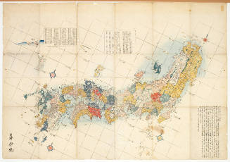
Map of Japan. (sheet 3)

A Map of the East-Indies and the Adjacent Countries; with the Settlements, Factories and Territori...

A Map of the East-Indies and the Adjacent Countries; with the Settlements, Factories and Territori...

A Map of the East-Indies and the Adjacent Countries; with the Settlements, Factories and Territori...

A Map of the East-Indies and the Adjacent Countries; with the Settlements, Factories and Territori...

A Map of the East-Indies and the Adjacent Countries; with the Settlements, Factories and Territori...

A Map of the East-Indies and the Adjacent Countries; with the Settlements, Factories and Territori...
Stanford's map of the empires of China and Japan : with the adjacent parts of the Russian Empire, ...
Kurile Islands special strategic map / compiled by the Army Map Service
Reconnaissance map of Brunei & adjacent territories, 1937 : Burunai
Stanford's map of the empires of China and Japan with the adjacent parts of the Russian Empire, India, Burma &c / Stanford's Geogl. Estabt
Stanford's map of China & Japan with the adjacent parts of the Russian Repubcs. India, Burma &c / Stanford's Geographical Establishment
Kurile Islands special strategic map (Sheet The geomagnetic vertical intensity (Z) in CGS-Unit for 1945 and areas of magnetic anomaly.)

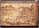
A map of the city of Nagasaki, and of the adjacent country; Sorts of money current in the Japanese Empire

Map of Japanese Homeland Island
Map of the Japanese Archipelago

Karta Aziatskoi Rossii . . . [Map of the Asian part of Russia and Possessions Adjacent, with the R...

Japan, Mandshuria (Showing The Course of the Amur River) The Kurile Isles &c. Accroding to the Bri...

Japan, Mandshuria (Showing The Course of the Amur River) The Kurile Isles &c. Accroding to the Bri...

General map of China and adjacent regions, showing treaty ports and railways
Map of the Island of Japan, Kurile &c. with the Adjacent Coasts of the Chinese Dominions and a Ske...
(Lower Sheet to) Map of the Island of Japan, Kurile &c. with the Adjacent Coasts of the Chinese Do...
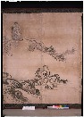
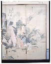
花鳥図屏風
Pas-caert van't Oostelyckste deel van Oost Indien : met alle de Eylanden daer onder gelegen, van Cabo Comorin tot aen Japan / by Hendrick Doncker Boekverkooper en Graadbooghmaacker Inde Nieuwbrughsteegh

Laurie and Whittle's New Chart of the Indian and Pacific Oceans Between the Cape of Good Hope, New...

A New Chart of The Pacific Ocean, Exhibiting The Western Coast of America, From Cape Horn To Beeri...
A New Chart of The Pacific Ocean, Exhibiting The Western Coast of America, From Cape Horn To Beeri...
(Composite Map of) Map of the Island of Japan, Kurile &c. with the Adjacent Coasts of the Chinese ...
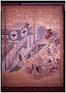
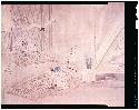
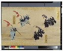
歌舞伎図屏風
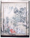
The Poet Li Bo's Visit to Mount Emei

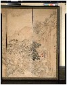
「下総相馬郡布施村紅竜山図」
Australien / wolfenbuttel bei C. H. Hartmann
耕作図屏風
蘭亭曲水図屏風
近世職人尽絵詞

Charts, etc
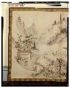
楼閣山水図屏風
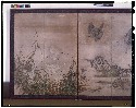
花鳥図屏風
種姫行列図

「〔御用屋敷地図〕」
蘭亭曲水図屏風
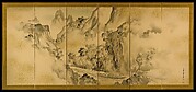
山水図屏風

Manshū jūmanbun no ichizu Chūbu Daikōanrei
![[Terre de Yezo] / [par Shihei Hayashi]](https://api.europeana.eu/api/v2/thumbnail-by-url.json?uri=http%3A%2F%2Fgallica.bnf.fr%2Fark%3A%2F12148%2Fbtv1b55004801j.thumbnail.jpg&type=IMAGE)
[Terre de Yezo] / [par Shihei Hayashi]
Last Updated: 2020-04-17
Uploaded: 2021-09-21