
Picture map of China. Designed by Frank Randolph Southard. Printed in United States of America. (C...
- People
- Time
- Owner Organization

Picture map of China. Designed by Frank Randolph Southard. Printed in United States of America. (C...
Stanford University Libraries
Stanford Libraries SearchWorks

(Covers to) Picture map of China. Designed by Frank Randolph Southard. Printed in United States of...
Stanford University Libraries
Stanford Libraries SearchWorks

An Improved Map of the United States By Shelton & Kensett
Stanford University Libraries
Stanford Libraries SearchWorks
Pearl Harbour, Oahu, Hawaii, United States of America [electronic resource]
Stanford University Libraries
Stanford Libraries SearchWorks

Williams' Copper - Plate Map Of The United States, Canada, Mexico, Central America, West Indies, &...
Stanford University Libraries
Stanford Libraries SearchWorks

Representation of the United States of America: a pleasing group which took part in the peace procession at ...
Auckland Libraries
DigitalNZ New Zealand API
![[Untitled Sea Chart of Australia, Indian Ocean, China, Japan, SE Asia, &c] (First Printed Map to S...](https://stacks.stanford.edu/image/iiif/cv359wv2441%2F22989/full/!200,200/0/default.jpg)
[Untitled Sea Chart of Australia, Indian Ocean, China, Japan, SE Asia, &c] (First Printed Map to S...
Stanford University Libraries
Stanford Libraries SearchWorks

Guide to Tokyo City
Yale University Library
Yale University Library Digital Collections

Sketch of a High-Ranking Officer's Portrait, from the Great United States of America (Kita Amerika dai gasshukokujin, Jokan shozo no utsushi
Art Institute of Chicago
Art Institute of Chicago API
Tokyo : Tokyo Railway system/ June 2015. Designed + produced by Zero Per Zero. Printed in Korea
Stanford University Libraries
Stanford Libraries SearchWorks
Tokyo metropolitan Railway system. Designed and produced by Zero Per Zero. Printed in Korea
Stanford University Libraries
Stanford Libraries SearchWorks
New railway map of Tokyo and vicinity. Published by Japan Guide Map Co., Ltd. Compiled and printed...
Stanford University Libraries
Stanford Libraries SearchWorks

New map of Shanghai. (on verso) A map of China : Published by K. Saito. Osaka Japan Sole agent T. ...
Stanford University Libraries
Stanford Libraries SearchWorks
![[Plan of Tianjin, China with Foreign Concessions] Tianjin di tu / Map of Tientsin](https://stacks.stanford.edu/image/iiif/vt775gn2391%2F36094/full/!200,200/0/default.jpg)
[Plan of Tianjin, China with Foreign Concessions] Tianjin di tu / Map of Tientsin
Stanford University Libraries
Stanford Libraries SearchWorks

Map of the Empire of China and Japan. J.W. del. (engraved by) Stockley, Sc London, James Wyld, Cha...
Stanford University Libraries
Stanford Libraries SearchWorks
This map of the Pacific shows the "pincers" strength of the United States from the Aleutian Islands in the n...
National Library of New Zealand
DigitalNZ New Zealand API
Meeting of the new Pacific War Council, during World War II, Washington, DC, United States
Alexander Turnbull Library
DigitalNZ New Zealand API
Brigadier-General Neal C Johnson, United States Army, and Brigadier R A Row, New Zealand Army, Vella Lavella...
Alexander Turnbull Library
DigitalNZ New Zealand API

A map of China : Published by K. Saito. Osaka Japan. Sole agent T. Kishida & Co Shanghai. (inset m...
Stanford University Libraries
Stanford Libraries SearchWorks
A Japanese camp in the Solomon Islands after-it had been wrecked by United States marines. Even food ivas on...
National Library of New Zealand
DigitalNZ New Zealand API
Stanford's map of China & Japan with the adjacent parts of the Russian Repubcs. India, Burma &c / Stanford's Geographical Establishment
National Library of Australia
Trove: National Library of Australia

JAPAN STRIKES WITHOUT WARNING IN THE PACIFIC: UNITED STATES BASES SUFFER HEAVY LOSS OF LIFE AND MATERIAL DAM...
Auckland Libraries
DigitalNZ New Zealand API
This map of the South-ivest Pacific combat zone shows how United Nations offensives are preparing the ' way ...
National Library of New Zealand
DigitalNZ New Zealand API
Court Exh. No. 28: Treaty between the United States of America, Belgium, the British Empire, China, France, Italy, Japan, The Netherlands and Portugal, signed at Washington, 6 Feb. 1922, known as Nine-Power Treaty, principals and policies to be followed in matters concerning China
NDL Digital Collections
NDL Digital Collections
「大谷新造目鏡橋」
C. V. Starr East Asian Library, University of California, Berkeley
ARC Ukiyo-e Portal Database

Il Regno Della China detto presentamente Catay e Mangin . . . 1682
Stanford University Libraries
Stanford Libraries SearchWorks

The Kingdome of China
Stanford University Libraries
Stanford Libraries SearchWorks

The Empire of Japan Divided into Seven Principal Parts and Subdivided ino Sixty Six Kingdoms; with...
Stanford University Libraries
Stanford Libraries SearchWorks

「江戸品川御殿山春之景」 「呼名 御殿山」
C. V. Starr East Asian Library, University of California, Berkeley
ARC Ukiyo-e Portal Database

Asia Noviter Delineata
Stanford University Libraries
Stanford Libraries SearchWorks

「顕微鏡ヲ以テ雪花ヲ見ル図」
C. V. Starr East Asian Library, University of California, Berkeley
ARC Ukiyo-e Portal Database

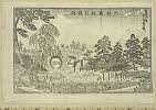
「洛東鳥辺山本寿寺并妙見宮細見図」
C. V. Starr East Asian Library, University of California, Berkeley
ARC Ukiyo-e Portal Database

Carte Physique & Politique. : No. 2 : l'Europe et du Bassin de la Méditerranée
Yoshida-South Library, Kyoto University
IIIF Discovery in Japan

Carte generale de l'Oceanie
Yoshida-South Library, Kyoto University
IIIF Discovery in Japan

Carte Nouvelle de la Grande Tartarie
Stanford University Libraries
Stanford Libraries SearchWorks

Tartariae Imperium
Stanford University Libraries
Stanford Libraries SearchWorks

「花園妙心寺」
C. V. Starr East Asian Library, University of California, Berkeley
ARC Ukiyo-e Portal Database

「象頭山金比羅八景之内 満濃池遊鶴」
C. V. Starr East Asian Library, University of California, Berkeley
ARC Ukiyo-e Portal Database
Last Updated: 2020-04-17
Uploaded: 2021-09-21