
(Covers to) Picture map of China. Designed by Frank Randolph Southard. Printed in United States of...
- People
- Time
- Owner Organization

Picture map of China. Designed by Frank Randolph Southard. Printed in United States of America. (C...
Stanford University Libraries
Stanford Libraries SearchWorks

Picture map of China. Designed by Frank Randolph Southard. Printed in United States of America. (C...
Stanford University Libraries
Stanford Libraries SearchWorks

An Improved Map of the United States By Shelton & Kensett
Stanford University Libraries
Stanford Libraries SearchWorks

Guide to Tokyo City
Yale University Library
Yale University Library Digital Collections
Pearl Harbour, Oahu, Hawaii, United States of America [electronic resource]
Stanford University Libraries
Stanford Libraries SearchWorks
Tokyo : Tokyo Railway system/ June 2015. Designed + produced by Zero Per Zero. Printed in Korea
Stanford University Libraries
Stanford Libraries SearchWorks
Tokyo metropolitan Railway system. Designed and produced by Zero Per Zero. Printed in Korea
Stanford University Libraries
Stanford Libraries SearchWorks
New railway map of Tokyo and vicinity. Published by Japan Guide Map Co., Ltd. Compiled and printed...
Stanford University Libraries
Stanford Libraries SearchWorks
![[Untitled Sea Chart of Australia, Indian Ocean, China, Japan, SE Asia, &c] (First Printed Map to S...](https://stacks.stanford.edu/image/iiif/cv359wv2441%2F22989/full/!200,200/0/default.jpg)
[Untitled Sea Chart of Australia, Indian Ocean, China, Japan, SE Asia, &c] (First Printed Map to S...
Stanford University Libraries
Stanford Libraries SearchWorks

Williams' Copper - Plate Map Of The United States, Canada, Mexico, Central America, West Indies, &...
Stanford University Libraries
Stanford Libraries SearchWorks

New map of Shanghai. (on verso) A map of China : Published by K. Saito. Osaka Japan Sole agent T. ...
Stanford University Libraries
Stanford Libraries SearchWorks

Map of the Empire of China and Japan. J.W. del. (engraved by) Stockley, Sc London, James Wyld, Cha...
Stanford University Libraries
Stanford Libraries SearchWorks
![[Plan of Tianjin, China with Foreign Concessions] Tianjin di tu / Map of Tientsin](https://stacks.stanford.edu/image/iiif/vt775gn2391%2F36094/full/!200,200/0/default.jpg)
[Plan of Tianjin, China with Foreign Concessions] Tianjin di tu / Map of Tientsin
Stanford University Libraries
Stanford Libraries SearchWorks
This map of the Pacific shows the "pincers" strength of the United States from the Aleutian Islands in the n...
National Library of New Zealand
DigitalNZ New Zealand API

Representation of the United States of America: a pleasing group which took part in the peace procession at ...
Auckland Libraries
DigitalNZ New Zealand API
Meeting of the new Pacific War Council, during World War II, Washington, DC, United States
Alexander Turnbull Library
DigitalNZ New Zealand API

Sketch of a High-Ranking Officer's Portrait, from the Great United States of America (Kita Amerika dai gasshukokujin, Jokan shozo no utsushi
Art Institute of Chicago
Art Institute of Chicago API

A map of China : Published by K. Saito. Osaka Japan. Sole agent T. Kishida & Co Shanghai. (inset m...
Stanford University Libraries
Stanford Libraries SearchWorks
Aerial view of. the explosion of a Japanese ammunition dump, hit by United States aircraft, at the south-eas...
National Library of New Zealand
DigitalNZ New Zealand API
A Japanese camp in the Solomon Islands after-it had been wrecked by United States marines. Even food ivas on...
National Library of New Zealand
DigitalNZ New Zealand API
Japan the country / Sydney Morning Herald ; designed by the Art Dept. of John Fairfax and Sons Limited
National Library of Australia
Trove: National Library of Australia
The decks of a United States cruiser as the crew pour shells into one of the Pacific Islands held, by the Ja...
National Library of New Zealand
DigitalNZ New Zealand API

JAPAN STRIKES WITHOUT WARNING IN THE PACIFIC: UNITED STATES BASES SUFFER HEAVY LOSS OF LIFE AND MATERIAL DAM...
Auckland Libraries
DigitalNZ New Zealand API

Japan's last citadels feel weight of American power. Map by Charles H. Owens. Times staff Artist. ...
Stanford University Libraries
Stanford Libraries SearchWorks

Map of Asia Showing its Gt. Political Divisions, and, also, the Various routes of Travel Between L...
Stanford University Libraries
Stanford Libraries SearchWorks
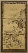
Hanging scroll
Metropolitan Museum of Art
The Metropolitan Museum of Art Open Access CSV

Indiae Orientalis, Insularumque Adiacentium Typus. Cum Privilegio
Stanford University Libraries
Stanford Libraries SearchWorks

A New Map of Great Tartary and China, with the adjoyning Parts of Asia, Taken from Mr. De Fer's Ma...
Stanford University Libraries
Stanford Libraries SearchWorks

India Orientalis
Stanford University Libraries
Stanford Libraries SearchWorks
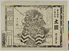
Tsuchigumo
Shochiku Otani Library
ARC Banzuke (Playbills) Portal Database

Tartariae Imperium
Stanford University Libraries
Stanford Libraries SearchWorks

India Orient
Stanford University Libraries
Stanford Libraries SearchWorks
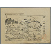
駿河国富士郡大宮国幣中社浅間神社之図
Mt.Fuji World Heritage Center, Shizuoka
ADEAC: A System of Digitalization and Exhibition for Archive Collections
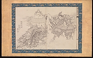
画本葛飾振
Metropolitan Museum of Art
ARC Ukiyo-e Portal Database
画本葛飾振
Metropolitan Museum of Art
ARC Ukiyo-e Portal Database

「華頂山桜馬場風景」
C. V. Starr East Asian Library, University of California, Berkeley
ARC Ukiyo-e Portal Database

Asia Noviter Delineata
Stanford University Libraries
Stanford Libraries SearchWorks
Last Updated: 2020-04-17
Uploaded: 2021-09-21