


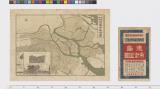


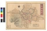
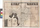


徳島市街及び附近名勝

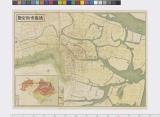
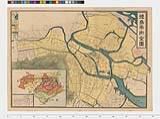
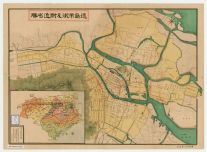
徳島市街全図

徳島市街全図

徳島市街全図

Europa zur Zeit der Kreuzzüge

徳島市街全図

Hyakumanbun no ichi Heiyō chiri chōsazu

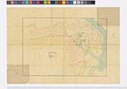
京都府地形圖

Europa im Anfange des sechsten Jahrhunderts

最新満州帝國大地圖

Russia in Asia
![Tokyo and vicinity, showing bombed-out areas [cartographic material]](https://stacks.stanford.edu/image/iiif/jx217xm7539%2Fjx217xm7539_00_0001/full/!200,200/0/default.jpg)
Tokyo and vicinity, showing bombed-out areas [cartographic material]

Magnae Tartariae Magni Mogolis Imperii Iaponiae et Chinae Nova Descriptio

La Gran Tartaria divisa nelle sue parti prinicpali . . . 1693

Map of the Empire of China and Japan. J.W. del. (engraved by) Stockley, Sc London, James Wyld, Cha...

Europa im achtzehnten Jahrhundert, von 1700 bis 1789

Europa im Zeitalter Napoleons, 1789 bis 1815

A New Map of Asia from the latest Observations Most Humbly Inscrib'd to the Right Honbl. George Ea...

Europa um 350 nach Christo

General map of China and adjacent regions, showing treaty ports and railways

The topographic map of Manchoukuo

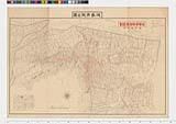
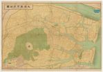
徳島県全図

Map Of The Grand Trunk Pacific Railway In British Columbia Showing Terminus At Prince Rupert. 3-28...

A New Map of Asia from the latest Observations Most Humbly Inscrib'd to the Right Honbl. George Ea...
Last Updated: 2025-06-03T01:00:34
Uploaded: 2025-06-04