
Manchoutikuo and adjoining territories
- People
- Time
- Owner Organization
Manchoutikuo and adjoining territories

Series (Standard map series designation system) ; 5205

Eastern Asia, showing Japan, Korea, Manchuria and adjoining parts of Siberia and China. 185 miles ...
China and Japan with adjoining countries / compiled and published by H.E.C.Robinson Pty. Ltd

Japan’s National Identity, Territorial Disputes and Sub-state Actors: Northern Territories/South K...
Reconnaissance map of Brunei & adjacent territories, 1937 : Burunai
Northern territories and Japan-Russia Relations: Will the Knot ever Untie

Japan, Manchuria, and adjacent regions
Northern territories and Japan-Russia relations: Latest developments under prime minister Taro Aso
Japan--USSR : northern territories / Central Intelligence Agency

Japan and South Manchuria : Railway and steamer connections

Japan and its relation to the territory bordering on the Pacific Ocean

Map of the Island of Japan, Kurile &c. with the Adjacent Coasts of the Chinese Dominions and a Ske...

Map of the Island of Japan, Kurile &c. with the Adjacent Coasts of the Chinese Dominions and a Ske...

Eastern Archipelago : Flores Sea. Tana Jampea and Adjacent Islands

The Japanese empire : with central and southern Manchukuo (Manchuria)

The Japanese empire : with central and southern Manchukuo (Manchuria)

Japan and Korea. (with) The Japanese Empire. (with) Port Arthur and Adjacent Territory. (with) For...

Japan and it's relation to the territory bordering on the Pacific ocean

Hokuryo, from the series Korea and Manchuria

General map of China and adjacent regions, showing treaty ports and railways
A map of the East-Indies and adjacent countries : with settlements, factories, and territories : explaining what belongs to England, Spain, France, Holland, Denmark, Portugal, etc. with many remarks not extant in any other map / by H. Moll, geog

A map of the East-Indies and adjacent countries : with settlements, factories, and territories : explaining what belongs to England, Spain, France, Holland, Denmark, Portugal, etc. with many remarks not extant in any other map / by H. Moll, geog

A Map of the East-Indies and the Adjacent Countries; with the Settlements, Factories and Territori...
General map of China and adjacent regions, showing treaty ports and railways

Gojūmanbun no ichi Gobaikaru hōmen sozu

Northwest Kyushu
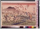
「木曽海道六拾九次之内」 「二拾弐」「小田井」

「木曽海道六拾九次之内」 「十五」「板鼻」

Indo Biruma gojūmanbun no ichi zu
木曽路山川_三枚続
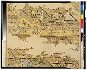
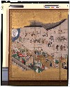
洛中洛外図(模本)

Hyakumanbun no ichi Heiyō chiri chōsazu
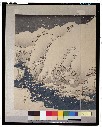
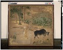
旧蝦夷風俗図屏風
![Settsu no Kuni meisho ōezu [cartographic material] : zen](https://stacks.stanford.edu/image/iiif/jy281rj3743%2Fjy281rj3743_0001/full/!200,200/0/default.jpg)
Settsu no Kuni meisho ōezu [cartographic material] : zen

Stieler's Hand-Atlas No. 65. China (Ostl. Theil.), Korea und Japan. (insets) Schang-hai. Tokyo. Ca...
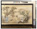
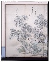
農夫図屏風
![Keijō Kinbō [cartographic material]](https://stacks.stanford.edu/image/iiif/jk515ck5320%2Fjk515ck5320_00_0001/full/!200,200/0/default.jpg)
Keijō Kinbō [cartographic material]
琴棋書画図屏風
歌舞伎図屏風

「初子之日野外御遊之図」

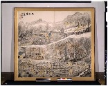
徳島県交通及産業概覧
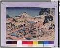
「富嶽三十六景」 「駿州片倉茶園ノ不二」

La Transasiatique, route terrestre de l'Extrême-Orient, de la Chine et du Japon à travers la Sibér...

(Oki yuki yama). (to accompany) Shomitsu Nippon chizu. (Atlas of Japan). Nippon Shoin. (Tokyo, 195...
蘭亭曲水図屏風

家根舟四手網

Hyakumanbunnoichi manso kokkyō hōmen kōkūzu
Last Updated: 2020-04-17
Uploaded: 2021-09-21