
Shinchiku shigaizu = : Map of Hsinchu city
- Owner Organization

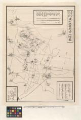
Kagi shigaizu = Map of Chiayi city
Stanford University Libraries
Stanford Libraries SearchWorks

Taichū shigaizu = Map of T'ai-chung city
Stanford University Libraries
Stanford Libraries SearchWorks

Nagasaki shigai zenzu = The map of nagasaki city. Kiushiu. Japan
Stanford University Libraries
Stanford Libraries SearchWorks

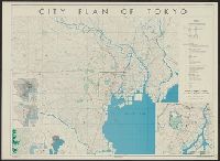
Map of Tokyo : city communications
Stanford University Libraries
Stanford Libraries SearchWorks

Jitchi tōsoku Kōbe shigai zenzu = New map of Kobe
Stanford University Libraries
Stanford Libraries SearchWorks

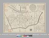
Central Tokyo : city map.
Stanford University Libraries
Stanford Libraries SearchWorks
![Kaisei Atami Shigai Zenzu. [Revised Map of the Entire City of Atami]](https://collections.library.yale.edu/iiif/2/15510883/full/!200,200/0/default.jpg)
Kaisei Atami Shigai Zenzu. [Revised Map of the Entire City of Atami]
Yale University Library
Yale University Library Digital Collections
Akita City: Map of city. Report No. 14f(1)(f), USSBS Index Section 2
NDL Digital Collections
NDL Digital Collections

Guide to Tokyo City
Yale University Library
Yale University Library Digital Collections
Map of Niigate
Yale University Library
Yale University Library Digital Collections

Koubeshi zenzu = Map of Kobe
NDL Digital Collections
NDL Digital Collections

Koubeshi zenzu = Map of Kobe
NDL Digital Collections
NDL Digital Collections
City of Kobe 192A
Harvard Art Museums
Harvard Art Museums API
Map- city of Tokyo. Report No. 12g(3), USSBS Index Section 2
NDL Digital Collections
NDL Digital Collections

Saishin zentsuuji shigaizu
NDL Digital Collections
NDL Digital Collections

A map of the city of Nagasaki, and of the adjacent country; Sorts of money current in the Japanese Empire
General Research Division. The New York Public Library
DPLA API
Map of city of Kyoto showing locations of sirens. Report No. 6d, USSBS Index Section 2
NDL Digital Collections
NDL Digital Collections
City plan of Yokohama
National Library of Australia
Trove: National Library of Australia
Japanese map of Nagasaki City giving brief history of city and other information. Report No. 3t(19), USSBS Index Section 2
NDL Digital Collections
NDL Digital Collections

New map of Kobe
Stanford University Libraries
Stanford Libraries SearchWorks

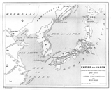
New Map of Japan
Stanford University Libraries
Stanford Libraries SearchWorks

City plan of Kōbe.
Stanford University Libraries
Stanford Libraries SearchWorks
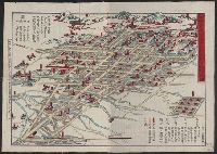
City plan of Tōkyō
Yale University Library
Yale University Library Digital Collections

Bird's Eye View of the City of Nebraska City. Otoe County Nebraska 1868
Stanford University Libraries
Stanford Libraries SearchWorks
東照神君開運城跡浜松鉄城閣及市街略図
Hamamatsu City Central Library
ADEAC: A System of Digitalization and Exhibition for Archive Collections
豊橋市街全圖 明治37年版
Toyohashi City Library
ADEAC: A System of Digitalization and Exhibition for Archive Collections

A mapp of the Formosa described by Candidius being Tyawan and part of the coast of Formosa
Yale University Library
Yale University Library Digital Collections

The Guide Map to the Railway in The Neighbourhood of Tokyo
Stanford University Libraries
Stanford Libraries SearchWorks

Manshū Gomanbun no ichi Haisen Kokusan fukin
Stanford University Libraries
Stanford Libraries SearchWorks

Papua Gomanbunnoichi zu
Stanford University Libraries
Stanford Libraries SearchWorks
![[歴民カード_歴史] 善宝寺寺地図](https://khirin-i.rekihaku.ac.jp/iiif/nmjh_rekimin_h/11448014_02.tif/full/200,/0/default.jpg)
[歴民カード_歴史] 善宝寺寺地図
National Museum of Japanese History
IIIF Discovery in Japan

「〔江戸火災地図」「弘化三年〕」
Tokyo Metropolitan Central Library
ARC Ukiyo-e Portal Database

Town plan of Kōfu
Stanford University Libraries
Stanford Libraries SearchWorks

Jūmanbunnoichi Guamutō fukin
Stanford University Libraries
Stanford Libraries SearchWorks
![[歴民カード_考古] 高蔵寺第20号窯](http://khirin-i.rekihaku.ac.jp/iiif/nmjh_rekimin_a/22747084_02.tif/full/200,/0/default.jpg)
[歴民カード_考古] 高蔵寺第20号窯
National Museum of Japanese History
IIIF Discovery in Japan

Town plan of Otomari : Japan: Karafuto
Monash University Library
Trove: National Library of Australia
Le Japon contemporain.
国際日本文化研究センター
Catalogue of the pre-1900 printed books on Japan in European languages held by Nichibunken

The Japanese petroleum industry (map no. two)
Stanford University Libraries
Stanford Libraries SearchWorks
![[歴民カード_歴史] 村絵図](https://khirin-i.rekihaku.ac.jp/iiif/nmjh_rekimin_h/11348145_02.tif/full/200,/0/default.jpg)
[歴民カード_歴史] 村絵図
National Museum of Japanese History
IIIF Discovery in Japan

Carte des isles du Japon et la presqu'isle de Corée avec les costes de la Chine depuis Pekin jusqu...
Bibliothèque nationale de France
Europeana API

光法村字四本柳全図
Saga Prefectual Library
IIIF Discovery in Japan
![Purutō heiyō chishi shiryōzu [cartographic material]](https://stacks.stanford.edu/image/iiif/dv198bk6496%2Fdv198bk6496_00_0001/full/!200,200/0/default.jpg)
Purutō heiyō chishi shiryōzu [cartographic material]
Stanford University Libraries
Stanford Libraries SearchWorks

千葉県北総東葛飾郡沿浦之地図
Funabashi-shi Western Library
ADEAC: A System of Digitalization and Exhibition for Archive Collections

浜松市全図
個人蔵
ADEAC: A System of Digitalization and Exhibition for Archive Collections

Hemisphere Septentrional pour voir plus distinctement Les Terres Arctiques . .
Stanford University Libraries
Stanford Libraries SearchWorks
![[歴民カード_考古] 土師器 壷形土器](https://khirin-i.rekihaku.ac.jp/iiif/nmjh_rekimin_a/23348042_02.tif/full/200,/0/default.jpg)
[歴民カード_考古] 土師器 壷形土器
National Museum of Japanese History
IIIF Discovery in Japan

Yōzu (kūchū shashin sokuryō) Rusontō jūmanbun no ichi zu
Stanford University Libraries
Stanford Libraries SearchWorks

Tō "So" jūmanbun no ichizu
Stanford University Libraries
Stanford Libraries SearchWorks
Last Updated: 2020-04-17
Uploaded: 2021-09-21