
Web Trend Map 4. The State of the Web Mapped onto Tokyo's Metro System
- Time
- Owner Organization

Map of the Japanese telegraph system

Map of the State of New York Published by Charles Magnus

Map of the State of New York Published by Charles Magnus

Map of the State of New York Published by Charles Magnus

Map of the State of New York Published by Charles Magnus

Lloyd's Official Map of the State of Tennessee Compiled From Actual Sureys and Official Documents ...
![[Highway map of the Tokyo region].](https://stacks.stanford.edu/image/iiif/gm158cc8245%2Fgm158cc8245_0001/full/!200,200/0/default.jpg)
[Highway map of the Tokyo region].
Map of the missionary districts of north Tokyo & Kyoto : under the jurisdiction of the Bishop of Tokyo 1895

The Guide Map to the Railway in The Neighbourhood of Tokyo

Map of Tokyo, featuring subway system. Copy rights by Creative Associates, Tokyo, Japan, (May 1975...
Series ; 5207

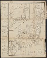
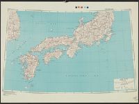
Japan road map, 1:1,000,000 / prepared under the direction of the Chief of Engineers, U.S. Army by the Army ...

An Improved Map of the United States By Shelton & Kensett
Map showing Green Islands, to the north of Biika. Several of the Japanese bases marked on the map 1 have sin...

Chang Fei from the State of Yen on Horseback

The history of Japan, giving an account of the ancient and present state and government of that empire; of i...
A new & accurate map of Asia : drawn from the most approved modern maps & charts / by Thos. Bowen ; engraved for Middletons complete system of geography
General map of China and adjacent regions, showing treaty ports and railways / prepared for the Department of State, by the Topographic Branch, U.S. Geological Survey

Cannon's Map of the Mineral Belt of Colorado Taken from the Records of the Surveyor General's Offi...
The "second demographic transition" : a conceptual map for the understanding of late modern demogr...

The New War Map of Maryland Part of Virginia & Pennsylvania. Published by B.B. Russell . .
Bilingual map of Greater Tokyo. Prepared by the Cartographic Division of King Associates. Publishe...

Okinawa Mem-O-Map part of the Ryukyu Islands. Drawn by T/4 John G. Drury 214th_ Ordnance Battalion...

A New and Accurate Map of the Empire of Japan Laid down from the Memoirs of the Portugese and Dutc...
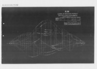
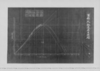
B.38. CURVE OF BENDING MOMENT WORST CONDITION
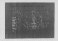
〔軍艦高砂 中央横断図面〕
軍艦八重山浮揚ノ際艦ノ転覆ヲ防グタメ右舷后部「ライタア」付着之図

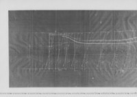
水雷駆逐艇雷中央横断図
戦艦中央切断図(但シ防禦甲板以上及舷側甲板(下端以外)、吃水ハ戦艦山城通リ、罐室幅モ山城ニ従フ)
軍艦比叡復原力測線
航空母艦加賀H.T.使用箇所之図
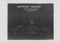
DESTROYER"YAMAKAZE" CURVE OF BENDING MOMENT AND DEFLECTION

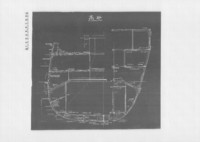
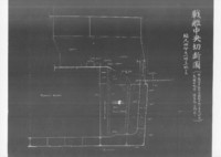
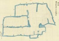
城田村黒井字拾二本松全図
![[歴民カード_歴史] 染型紙](https://khirin-i.rekihaku.ac.jp/iiif/nmjh_rekimin_h/11049041_02.tif/full/200,/0/default.jpg)
[歴民カード_歴史] 染型紙

Meisho Edo hyakkei Fireworks at Ryoogoku

Plan for the Noh Stage in Edo Castle
![[歴民カード_歴史] 染型紙](https://khirin-i.rekihaku.ac.jp/iiif/nmjh_rekimin_h/11049043_02.tif/full/200,/0/default.jpg)
[歴民カード_歴史] 染型紙

Japan. Re- Published, Jany st. 1845, by G.F. Cruchley, Mapseller, 81 Fleet Street, London. (to acc...
![[梓元口上]](http://www.arc.ritsumei.ac.jp/archive01/theater/th_image/PB/kokkai/rarebook.ndl.go.jp/pre/th_image/gazou/W0000014/w0000509/w0000000/w0000130.jpg)
[梓元口上]

仁比山村鶴字一本松全図

Night

犬井道村字五本谷全図
![[panel]](https://framemark.vam.ac.uk/collections/2006AN6639/full/!200,400/0/default.jpg)
[panel]

佐賀県肥前国佐賀郡江上村之内字四本杉全図

「東海道五十三駅」 「荒井」

佐賀郡南里村字三本谷全図
厘外村東分字四本松全図

佐賀郡江上村字三本松全図
Last Updated: 2020-04-17
Uploaded: 2021-09-21