
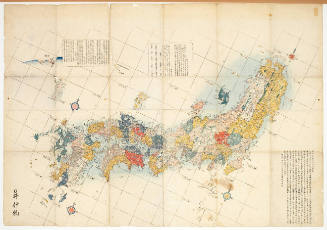
The Japanese petroleum industry (map no. two)
- Time
- Owner Organization

Liquid Petroleum Gas Industry Profile: Japan
Stanford University Libraries
Stanford Libraries SearchWorks
Japanese Software Industry: Where's the Walkman?
Stanford University Libraries
Stanford Libraries SearchWorks
Japanese Software Industry
Stanford University Libraries
Stanford Libraries SearchWorks
The war against Japan (Japanese & Pacific Map)
Australian National Maritime Museum
Trove: National Library of Australia
![The Japanese rubber tire industry including Japanese held mainland [cartographic material]](https://stacks.stanford.edu/image/iiif/js080mn1927%2Fjs080mn1927_00_0001/full/!200,200/0/default.jpg)
The Japanese rubber tire industry including Japanese held mainland [cartographic material]
Stanford University Libraries
Stanford Libraries SearchWorks
Map of the Japanese Archipelago
Honolulu Museum of Art
Honolulu Museum of Art Collection

'Prisoner' of the Japanese._x000D_ Two Japanese
TopFoto
Europeana API

Map of the Japanese telegraph system
Boston Public Library
DPLA API
Oil & Gas Industry Profile: Japan
Stanford University Libraries
Stanford Libraries SearchWorks
The Motor industry of Japan
Stanford University Libraries
Stanford Libraries SearchWorks
![[Taisho Japanese map of the world. Taisho Japanese map of Japan and Korea]. [9 insets].](https://stacks.stanford.edu/image/iiif/yj892bp5625%2F11670000/full/!200,200/0/default.jpg)
[Taisho Japanese map of the world. Taisho Japanese map of Japan and Korea]. [9 insets].
Stanford University Libraries
Stanford Libraries SearchWorks
The Japanese Textile Industry
NDL Digital Collections
NDL Digital Collections

Two Japanese women
Auckland Libraries
DigitalNZ New Zealand API

Two Japanese women
Auckland Libraries
DigitalNZ New Zealand API
The biotechnology industry in Germany and Japan
German National Library
Europeana API

Coal Resources of the World. Japan. Map No. 14. Plate I. Map Showing the Distribution of Coal in J...
Stanford University Libraries
Stanford Libraries SearchWorks
Automobile Industry Production Industry Profile: Japan
Stanford University Libraries
Stanford Libraries SearchWorks

Garden Party for Barons of Japanese Industry, Tokyo
Philadelphia Museum of Art
Philadelphia Museum of Art collection

The Japanese aircraft industry, showing location and apparent production of the plants in airframe...
Stanford University Libraries
Stanford Libraries SearchWorks

Japanese movies industry, Toho Studios (from a series on Japan)
Museum of New Zealand Te Papa Tongarewa
DigitalNZ New Zealand API
Court Exh. No. 764: Two books of map in Japanese. For idetification only
NDL Digital Collections
NDL Digital Collections
The birth of the modern japanese pharmaceutical industry: antibiotics during the american occupati...
idUS. Deposition of Investigations of the Universidad de Seville
Europeana API
The Steel industry of Japan
Stanford University Libraries
Stanford Libraries SearchWorks
Photo industrial study No. 2, the petroleum industry. Report No. 13-f(2), USSBS Index Section 6
NDL Digital Collections
NDL Digital Collections
![Japan [cartographic material] : principal fishing ports](https://stacks.stanford.edu/image/iiif/mz394yg5271%2Fmz394yg5271_00_0001/full/!200,200/0/default.jpg)
Japan [cartographic material] : principal fishing ports
Stanford University Libraries
Stanford Libraries SearchWorks

Kanto Plain administrative divisions
Stanford University Libraries
Stanford Libraries SearchWorks

Proposed plan of Ujigawa denki kabushiki kwai-sha : From Nango, Ishiyama-Mura, Shiga Prefecture, t...
Stanford University Libraries
Stanford Libraries SearchWorks

Okinawa - Jima
Stanford University Libraries
Stanford Libraries SearchWorks
![Nagoya [cartographic material] : municipal water supply, distribution](https://stacks.stanford.edu/image/iiif/cx861js2541%2Fcx861js2541_00_0001/full/!200,200/0/default.jpg)
Nagoya [cartographic material] : municipal water supply, distribution
Stanford University Libraries
Stanford Libraries SearchWorks

Hokutō onsen fukinzu = Map of Beitou hot springs and surrounding area
Stanford University Libraries
Stanford Libraries SearchWorks

Jūmanbunnoichi Guamutō fukin
Stanford University Libraries
Stanford Libraries SearchWorks

Plans of Anchorages in Witu Islands
Stanford University Libraries
Stanford Libraries SearchWorks
![Town plan of Sendai [cartographic material]](https://stacks.stanford.edu/image/iiif/fv573yp8495%2Ffv573yp8495_00_0001/full/!200,200/0/default.jpg)
Town plan of Sendai [cartographic material]
Stanford University Libraries
Stanford Libraries SearchWorks

Population densities in Japan
Stanford University Libraries
Stanford Libraries SearchWorks

Yōzu (kūchū shashin sokuryō) Rusontō jūmanbun no ichi zu
Stanford University Libraries
Stanford Libraries SearchWorks
![Yokohama : [base map showing political divisions]](https://stacks.stanford.edu/image/iiif/hg765ms3579%2Fhg765ms3579_00_0001/full/!200,200/0/default.jpg)
Yokohama : [base map showing political divisions]
Stanford University Libraries
Stanford Libraries SearchWorks

Eastern Archipelago : Flores Sea. Tana Jampea and Adjacent Islands
Stanford University Libraries
Stanford Libraries SearchWorks

Manshū Gomanbun no ichi Haisen Kokusan fukin
Stanford University Libraries
Stanford Libraries SearchWorks

Japan, railroad network
Stanford University Libraries
Stanford Libraries SearchWorks

Zentsuji, Kagawa Prefecture, Shikoku, Japan
Stanford University Libraries
Stanford Libraries SearchWorks
![Japan [cartographic material] : ports of greatest shipping activity](https://stacks.stanford.edu/image/iiif/yg817zs3009%2Fyg817zs3009_00_0001/full/!200,200/0/default.jpg)
Japan [cartographic material] : ports of greatest shipping activity
Stanford University Libraries
Stanford Libraries SearchWorks
![Tōkyō, Ōmori-ku, guide to postal districts [cartographic material] = 大森區詳細圖](https://collections.library.yale.edu/iiif/2/15511728/full/!200,200/0/default.jpg)
Tōkyō, Ōmori-ku, guide to postal districts [cartographic material] = 大森區詳細圖
Yale University Library
Yale University Library Digital Collections

Descripcion De Las Indias Del Poniente
Stanford University Libraries
Stanford Libraries SearchWorks

Eastern Archipelago : Celebes - East Coast. Tg. Losoni to Northern Entrance to Buton Str.
Stanford University Libraries
Stanford Libraries SearchWorks

Central Japan (central and northern Honshū) water supply
Stanford University Libraries
Stanford Libraries SearchWorks

Central Japan (central and northern Honshū) distribution of population
Stanford University Libraries
Stanford Libraries SearchWorks

City plan of Kōbe.
Stanford University Libraries
Stanford Libraries SearchWorks
![Kure [cartographic material] : plan of port and naval establishments](https://stacks.stanford.edu/image/iiif/rk636yd7844%2Frk636yd7844_0001/full/!200,200/0/default.jpg)
Kure [cartographic material] : plan of port and naval establishments
Stanford University Libraries
Stanford Libraries SearchWorks
Last Updated: 2020-04-17
Uploaded: 2021-09-21