
Proposed plan of Ujigawa denki kabushiki kwai-sha : From Nango, Ishiyama-Mura, Shiga Prefecture, t...
- Time
- Owner Organization

Eastern Archipelago : Flores Sea. Tana Jampea and Adjacent Islands
Stanford University Libraries
Stanford Libraries SearchWorks
![Kure [cartographic material] : plan of port and naval establishments](https://stacks.stanford.edu/image/iiif/rk636yd7844%2Frk636yd7844_0001/full/!200,200/0/default.jpg)
Kure [cartographic material] : plan of port and naval establishments
Stanford University Libraries
Stanford Libraries SearchWorks
![Japan [cartographic material] : principal fishing ports](https://stacks.stanford.edu/image/iiif/mz394yg5271%2Fmz394yg5271_00_0001/full/!200,200/0/default.jpg)
Japan [cartographic material] : principal fishing ports
Stanford University Libraries
Stanford Libraries SearchWorks

Isahaya, Japan, Nagasaki-ken, Kyushū.
Stanford University Libraries
Stanford Libraries SearchWorks

The Japanese petroleum industry (map no. two)
Stanford University Libraries
Stanford Libraries SearchWorks

Japan. Pergamon World Atlas. Pergamon Press, Ltd. & P.W.N. Poland 1967. Sluzba Topograficzna W.P
Stanford University Libraries
Stanford Libraries SearchWorks

City plan of Kōbe.
Stanford University Libraries
Stanford Libraries SearchWorks
![Nijumanbunnoichi zu pantaruto [cartographic material] : Daitoshu timorushu oyobi zokuchi](https://stacks.stanford.edu/image/iiif/vs896bc0895%2Fvs896bc0895_00_0001/full/!200,200/0/default.jpg)
Nijumanbunnoichi zu pantaruto [cartographic material] : Daitoshu timorushu oyobi zokuchi
Stanford University Libraries
Stanford Libraries SearchWorks

Southwest Japan (Kyūshū, Shikoku, and southwest Honshū), cotton spinning, silk and rayon production
Stanford University Libraries
Stanford Libraries SearchWorks

Southwest Japan (Kyūshū, Shikoku, and southwest Honshū), non-metallic mineral production
Stanford University Libraries
Stanford Libraries SearchWorks
![Tōbu nyūginia fon hantō oyobi madan chiku heiyō chishi shiryōzu [cartographic material]](https://stacks.stanford.edu/image/iiif/ns225gy7512%2Fns225gy7512_00_0001/full/!200,200/0/default.jpg)
Tōbu nyūginia fon hantō oyobi madan chiku heiyō chishi shiryōzu [cartographic material]
Stanford University Libraries
Stanford Libraries SearchWorks

Kanto Plain administrative divisions
Stanford University Libraries
Stanford Libraries SearchWorks
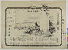
Tsurukame、oukan
Shochiku Otani Library
ARC Banzuke (Playbills) Portal Database

Rand, McNally & Company's indexed atlas of the world map of Japan Copyright 1892, by Rand, McNally...
Stanford University Libraries
Stanford Libraries SearchWorks

Japan: Topography and industrial areas
Stanford University Libraries
Stanford Libraries SearchWorks

Southwest Japan (Kyūshū, Shikoku, and southwest Honshū) non-ferrous metals, mines and processing p...
Stanford University Libraries
Stanford Libraries SearchWorks

Carte De L'Oceanie Contenant L'Australe, La Polynesie et Les Iles Asiatique [Australia called Nota...
Stanford University Libraries
Stanford Libraries SearchWorks
Last Updated: 2020-04-17
Uploaded: 2021-09-21