
General Railway Map of Japan and Manchuria : Showing lines open and under construction on March 31...
- Time
- Owner Organization

General map of China and adjacent regions, showing treaty ports and railways
Map showing dispositions at Tebaga gap between 21 and 29 March 1943
![Tokyo [cartographic material] : [showing rail, subway and tram lines of the metropolitan area].](https://stacks.stanford.edu/image/iiif/ys971pn1490%2Fys971pn1490_0001/full/!200,200/0/default.jpg)
Tokyo [cartographic material] : [showing rail, subway and tram lines of the metropolitan area].

General map of China and adjacent regions showing treaty ports and railroads / prepared for the Department o...

Eastern Asia, showing Japan, Korea, Manchuria and adjoining parts of Siberia and China. 185 miles ...
General map of China and adjacent regions, showing treaty ports and railways / prepared for the Department of State, by the Topographic Branch, U.S. Geological Survey
Map of Manila Bay, showing Bataan Peninsula, on the west of the bay, where General Mac Arthur's American and...

China

A New Map of Asia from the latest Observations Most Humbly Inscrib'd to the Right Honbl. George Ea...

Karta Aziatskoi Rossii i smezhnykhi s neiu vladenii : S ukazanem puti sldovaniia Gosudaria Imperat...

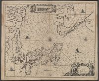
Nova Et Accurata Iaponiae Terrae Esonis Ac Insularum . . . (Korea shown as an island)

National school board serie: No. 2 : Africa

L'Empire de la Chine d'après l'Atlas Chinois avec les Isles du Japon . .

佐賀県管内図

Peking (Beijing). Tokio (Tokyo)

The Japanese empire : with central and southern Manchukuo (Manchuria)

China

The Japanese empire : with central and southern Manchukuo (Manchuria)
Stanford's map of eastern China, Japan and Korea : the seat of war in 1894

Terza Tavola (China, Southeast Asia, Philippines and Japan)

Maris Pacifici quod vulgo Mar del Zud
![[ブッツゲル歴史地図1815-1866]](https://rmda.kulib.kyoto-u.ac.jp/iiif/RB00023936/RB00023936_00001_0.ptif/full/200,/0/default.jpg)
[ブッツゲル歴史地図1815-1866]

Nova Et Accurata Iaponiae Terrae Esonis Ac Insularum . .

Tabula Indiae Orientalis et Regnorum Adjacentium J. Van Braam et G. onder de Linden . .

A New Map of Great Tartary and China, with the adjoyning Parts of Asia, Taken from Mr. De Fer's Ma...
Nova et Accurata Japoniae, Terrae Esonis, ac Insularem Adjacentium ex Novissimâ detectione descriptio

Kashū Futamata Honsenji keidai no zu

Paskaerte Zynde t'Oosterdeel Van Oost Indien, met alle de Eylanden daer ontrendt geleegen van C.Co...

L'Empire de la Chine d'après l'Atlas Chinois avec les Isles du Japon . .

Hermann Berghaus : Chart of the world on Mercators projection

A Chart of the Eastermost part of the East Indies and China from Cape Comarin to Japan with the Ad...
Last Updated: 2020-04-17
Uploaded: 2021-09-21