
Welfare map of Peiping : also showing other points if interest. (Drawn by) Atterburt
- People
- Time
- Owner Organization
Craigie's map of South Australia showing towns, roads & railways / compiled, drawn & published by Kenneth Craigie & Co
National Library of Australia
Trove: National Library of Australia

Map of Asia showing its gt. political divisions, and also various routes of travel between London ...
Stanford University Libraries
Stanford Libraries SearchWorks

Map of Asia showing its gt. political divisions, and also various routes of travel between London ...
Stanford University Libraries
Stanford Libraries SearchWorks

Map of Asia showing its gt. political divisions, and also various routes of travel between London ...
Stanford University Libraries
Stanford Libraries SearchWorks

Map of Asia showing its Gt. Political Divisions, and, also, the Various routes of travel between L...
Stanford University Libraries
Stanford Libraries SearchWorks

Map of Asia showing its gt. political divisions, and also the various routes of travel between Lon...
Stanford University Libraries
Stanford Libraries SearchWorks

Map of Asia showing its gt. political divisions, and also the various routes of travel between Lon...
Stanford University Libraries
Stanford Libraries SearchWorks

Map of Asia showing its gt. political divisions, and also the various routes of travel between Lon...
Stanford University Libraries
Stanford Libraries SearchWorks

Map of Asia Showing its Gt. Political Divisions, and, also, the Various routes of Travel Between L...
Stanford University Libraries
Stanford Libraries SearchWorks

Map Of Asia Showing its Gt. Political Divisions, and also the Various Routes of Travel Between Lon...
Stanford University Libraries
Stanford Libraries SearchWorks

Map Of Asia Showing its Gt. Political Divisions, and also the Various Routes of Travel Between Lon...
Stanford University Libraries
Stanford Libraries SearchWorks
Map of North Africa showing the extent of operations undertaken by the Long Range Desert Group during World ...
Alexander Turnbull Library
DigitalNZ New Zealand API
Court Exh. No. 882: Copies of map prepared and issued by the American Army Map Service showing mandated islands of Japan and their situation with respect to other countries
NDL Digital Collections
NDL Digital Collections
Blueprint map showing area destroyed or burned by atomic bomb and areas burned out or partially destroyed by other air raids, Map showing location and range of each air-raid warning siren. Report No. 5c, No. 5d, USSBS Index Section 2
NDL Digital Collections
NDL Digital Collections
Western shore of the Bay of Yedo / surveyed by order of Commodore M.C. Perry U.S.N. by Lieut. Wm. L. Maury and other officers of the Japan Expedition 1854 ; drawn by Edward Sels ; engraved by Selmar Siebert
National Library of Australia
Trove: National Library of Australia
A new & accurate map of Asia : drawn from the most approved modern maps & charts / by Thos. Bowen ; engraved for Middletons complete system of geography
National Library of Australia
Trove: National Library of Australia
This map shows, by the cross-lining, the Netherlands East Indies and also the island possessions of the U.S....
National Library of New Zealand
DigitalNZ New Zealand API

General Railway Map of Japan and Manchuria : Showing lines open and under construction on March 31...
Stanford University Libraries
Stanford Libraries SearchWorks
Map showing New Britain and the town of Rabaul, which has been bombed by Japanese aircraft. (Evening Post, 0...
National Library of New Zealand
DigitalNZ New Zealand API
Reconnoissance of the Gulf and survey of the western shore of the Bay of Yedo / by order of Commodore M.C. Perry U.S.N. by Lieut. W.L. Maury and other officers of the U.S. Japan Expedition in 1853-54 ; drawn by Edw. Sels ; engr. by Selmar Siebert
National Library of Australia
Trove: National Library of Australia
General map of China and adjacent regions, showing treaty ports and railways / prepared for the Department of State, by the Topographic Branch, U.S. Geological Survey
National Library of Australia
Trove: National Library of Australia

Japan road map, 1:1,000,000 / prepared under the direction of the Chief of Engineers, U.S. Army by the Army ...
Yale University Library
Yale University Library Digital Collections
A map of the East-Indies and adjacent countries : with settlements, factories, and territories : explaining what belongs to England, Spain, France, Holland, Denmark, Portugal, etc. with many remarks not extant in any other map / by H. Moll, geog
National Library of Australia
Trove: National Library of Australia

A map of the East-Indies and adjacent countries : with settlements, factories, and territories : explaining what belongs to England, Spain, France, Holland, Denmark, Portugal, etc. with many remarks not extant in any other map / by H. Moll, geog
State Library of New South Wales
Trove: National Library of Australia
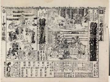
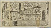
Hatsuyukitomimasunokagekiyo、isemeishowazatoiezuto
Museum of Fine Arts, Boston
ARC Banzuke (Playbills) Portal Database
Sakoujouigonichimonogatari、bingosaburou、hananoenmagouhitomure
Shochiku Otani Library
ARC Banzuke (Playbills) Portal Database
Wakenokiyomaro、gotaiheikishiraishibanashi、yamatoganaariwarakeizu
Shochiku Otani Library
ARC Banzuke (Playbills) Portal Database
Kanadehonchuushingura、genrokuhanaminonigiwai
大阪府立中之島図書館
ARC Banzuke (Playbills) Portal Database
山田郡廣澤村 藤生佐吉郎
坂野家
ADEAC: A System of Digitalization and Exhibition for Archive Collections
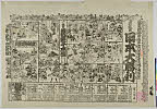
Touzokusekai
Shochiku Otani Library
ARC Banzuke (Playbills) Portal Database
Kokorotokokoro、torikaeshinjuu
Shochiku Otani Library
ARC Banzuke (Playbills) Portal Database
Koganenoaragoto、minamotonoyoshitomo、kokkeitouronkai
Shochiku Otani Library
ARC Banzuke (Playbills) Portal Database
Suisugiminden、kioijishikuruwanosakari
Shochiku Otani Library
ARC Banzuke (Playbills) Portal Database
Hitokanadekodakarasoga、yabutsubakitaretokorobine、asamidoritsuyunotamagawa
Museum of Fine Arts, Boston
ARC Banzuke (Playbills) Portal Database
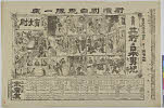
Onnadouraku
Shochiku Otani Library
ARC Banzuke (Playbills) Portal Database
Erunani、sakuratarou
Shochiku Otani Library
ARC Banzuke (Playbills) Portal Database
Zokusetsubidankoumonki、rokkasen
Shochiku Otani Library
ARC Banzuke (Playbills) Portal Database
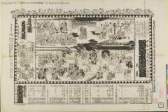
Yoshidagotenkanokonofurisode、karamoyouyamatosuikoden、nunosarashiironotamagawa
Shochiku Otani Library
ARC Banzuke (Playbills) Portal Database
Toukaidouyotsuyakaidan、yoshitsunesenbonzakura、michiyukihatsunenotabi
Museum of Fine Arts, Boston
ARC Banzuke (Playbills) Portal Database
Hiraganaseisuiki、kaikanoumeunaniwabidan、kuruwabunshou
Shochiku Otani Library
ARC Banzuke (Playbills) Portal Database
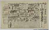
Tenichibouoookaseidan、ichinotanifutabagunki、kankatsudetachisatonosayaate
Shochiku Otani Library
ARC Banzuke (Playbills) Portal Database
Nippondaishouri、yoshitsunesenbonzakura、kabukitaimensoga
Shochiku Otani Library
ARC Banzuke (Playbills) Portal Database
Sokoganihondanji、mekurataii
Shochiku Otani Library
ARC Banzuke (Playbills) Portal Database
Shoseinohanzai、atakayoshitsunemondai
Shochiku Otani Library
ARC Banzuke (Playbills) Portal Database
Kuninohimitsu、kanippatsu
Shochiku Otani Library
ARC Banzuke (Playbills) Portal Database
Tsumakoushikasanonoadauchi、akasakajounoichiya、okazakinoneko、itsutsukarigane、awasekagami
Shochiku Otani Library
ARC Banzuke (Playbills) Portal Database
Soufuren、kohakasugai
Shochiku Otani Library
ARC Banzuke (Playbills) Portal Database
![Sodegauraukinanoharusame、[komochiyamauba]](http://mfas3.s3.amazonaws.com/styles/grid-2_thumbnail_retina/s3/objects/SC211652.jpg)
Sodegauraukinanoharusame、[komochiyamauba]
Museum of Fine Arts, Boston
ARC Banzuke (Playbills) Portal Database
Last Updated: 2020-04-17
Uploaded: 2021-09-21