
Plans on the West Coast of Celebes
- Time
- Owner Organization

Celebes - West Coast : Cape William to Tandyung Karang

Plans on the north-eastern coast of New Guinea

JAPANESE RAID TOWNS ON THE NORTH-WEST COAST OF AUSTRALIA
![Karia [Kariya], west coast of Japan](https://api.europeana.eu/api/v2/thumbnail-by-url.json?uri=http%3A%2F%2Fcollections.rmg.co.uk%2FmediaLib%2F537%2Fmedia-537366%2Flarge.jpg&type=IMAGE)
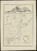
Karia [Kariya], west coast of Japan

Approach to West Coast of Gazelle Peninsula

Australia - West Coast. Shark Bay

Plans of Anchorages in Tomori Gulf and Adjacent Coast

Sunrise on the Coast

Whaling Scene On The Coast Of Japan

Suzukawa Coast on the Tokaido

A general view of the Peishantsuy forts, on the W. coast of Wei-Hai-Wei

A general view of the Peishantsuy forts, on the W. coast of Wei-Hai-Wei

A rear-view of the Peishantsuy forts, on the W. coast of Wei-Hai-Wei

A rear-view of the Peishantsuy forts, on the W. coast of Wei-Hai-Wei

The Chaopeitsuy forts on the E. coast of Wei-Hai-Wei

The Chaopeitsuy forts on the E. coast of Wei-Hai-Wei

A portion of the shelter trenches on Motienling, on the E. coast of Wei-Hai-Wei

A portion of the shelter trenches on Motienling, on the E. coast of Wei-Hai-Wei

The destruction by shells of the torpedo-station on Peishantsuy, on the W. coast of Wei-Hai-Wei

A view of the Lungmeaoutsuy forts, on the east coast of Wei-Hai-Wei

The central and part of the right portion of Tseszetai forts on the W. Coast of Wei-Hai-Wei

Picture of the Coast of Yokohama

Two guns on the Hwang-Tooyai fort, on the N. W. Coast of Wei-Hai-Wei

A portion of the eminence to the left of the Tseszetai forts on the W. coast of Wei-Hai-Wei

Yōzu (kūchū shashin sokuryō) Mōko jūmanbun no ichizu

Niman-gosenbun no ichi kūkchū shashin sokuzu Shanhai kinbō

Ryōtō Kaiwan : Daitzu Shan to Fuchou Chao

Northern Approaches to Makassar
Japan, the islands of Loochoo & Formosa, and the maritime provinces of China with the tract of the Morrison's voyage in 1837 / J. Arrowsmith, Lith

Plans of Anchorages in Witu Islands

Asia : Coast of China : Ryōtō Kaiwan. Approaches to Ryō Ga Entrance
![Kasei Kita Shina jūmanbun no ichi zu. Hsüchow (Xuzhou) [cartographic material]](https://stacks.stanford.edu/image/iiif/js550gn2130%2Fjs550gn2130_00_0001/full/!200,200/0/default.jpg)
Kasei Kita Shina jūmanbun no ichi zu. Hsüchow (Xuzhou) [cartographic material]

Japan, political divisions

Futsuryō Indoshina Gojūmanbunnoichi Zu = Carte de l'Indochine

Durville Island and Approaches
Plans of Anchorages in Tomori Gulf and Adjacent Coast

China - east coast : Hangchow Wan - southeast portion : including the approaches to the Yung Kiang

Saipantō oyobi Teniantō

Straits between Sumbawa, Flores and Sumba

Central Portion of Sumbawa with Pulo Tenga Islands
Kaart van Japan ... Van R.G. Bennet en J. Van Wyk R. ... R Van Wyk Jx del

Japan, acreage of rice by prefectures, 1939. Japan, acreage of wheat by prefectures, 1939
Chart of Japanese islands and surrounding seas
The island of Formosa

Sanbyakumanbunnoichi Ōa Kōkūzu

South Pacific Ocean, British New Guinea - South Coast. Orangerie Bay to Round Head

Salayar Strait to Tana Keke I.
The entrance of Nangasacqui the chief port of the island of Kiusiu in the Kingdom of Japan from the manuscript chart of the Dutch East India Company
Last Updated: 2020-04-17
Uploaded: 2021-09-21