
Plans of Anchorages in Tomori Gulf and Adjacent Coast
- Time
- Owner Organization

Plans on the north-eastern coast of New Guinea
Stanford University Libraries
Stanford Libraries SearchWorks

Japan : South coast of Honshu : Gulf of Tokyo or Yedo. Compiled from Japanese Government, and Brit...
Stanford University Libraries
Stanford Libraries SearchWorks

Plans of Anchorages in Witu Islands
Stanford University Libraries
Stanford Libraries SearchWorks
![Japan and adjacent regions of Asia and the Pacific Ocean [cartographic material] / compiled and drawn in the...](https://collections.library.yale.edu/iiif/2/15510875/full/!200,200/0/default.jpg)
Japan and adjacent regions of Asia and the Pacific Ocean [cartographic material] / compiled and drawn in the...
Yale University Library
Yale University Library Digital Collections
![Japan and adjacent regions of Asia and the Pacific Ocean [cartographic material] / compiled and drawn in the...](https://collections.library.yale.edu/iiif/2/15509964/full/!200,200/0/default.jpg)
Japan and adjacent regions of Asia and the Pacific Ocean [cartographic material] / compiled and drawn in the...
Yale University Library
Yale University Library Digital Collections

Spiral Motif in Green, Violet, Blue and Gold: The Coast of the Inland Sea
Tate Gallery
The Tate Collection

Plans in south eastern part of New Guinea
Stanford University Libraries
Stanford Libraries SearchWorks

Nippon, Naikai. Plans in Harima
Stanford University Libraries
Stanford Libraries SearchWorks

A map of the city of Nagasaki, and of the adjacent country; Sorts of money current in the Japanese Empire
General Research Division. The New York Public Library
DPLA API

General map of China and adjacent regions, showing treaty ports and railways
Stanford University Libraries
Stanford Libraries SearchWorks

Eastern Archipelago : Flores Sea. Tana Jampea and Adjacent Islands
Stanford University Libraries
Stanford Libraries SearchWorks

Plans in the south-eastern part of New Guinea
Stanford University Libraries
Stanford Libraries SearchWorks

Map of the Island of Japan, Kurile &c. with the Adjacent Coasts of the Chinese Dominions and a Ske...
Stanford University Libraries
Stanford Libraries SearchWorks

Map of the Island of Japan, Kurile &c. with the Adjacent Coasts of the Chinese Dominions and a Ske...
Stanford University Libraries
Stanford Libraries SearchWorks
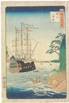
The Coast in Tsushima Province
Minneapolis Institute of Arts
Minneapolis Institute of Art API
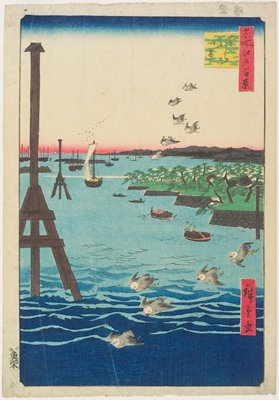
View of Shiba Coast
Minneapolis Institute of Arts
Minneapolis Institute of Art API
Japan and adjacent regions of Asia and the Pacific Ocean / compiled and drawn in the Cartographic Section of the National Geographic Society
National Library of Australia
Trove: National Library of Australia
Soviet and Japanese Economic Plans and Progress
Open Society Archives
Europeana API

A Map of the East-Indies and the Adjacent Countries; with the Settlements, Factories and Territori...
Stanford University Libraries
Stanford Libraries SearchWorks

A Map of the East-Indies and the Adjacent Countries; with the Settlements, Factories and Territori...
Stanford University Libraries
Stanford Libraries SearchWorks

A Map of the East-Indies and the Adjacent Countries; with the Settlements, Factories and Territori...
Stanford University Libraries
Stanford Libraries SearchWorks

A Map of the East-Indies and the Adjacent Countries; with the Settlements, Factories and Territori...
Stanford University Libraries
Stanford Libraries SearchWorks
"Sea-coast of Kanagawa"
Royal Library of the Netherlands
Europeana API

Charts, etc
Yale University Library
Yale University Library Digital Collections

Central Portion of Sumbawa with Pulo Tenga Islands
Stanford University Libraries
Stanford Libraries SearchWorks

Northern Approaches to Makassar
Stanford University Libraries
Stanford Libraries SearchWorks

New Guinea - N. E. Coast. C. Ward Hunt to C. Nelson
Stanford University Libraries
Stanford Libraries SearchWorks

Hermit Islands
Stanford University Libraries
Stanford Libraries SearchWorks
新板蝦夷土産道中寿五六
University of California, Berkeley
ARC Ukiyo-e Portal Database
![Ichimanbun no ichi chikeizu Shinkyō kinbō [cartographic material]](https://stacks.stanford.edu/image/iiif/jc790cg6868%2Fjc790cg6868_00_0001/full/!200,200/0/default.jpg)
Ichimanbun no ichi chikeizu Shinkyō kinbō [cartographic material]
Stanford University Libraries
Stanford Libraries SearchWorks

Map of Kyoto and vicinity
Stanford University Libraries
Stanford Libraries SearchWorks

Straits between Sumbawa, Flores and Sumba
Stanford University Libraries
Stanford Libraries SearchWorks

New Guinea - South Coast. Freshwater Bay to C. Blackwood
Stanford University Libraries
Stanford Libraries SearchWorks
![Sanjūmanbun no ichi Shina engan rikukai hengōzu [cartographic material]](https://stacks.stanford.edu/image/iiif/cn019rx5665%2Fcn019rx5665_00_0001/full/!200,200/0/default.jpg)
Sanjūmanbun no ichi Shina engan rikukai hengōzu [cartographic material]
Stanford University Libraries
Stanford Libraries SearchWorks
Plans on the north-eastern coast of New Guinea
Stanford University Libraries
Stanford Libraries SearchWorks
Hyoubankozou、koinoyamai
Shochiku Otani Library
ARC Banzuke (Playbills) Portal Database
![Hailaerh fukin zu [cartographic material]](https://stacks.stanford.edu/image/iiif/nc103dh1915%2Fnc103dh1915_00_0001/full/!200,200/0/default.jpg)
Hailaerh fukin zu [cartographic material]
Stanford University Libraries
Stanford Libraries SearchWorks
![Jūmanbunnoichi Torakkutō fukin (sono 3) [cartographic material]](https://stacks.stanford.edu/image/iiif/sf484dd2736%2Fsf484dd2736_00_0001/full/!200,200/0/default.jpg)
Jūmanbunnoichi Torakkutō fukin (sono 3) [cartographic material]
Stanford University Libraries
Stanford Libraries SearchWorks

Tabula Indiae Orientalis et Regnorum Adjacentium J. Van Braam et G. onder de Linden . .
Stanford University Libraries
Stanford Libraries SearchWorks
Last Updated: 2020-04-17
Uploaded: 2021-09-21