
Eastern Archipelago, Arafura Sea. Tanimbar Islands
- Time
- Owner Organization

Eastern Archipelago : Flores Sea. Tana Jampea and Adjacent Islands
Stanford University Libraries
Stanford Libraries SearchWorks

Eastern Archipelago. Flores and Timor Seas
Stanford University Libraries
Stanford Libraries SearchWorks

Eastern Archipelago. Sumba or Sandelhout
Stanford University Libraries
Stanford Libraries SearchWorks

North Pacific Ocean : Eastern Part of Hawaiin Islands
Stanford University Libraries
Stanford Libraries SearchWorks
.jpg)
SOUTH-EAST ASIA AND EAST INDIES ARCHIPELAGO
New Zealand Electronic Text Collection
DigitalNZ New Zealand API
![East India Archipelago [Eastern Passages to China and Japan] [Chart No. 4] . . . 1868 (Mindanao, B...](https://stacks.stanford.edu/image/iiif/qk341np8650%2F34532/full/!200,200/0/default.jpg)
East India Archipelago [Eastern Passages to China and Japan] [Chart No. 4] . . . 1868 (Mindanao, B...
Stanford University Libraries
Stanford Libraries SearchWorks
![East India Archipelago [Eastern Passages to China and Japan] [Chart No. 2] . . . 1868 (North Austr...](https://stacks.stanford.edu/image/iiif/hf333br4460%2F34582/full/!200,200/0/default.jpg)
East India Archipelago [Eastern Passages to China and Japan] [Chart No. 2] . . . 1868 (North Austr...
Stanford University Libraries
Stanford Libraries SearchWorks
![East India Archipelago [Eastern Passages to China and Japan] [Chart No. 7] . . . 1868 (Taiwan, Nor...](https://stacks.stanford.edu/image/iiif/xy078vp9272%2F34545/full/!200,200/0/default.jpg)
East India Archipelago [Eastern Passages to China and Japan] [Chart No. 7] . . . 1868 (Taiwan, Nor...
Stanford University Libraries
Stanford Libraries SearchWorks
![East India Archipelago [Eastern Passages to China and Japan] [Chart No. 1] . . . 1866 (Java, Borne...](https://stacks.stanford.edu/image/iiif/ww842xr3210%2F34640/full/!200,200/0/default.jpg)
East India Archipelago [Eastern Passages to China and Japan] [Chart No. 1] . . . 1866 (Java, Borne...
Stanford University Libraries
Stanford Libraries SearchWorks
![Japan, Philippine Sea, Nansei Shotō (Ryuku [sic] Islands), including Daitō Shotō [electronic resou...](https://www.gumtree.com/static/1/resources/assets/rwd/images/orphans/a37b37d99e7cef805f354d47.noimage_thumbnail.png)
Japan, Philippine Sea, Nansei Shotō (Ryuku [sic] Islands), including Daitō Shotō [electronic resou...
Stanford University Libraries
Stanford Libraries SearchWorks
![Sea fisheries of eastern Asia [cartographic material]](https://stacks.stanford.edu/image/iiif/mr870gt3467%2Fmr870gt3467_00_0001/full/!200,200/0/default.jpg)
Sea fisheries of eastern Asia [cartographic material]
Stanford University Libraries
Stanford Libraries SearchWorks
South Sea Islands 1:50,000 : Gomanbun no ichi kotsuzu nanyo gunto
National Library of Australia
Trove: National Library of Australia

Spice Islands
Freer and Sackler
DPLA API
Airport Index: Eastern Hawaiian Islands
NDL Digital Collections
NDL Digital Collections

Hermit Islands
Stanford University Libraries
Stanford Libraries SearchWorks

Ryukyu Islands, orientation
Stanford University Libraries
Stanford Libraries SearchWorks

Three Little Islands, from the series The Inland Sea, Second Series
Freer and Sackler
DPLA API

South Pacific Ocean : Islands and Anchorages in Cook Islands
Stanford University Libraries
Stanford Libraries SearchWorks
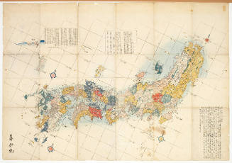
Map of the Japanese Archipelago
Honolulu Museum of Art
Honolulu Museum of Art Collection

Matsushima (Islands)
Freer and Sackler
DPLA API

Japan Series: North Honshu Islands
Museum of New Zealand Te Papa Tongarewa
DigitalNZ New Zealand API
"Matsushima, inland sea"
Royal Library of the Netherlands
Europeana API
Solomon Islands, Bismarck Archipelago and islands of southeastern end of New Guinea, July 1944. Report No. 37-a(19), USSBS Index Section 6
NDL Digital Collections
NDL Digital Collections

Plans of Anchorages in Witu Islands
Stanford University Libraries
Stanford Libraries SearchWorks

Celebes - West Coast : Cape William to Tandyung Karang
Stanford University Libraries
Stanford Libraries SearchWorks
Eastern Archipelago. Sumba or Sandelhout
Stanford University Libraries
Stanford Libraries SearchWorks

Saipantō
Stanford University Libraries
Stanford Libraries SearchWorks
![Japan [cartographic material] : railroads and railroad facilities](https://stacks.stanford.edu/image/iiif/yv242dj2410%2Fyv242dj2410_00_0001/full/!200,200/0/default.jpg)
Japan [cartographic material] : railroads and railroad facilities
Stanford University Libraries
Stanford Libraries SearchWorks
![[Russian Map of Northeastern Asia, Japan, Korea, China, Alaska, etc.] ( Summary map of hydrographi...](https://stacks.stanford.edu/image/iiif/pj697kr2558%2F35405/full/!200,200/0/default.jpg)
[Russian Map of Northeastern Asia, Japan, Korea, China, Alaska, etc.] ( Summary map of hydrographi...
Stanford University Libraries
Stanford Libraries SearchWorks
![Japan [cartographic material] : industrial concentration by prefectures](https://stacks.stanford.edu/image/iiif/zh931gv1396%2Fzh931gv1396_00_0001/full/!200,200/0/default.jpg)
Japan [cartographic material] : industrial concentration by prefectures
Stanford University Libraries
Stanford Libraries SearchWorks

Guide to Tokyo City
Yale University Library
Yale University Library Digital Collections

Tō "So" jūmanbun no ichizu
Stanford University Libraries
Stanford Libraries SearchWorks

Shinchiku shigaizu = : Map of Hsinchu city
Stanford University Libraries
Stanford Libraries SearchWorks
![Osaka : [base map showing political divisions]](https://stacks.stanford.edu/image/iiif/rk252rh2515%2Frk252rh2515_00_0001/full/!200,200/0/default.jpg)
Osaka : [base map showing political divisions]
Stanford University Libraries
Stanford Libraries SearchWorks

奥御右筆衆御役屋敷絵図
Kyoto University Library
IIIF Discovery in Japan

Rice areas in Japan
Stanford University Libraries
Stanford Libraries SearchWorks

Japan : railroads and railroad facilities
Yale University Library
Yale University Library Digital Collections

Central Japan (central and northern Honshū) distribution of population
Stanford University Libraries
Stanford Libraries SearchWorks
![Suirobu Hi [Kaizu]](https://stacks.stanford.edu/image/iiif/nm634np1065%2Fnm634np1065_0001/full/!200,200/0/default.jpg)
Suirobu Hi [Kaizu]
Stanford University Libraries
Stanford Libraries SearchWorks
Last Updated: 2020-04-17
Uploaded: 2021-09-21