
大日本帝國羽前全國羽後國飽海郡土性圖 = Agronomic map of Uzen-province and Akumi district of Ugo-province

大日本帝國日向國土性圖 = Agronomic map of Hyūga-province
京都大学吉田南総合図書館
IIIF Discovery in Japan

大日本帝國越中國土性圖
京都大学吉田南総合図書館
IIIF Discovery in Japan

大日本帝國美作備前備中土性圖 = Agronomic map of Mimasaka Bizen and Bitchū provinces
京都大学吉田南総合図書館
IIIF Discovery in Japan

大日本帝國豊後全國豊前國東南部土性圖
京都大学吉田南総合図書館
IIIF Discovery in Japan
羽後國養蚕之圖七
船橋市西図書館
ADEAC:デジタルアーカイブシステム

大日本帝國羽前全國羽後國飽海郡土性圖
国立国会図書館デジタルコレクション
国立国会図書館デジタルコレクション

日本帝國交通新地圖 New map of Japanese empire for communication
国立国会図書館デジタルコレクション
国立国会図書館デジタルコレクション

大日本帝國油田第九區地質及地形圖 : 越後國寺泊油田 = Geological and topographical map of the oil fields of Japan, section IX : Teradomari oil field, Echigo
京都大学吉田南総合図書館
IIIF Discovery in Japan
東北帝國大學附屬圖書館第一部洋書目録 Catalogue of European books in the Tōhoku Imperial University Library First Department
国立国会図書館デジタルコレクション
国立国会図書館デジタルコレクション
東北帝國大學附屬圖書館第一部洋書目録 Catalogue of European books in the Tōhoku Imperial University Library First Department
国立国会図書館デジタルコレクション
国立国会図書館デジタルコレクション
東北帝國大學附屬圖書館第一部洋書目録 Catalogue of European books in the Tōhoku Imperial University Library First Department
国立国会図書館デジタルコレクション
国立国会図書館デジタルコレクション
東北帝國大學附屬圖書館第一部洋書目録 Catalogue of European books in the Tōhoku Imperial University Library First Department
国立国会図書館デジタルコレクション
国立国会図書館デジタルコレクション
東北帝國大學附屬圖書館第一部洋書目録 Catalogue of European books in the Tōhoku Imperial University Library First Department
国立国会図書館デジタルコレクション
国立国会図書館デジタルコレクション
大日本帝國美作備前備中土性圖 = Agronomic map of Mimasaka Bizen and Bitchū provinces
京都大学吉田南総合図書館
IIIF Discovery in Japan

大日本帝国播磨但馬淡路全国摂津国西部丹波国西南部兵庫県管内土性図
京都大学吉田南総合図書館
IIIF Discovery in Japan
大日本帝國越中國土性圖
京都大学吉田南総合図書館
IIIF Discovery in Japan
大日本帝國豊後全國豊前國東南部土性圖
京都大学吉田南総合図書館
IIIF Discovery in Japan

Shizuoka ken, Japan. (to accompany) Shomitsu Nippon chizu. (Atlas of Japan). Nippon Shoin. (Tokyo,...
スタンフォード大学図書館
スタンフォード大学図書館SearchWorks
大日本帝國日向國土性圖 = Agronomic map of Hyūga-province
京都大学吉田南総合図書館
IIIF Discovery in Japan

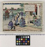
Kai Saru-hashi (Object); Rokuju-yo Shu Meisho Zue (Series)
大英博物館
大英博物館コレクション

朝鮮全圖
京都大学吉田南総合図書館
IIIF Discovery in Japan
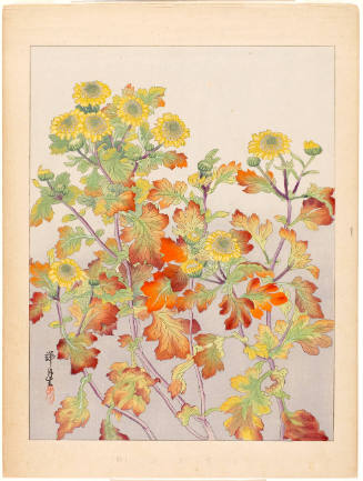
Winter Chrysanthemums (Kangiku)
ホノルル美術館
ホノルル美術館コレクション
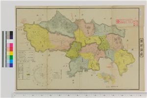
信濃全図
県立長野図書館
信州デジタルコモンズ長野図書館所蔵資料

The topographic map of Manchoukuo
スタンフォード大学図書館
スタンフォード大学図書館SearchWorks

Hyogo ken, Japan. (to accompany) Shomitsu Nippon chizu. (Atlas of Japan). Nippon Shoin. (Tokyo, 19...
スタンフォード大学図書館
スタンフォード大学図書館SearchWorks
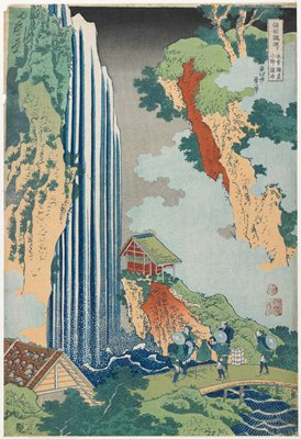
The Waterfall at Ono on the Kisokaidō Road
ミネアポリス美術館
ミネアポリス美術館API

北海道の観光と交通
国際日本文化研究センター
IIIF Discovery in Japan
最終更新日: 2020-04-16
登録日: 2021-07-27