

大日本帝國日向國土性圖 = Agronomic map of Hyūga-province
Yoshida-South Library, Kyoto University
IIIF Discovery in Japan

大日本帝國豊後全國豊前國東南部土性圖
Yoshida-South Library, Kyoto University
IIIF Discovery in Japan

大日本帝國中部地形圖
Yoshida-South Library, Kyoto University
IIIF Discovery in Japan

大日本帝國豫察中部地形圖
Yoshida-South Library, Kyoto University
IIIF Discovery in Japan

大日本帝國美作備前備中土性圖 = Agronomic map of Mimasaka Bizen and Bitchū provinces
Yoshida-South Library, Kyoto University
IIIF Discovery in Japan

大日本國全圖
Kyoto University Library
IIIF Discovery in Japan

大日本國全圖
Yoshida-South Library, Kyoto University
IIIF Discovery in Japan

大日本國全圖
National Diet Library, Japan
ARC Early Japanese Book Portal Database

大日本國大繪圖
National Diet Library, Japan
ARC Early Japanese Book Portal Database

日本國中細見圖
National Diet Library, Japan
ARC Early Japanese Book Portal Database

大日本帝國豫察東部地形圖
Department of Science, Kyoto University
IIIF Discovery in Japan

大日本帝國中部鉱産図
Kyushu University Collections
Kyushu University Collections

大日本帝國豫察西南部地質圖
Yoshida-South Library, Kyoto University
IIIF Discovery in Japan

大日本帝國羽前全國羽後國飽海郡土性圖 = Agronomic map of Uzen-province and Akumi district of Ugo-province
Yoshida-South Library, Kyoto University
IIIF Discovery in Japan
大日本帝国土性図 上野全国
Geospatial Information Authority of Japan
FishPix

大日本國沿海略圖
Kyoto University Library
IIIF Discovery in Japan

Dainihon teikoku etchuunokuni doseizu
NDL Digital Collections
NDL Digital Collections

大日本帝國東京金龍山淺草寺之圖
Tokyo Metropolitan Central Library
Tokyo Metropolitan Library Edo-Tokyo Digital Collections

大日本帝國西部鉱産図
Kyushu University Collections
Kyushu University Collections

「日本地誌略圖」「三十八」「越中國」「神通川舟橋」
Tokyo Metropolitan Central Library
Tokyo Metropolitan Library Edo-Tokyo Digital Collections

日本帝國主義論 /
Library of Congress
Digital Collections, Library of Congress

「日本地誌略圖」「三十九」「越後國」「新潟港之圖」
Tokyo Metropolitan Central Library
Tokyo Metropolitan Library Edo-Tokyo Digital Collections

「大日本物産圖會」「同國長鮑製之圖」
Tokyo Metropolitan Central Library
Tokyo Metropolitan Library Edo-Tokyo Digital Collections

「大日本物産圖會」「伊勢國鮑採之圖」
Tokyo Metropolitan Central Library
Tokyo Metropolitan Library Edo-Tokyo Digital Collections

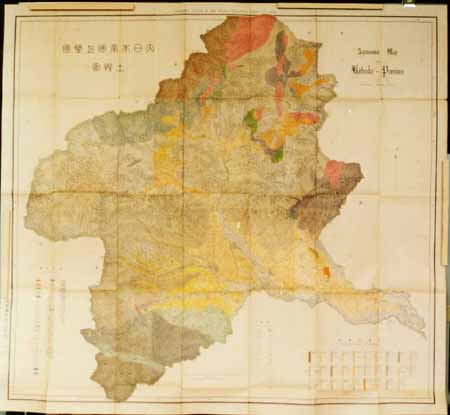
大日本帝国播磨但馬淡路全国摂津国西部丹波国西南部兵庫県管内土性図
Yoshida-South Library, Kyoto University
IIIF Discovery in Japan
大日本帝國美作備前備中土性圖 = Agronomic map of Mimasaka Bizen and Bitchū provinces
Yoshida-South Library, Kyoto University
IIIF Discovery in Japan

Carte du théâtre de la guerre Russo-Japonaise
Bibliothèque nationale de France
Europeana API
大日本帝國羽前全國羽後國飽海郡土性圖 = Agronomic map of Uzen-province and Akumi district of Ugo-province
Yoshida-South Library, Kyoto University
IIIF Discovery in Japan

Kyoutomeishoarashiyamayorisangenyawonozomu
Art Research Center, Ritsumeikan University
ARC Ukiyo-e Portal Database
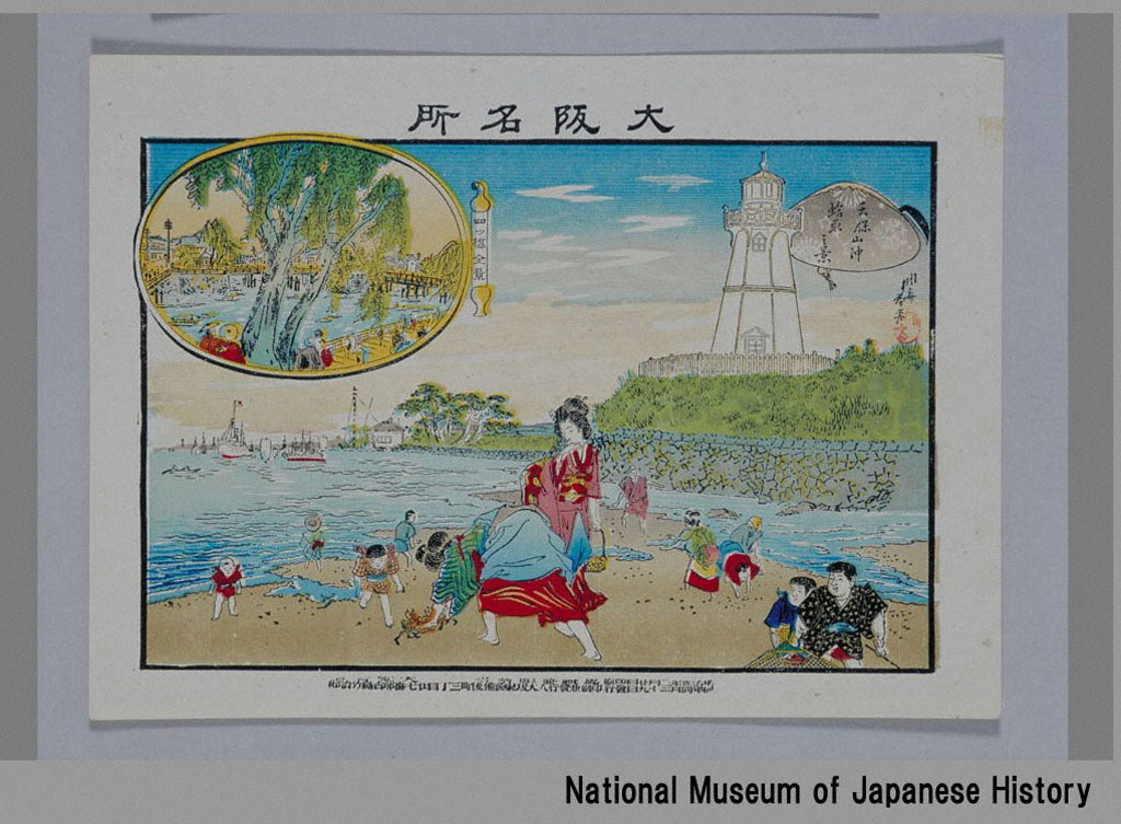
「大阪名所」 「天保山沖蛤取之景」「四ツ橋全景」
National Museum of Japanese History
ARC Ukiyo-e Portal Database
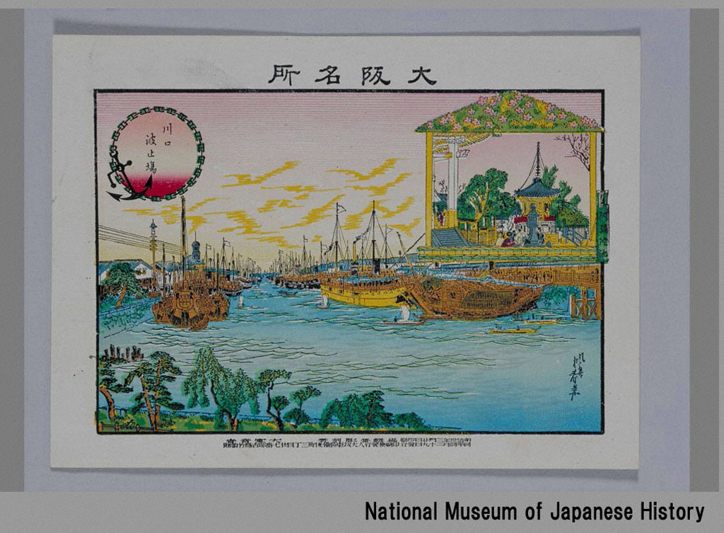
「大阪名所」 「川口波止場」「阿弥陀池」
National Museum of Japanese History
ARC Ukiyo-e Portal Database
Shinanozenzu
Nagano Prefectural Library
信州デジタルコモンズ長野図書館所蔵資料
Five Hundred Rankans Temple and Sazaidō Hall, series Famous Views of the Eastern Capital
Honolulu Museum of Art
Honolulu Museum of Art Collection

Fujisanjuurokkeihakonenokosui
Art Institute of Chicago
ARC Ukiyo-e Portal Database
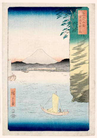
Cherry Blossoms at Hommoku in Musashi Province, series Thirty-six Views of Mt. Fuji
Honolulu Museum of Art
Honolulu Museum of Art Collection
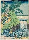
「諸国滝廻」 「東都葵ケ岡(あおいがおか)の滝」
Museum of Fine Arts, Boston
ARC Ukiyo-e Portal Database

Rokujuuyoshuumeishozuesagami、enoshima iwayanokuchi
Art Institute of Chicago
ARC Ukiyo-e Portal Database

「東都名所」 「五百羅漢さゞゐ堂」
Art Institute of Chicago
ARC Ukiyo-e Portal Database

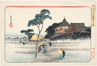
Guide to Famous Places at the Fifty-Three Post-Stations along the Tokaido Highway ( Known as the "Tatee Upright" Tokaido Series ) : Yokkaichi
Keio University Media Center
Digital Collections of Keio University Libraries
Last Updated: 2020-04-16
Uploaded: 2021-07-27