
日本本州北西岸伯耆境港 = Japan, Honshū-north west coast, Sakai Harbour
- Time
- Owner Organization

日本本州北西岸若狭小濱港 = Japan Honshū, north west coast, Ohama Harbour
Yoshida-South Library, Kyoto University
IIIF Discovery in Japan

日本本州南岸志摩的矢港 = Japan, Honshū-south coast, Matoya Harbour
Yoshida-South Library, Kyoto University
IIIF Discovery in Japan

日本九州西岸肥前長崎港 = Japan Kiushū, west coast, Nagasaki Harbour
Yoshida-South Library, Kyoto University
IIIF Discovery in Japan

日本九州西岸肥後三角港 = Japan Kiūshū, west coast, Misumi Harbour
Yoshida-South Library, Kyoto University
IIIF Discovery in Japan

日本本州南岸東京海湾浦賀港 = Japan Honshū, south coast Tōkio gulf Uraga harbour
Yoshida-South Library, Kyoto University
IIIF Discovery in Japan

日本北州西岸後志小樽港 = Japan Hokusyū, west coast, Shiribeshi, Otaru Kō
Yoshida-South Library, Kyoto University
IIIF Discovery in Japan

日本四国南岸土佐浦戸港高知=Japan Shikoku, south coast, Urado Harbour and Kōchi
Yoshida-South Library, Kyoto University
IIIF Discovery in Japan

日本本州北西岸岩瀬及伏木錨地 = Iwase and Fushiki Anchorages at n. w. coast of Honshū-Japan
Yoshida-South Library, Kyoto University
IIIF Discovery in Japan

日本本州北西岸能登七尾湾= Japan Honshū, N. W. coast, Nanao Bay : north bay from survey of Lieutt. K. Kimotski, I. J. N. 12th. Year of Meiji (1879), South Bay, West Bay and the Soundings at outer part of the Bays from survey of commr. K. Isono
Yoshida-South Library, Kyoto University
IIIF Discovery in Japan

日本四国西岸伊豫宇和島湾 = Japan Shikoku, west coast Uwajima Bay surveyed by Lieut.ts S. Aoki, S.Yoshida, I. J. N. 8.th Year of Meiji, (1875), The Parts west of Ōra Zaki and Mizuga Ura enlarged from the survey of Comm.r K. Kimotski, I. J. N
Yoshida-South Library, Kyoto University
IIIF Discovery in Japan
![土佐国[南海道図]](https://rmda.kulib.kyoto-u.ac.jp/iiif/RB00020062/RB00020062_00001_0.ptif/full/200,/0/default.jpg)
土佐国[南海道図]
Kyoto University Library
IIIF Discovery in Japan

佐賀県管内全図
Saga Prefectual Library
IIIF Discovery in Japan
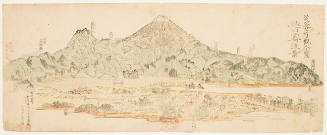
Frontispiece (Kantō), series Striking Views of Mount Fuji
Honolulu Museum of Art
Honolulu Museum of Art Collection
日本四国南岸土佐浦戸港高知=Japan Shikoku, south coast, Urado Harbour and Kōchi
Yoshida-South Library, Kyoto University
IIIF Discovery in Japan

「芸子色競」 「四」
British Museum
ARC Ukiyo-e Portal Database
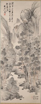
Landscape with Pines in the Manner of Wang Hui
Minneapolis Institute of Arts
Minneapolis Institute of Art API
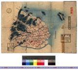
千葉県銚子港全図
Funabashi-shi Western Library
ADEAC: A System of Digitalization and Exhibition for Archive Collections

第一武蔵湾
Funabashi-shi Western Library
ADEAC: A System of Digitalization and Exhibition for Archive Collections

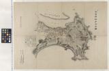
Ishikawagunbungenezu
Imizu City Shinminato Museum
ADEAC: A System of Digitalization and Exhibition for Archive Collections
愛知県三河国幡豆郡全図 : 幡豆郡図
Iwase Bunko Libray
ADEAC: A System of Digitalization and Exhibition for Archive Collections
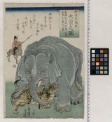
中天笠舶来大象之図
Funabashi-shi Western Library
ADEAC: A System of Digitalization and Exhibition for Archive Collections

Kōzuke no Kuni Myōgi Kondō ryōzan zenzu
Stanford University Libraries
Stanford Libraries SearchWorks
Schetskaart van Timor (Nederlandsch gebied)
National Library of Australia
Trove: National Library of Australia
Last Updated: 2020-04-16
Uploaded: 2021-07-27